Postal Code AD500 - Andorra la Vella
| Primary City | Andorra la Vella |
| Area of Postal Code AD500 | 22.3 km² |
| Population | 16,163 |
| Male Population | 8,126 (50.3%) |
| Female Population | 8,037 (49.7%) |
| Population change from 1975 to 2015 | +43.9% |
| Population change from 2000 to 2015 | -12.9% |
| Median Age | 40.8 years |
| Male Median Age | 40.3 years |
| Female Median Age | 41.4 years |
| Area Codes | 7, 8 |
| Timezone | Central European Summer Time |
| Coordinates | 42.49705553019437° / 1.51569273805942° |
| Related Postal Codes | AD100, AD200, AD300, AD400, AD600, AD700 |
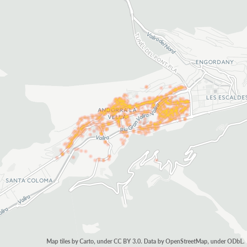
Map of Postal Code AD500 - Andorra la Vella
Interactive Map
Postal Code AD500 - Andorra la Vella Population
Years 1975 to 2020
| Data | 1975 | 1990 | 2000 | 2015 | 2020 |
|---|---|---|---|---|---|
| Population | 11,233 | 17,185 | 18,554 | 16,163 | 16,660 |
| Population Density | 503.4 / km² | 770.1 / km² | 831.4 / km² | 724.3 / km² | 746.6 / km² |
Postal Code AD500 - Andorra la Vella Population change from 2000 to 2015
Decrease of 12.9% from year 2000 to 2015
| Location | Change since 1975 | Change since 1990 | Change since 2000 |
|---|---|---|---|
| Postal Code AD500 - Andorra la Vella | +43.9% | -5.9% | -12.9% |
| Andorra la Vella | +54% | -5.9% | -13.3% |
| Andorra la Vella (administrative region) | +51.5% | -4.7% | -11.6% |
| Andorra | +129.5% | +29.3% | +7.8% |
Postal Code AD500 - Andorra la Vella Median Age
Median Age: 40.8 years
| Location | Median Age | Median Age (Female) | Median Age (Male) |
|---|---|---|---|
| Postal Code AD500 - Andorra la Vella | 40.8 yrs | 41.4 yrs | 40.3 yrs |
| Andorra la Vella | 40.9 yrs | 41.6 yrs | 40.1 yrs |
| Andorra la Vella (administrative region) | 40.7 yrs | 41.4 yrs | 40 yrs |
| Andorra | 40.1 yrs | 39.8 yrs | 40.4 yrs |
Postal Code AD500 Population Density
Population Density: 724 / km²
| Location | Population | Area | Density |
|---|---|---|---|
| Postal Code AD500 | 16,163 | 22.3 km² | 724 / km² |
| Andorra la Vella | 16,468 | 8.3 km² | 1,987 / km² |
| Andorra la Vella (administrative region) | 16,741 | 14.5 km² | 1,155 / km² |
| Andorra | 70,488 | 464.5 km² | 152 / km² |
Postal Code AD500 - Andorra la Vella Historical and Projected Population
Estimated Population from 0 to 2100
- JRC (European Commission's Joint Research Centre) work on the GHS built-up grid
- CIESIN (Center for International Earth Science Information Network)
- [Link] Klein Goldewijk, K., Beusen, A., Doelman, J., and Stehfest, E.: Anthropogenic land use estimates for the Holocene – HYDE 3.2, Earth Syst. Sci. Data, 9, 927–953, https://doi.org/10.5194/essd-9-927-2017, 2017.
Area Codes
Percentage Area Codes used by businesses in Postal Code AD500 - Andorra la Vella
Industries
Business Distribution by Industry in Postal Code AD500 - Andorra la Vella
| Industry Description | Number of Establishments | Average Age of Business |
|---|---|---|
| Art galleries | 45 | — |
| Bars, pubs and taverns | 62 | — |
| Beauty salons | 45 | — |
| Car repair | 54 | — |
| Clothing stores | 106 | — |
| Corporate management | 69 | 37.4 years |
| Electronics stores | 59 | — |
| Hairdressers | 44 | — |
| Hotels and motels | 54 | — |
| Lawyers legal | 48 | — |
| Other accommodation | 69 | — |
| Pharmacies and drug stores | 49 | — |
| Real estate | 84 | — |
| Restaurants | 221 | — |
| Shopping | 214 | 40.7 years |
Business distribution by price for Postal Code AD500 - Andorra la Vella
Human Development Index (HDI)
Statistic composite index of life expectancy, education, and per capita income.
Postal Code AD500 CO2 Emissions
Carbon Dioxide (CO2) Emissions Per Capita in Tonnes Per Year
| Location | CO2 Emissions | CO2 Emissions Per Capita | CO2 Emissions Intensity |
|---|---|---|---|
| Postal Code AD500 | 197,009 tn | 12.19 tn | 8,828.3 tons/km² |
| Andorra la Vella | 200,727 tn | 12.19 tn | 24,215.9 tons/km² |
| Andorra la Vella (administrative region) | 204,054 tn | 12.19 tn | 14,076.1 tons/km² |
| Andorra | 835,773 tn | 11.86 tn | 1,799.5 tons/km² |
| 2013 CO2 emissions (tonnes/year) | 197,009 tn |
| 2013 CO2 emissions (tonnes/year) per capita | 12.19 tn |
| 2013 CO2 emissions intensity (tonnes/km²/year) | 8,828.3 tons/km² |
Natural Hazards Risk
Relative risk out of 10
| Hazard | Risk Level |
|---|---|
| Earthquake | Medium (4) |
Recent Nearby Earthquakes
Magnitude 3.0 and greater
| Date▼ | Time↕ | Magnitude↕ | Distance↕ | Depth↕ | Location↕ | Link |
|---|---|---|---|---|---|---|
| 4/3/19 | 8:29 AM | 3.7 | 29.2 km | 10,000 m | 13km SE of Sort, Spain | usgs.gov |
| 7/22/08 | 3:36 PM | 4.3 | 94.9 km | 5,000 m | Pyrenees | usgs.gov |
| 5/18/08 | 7:49 AM | 3.3 | 73.7 km | 5,000 m | Pyrenees | usgs.gov |
| 2/14/08 | 11:34 PM | 3.9 | 77 km | 4,000 m | Pyrenees | usgs.gov |
| 9/11/07 | 1:49 AM | 3.6 | 27.4 km | 5,000 m | Pyrenees | usgs.gov |
| 7/13/07 | 8:02 AM | 3.8 | 49.9 km | 5,000 m | Pyrenees | usgs.gov |
| 7/7/07 | 6:24 AM | 3.2 | 18.2 km | — | Pyrenees | usgs.gov |
| 4/9/07 | 2:40 AM | 3.4 | 42.5 km | 10,000 m | Pyrenees | usgs.gov |
| 8/3/06 | 8:48 AM | 3.3 | 6.8 km | 5,000 m | Pyrenees | usgs.gov |
| 6/12/06 | 9:04 AM | 3.3 | 11.2 km | — | Pyrenees | usgs.gov |
Primary City
Andorra la Vella (Catalan pronunciation: [ənˈdorə ɫə ˈβeʎə], locally: [anˈdɔra la ˈβeʎa]) is the capital of the Principality of Andorra, and is located high in the east Pyrenees between France and Spain. It is also the name of the parish that surroun..
Andorra la Vella Wikipedia Page
Cities
Percentage of businesses by city in Postal Code AD500 - Andorra la Vella
About Our Data
The data on this page is estimated using a number of publicly available tools and resources. It is provided without warranty, and could contain inaccuracies. Use at your own risk.