Postal Code 2007 - Ultimo, New South Wales
| Primary City | Ultimo, New South Wales |
| Area of Postal Code 2007 | 0.561 km² |
| Population | 6,524 |
| Male Population | 3,284 (50.3%) |
| Female Population | 3,240 (49.7%) |
| Population change from 1975 to 2015 | +71.8% |
| Population change from 2000 to 2015 | +25.3% |
| Median Age | 29.3 years |
| Male Median Age | 29.5 years |
| Female Median Age | 29 years |
| Neighborhoods | Chippendale, Glebe, Haymarket, South Sydney, Ultimo |
| Timezone | Australian Eastern Standard Time |
| Coordinates | -33.880286669353765° / 151.19794806423673° |
| Related Postal Codes | 2000, 2001, 2002, 2004, 2006, 2008, 2009, 2013, 2015, 2016 |
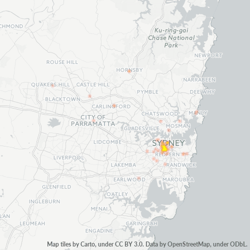
Map of Postal Code 2007 - Ultimo, New South Wales
Interactive Map
Postal Code 2007 - Ultimo, New South Wales Population
Years 1975 to 2020
| Data | 1975 | 1990 | 2000 | 2015 | 2020 |
|---|---|---|---|---|---|
| Population | 3,797 | 4,658 | 5,205 | 6,524 | 7,067 |
| Population Density | 6,771.4 / km² | 8,306.8 / km² | 9,282.3 / km² | 11,634.6 / km² | 12,602.9 / km² |
Postal Code 2007 - Ultimo, New South Wales Population change from 2000 to 2015
Increase of 25.3% from year 2000 to 2015
| Location | Change since 1975 | Change since 1990 | Change since 2000 |
|---|---|---|---|
| Postal Code 2007 - Ultimo, New South Wales | +71.8% | +40.1% | +25.3% |
| Ultimo | +72.4% | +40.4% | +25.4% |
| New South Wales | +72.6% | +40.2% | +25.4% |
| Australia | +72.6% | +40.3% | +25.5% |
Postal Code 2007 - Ultimo, New South Wales Median Age
Median Age: 29.3 years
| Location | Median Age | Median Age (Female) | Median Age (Male) |
|---|---|---|---|
| Postal Code 2007 - Ultimo, New South Wales | 29.3 yrs | 29 yrs | 29.5 yrs |
| Ultimo | 29.3 yrs | 29 yrs | 29.5 yrs |
| New South Wales | 38.3 yrs | 39.2 yrs | 37.4 yrs |
| Australia | 37.7 yrs | 38.6 yrs | 36.8 yrs |
Postal Code 2007 Population Density
Population Density: 11,635 / km²
| Location | Population | Area | Density |
|---|---|---|---|
| Postal Code 2007 | 6,524 | 0.561 km² | 11,635 / km² |
| Ultimo, New South Wales | 11,080 | 0.558 km² | 19,842 / km² |
| New South Wales | 8.1 million | 801,634.1 km² | 10.1 / km² |
| Australia | 23.8 million | 7,690,961.5 km² | 3.1 / km² |
Postal Code 2007 - Ultimo, New South Wales Historical and Projected Population
Estimated Population from 1880 to 2100
- JRC (European Commission's Joint Research Centre) work on the GHS built-up grid
- CIESIN (Center for International Earth Science Information Network)
- [Link] Klein Goldewijk, K., Beusen, A., Doelman, J., and Stehfest, E.: Anthropogenic land use estimates for the Holocene – HYDE 3.2, Earth Syst. Sci. Data, 9, 927–953, https://doi.org/10.5194/essd-9-927-2017, 2017.
Neighborhoods
Business Distribution by neighborhood in Postal Code 2007 - Ultimo, New South Wales
Area Codes
Percentage Area Codes used by businesses in Postal Code 2007 - Ultimo, New South Wales
Industries
Business Distribution by Industry in Postal Code 2007 - Ultimo, New South Wales
| Industry Description | Number of Establishments | Average Age of Business |
|---|---|---|
| Accountants | 56 | 26.1 years |
| Advertising and marketing | 114 | 19.4 years |
| Cafes | 65 | — |
| Clothing stores | 64 | — |
| Construction of buildings | 48 | 25.7 years |
| Corporate management | 153 | 24.1 years |
| Education | 47 | 21.8 years |
| Electronics stores | 149 | 21.3 years |
| Health and medical | 45 | 27.9 years |
| Higher education (colleges and universities) | 48 | 24.9 years |
| Real estate | 46 | 27.5 years |
| Restaurants | 192 | 14.2 years |
| Shopping | 129 | 27.5 years |
| Specialized design | 77 | — |
Business distribution by price for Postal Code 2007 - Ultimo, New South Wales
Human Development Index (HDI)
Statistic composite index of life expectancy, education, and per capita income.
Postal Code 2007 CO2 Emissions
Carbon Dioxide (CO2) Emissions Per Capita in Tonnes Per Year
| Location | CO2 Emissions | CO2 Emissions Per Capita | CO2 Emissions Intensity |
|---|---|---|---|
| Postal Code 2007 | 129,201 tn | 19.8 tn | 230,409.7 tons/km² |
| Ultimo, New South Wales | 219,427 tn | 19.8 tn | 392,938.9 tons/km² |
| New South Wales | 140,286,593 tn | 17.39 tn | 175 tons/km² |
| Australia | 401,155,564 tn | 16.88 tn | 52.2 tons/km² |
| 2013 CO2 emissions (tonnes/year) | 129,201 tn |
| 2013 CO2 emissions (tonnes/year) per capita | 19.8 tn |
| 2013 CO2 emissions intensity (tonnes/km²/year) | 230,409.7 tons/km² |
Natural Hazards Risk
Relative risk out of 10
| Hazard | Risk Level |
|---|---|
| Drought | Medium (4) |
| Flood | High (8) |
| Earthquake | Medium (4) |
Recent Nearby Earthquakes
Magnitude 3.0 and greater
| Date▼ | Time↕ | Magnitude↕ | Distance↕ | Depth↕ | Location↕ | Link |
|---|---|---|---|---|---|---|
| 9/9/12 | 11:23 PM | 3.2 | 76.7 km | 2,000 m | near the southeast coast of Australia | usgs.gov |
| 8/17/07 | 8:57 PM | 3.2 | 93.9 km | 18,000 m | near the southeast coast of Australia | usgs.gov |
| 4/10/07 | 5:58 PM | 3.1 | 44.8 km | 20,000 m | near the southeast coast of Australia | usgs.gov |
| 10/31/05 | 10:13 AM | 3.1 | 94.7 km | — | near the southeast coast of Australia | usgs.gov |
| 2/14/02 | 5:27 AM | 3.9 | 81.1 km | 10,000 m | near the southeast coast of Australia | usgs.gov |
| 3/16/99 | 5:58 PM | 3.8 | 62.1 km | 10,000 m | near the southeast coast of Australia | usgs.gov |
| 6/24/87 | 7:53 AM | 3.1 | 54.3 km | 33,000 m | near the southeast coast of Australia | usgs.gov |
| 2/20/86 | 1:43 PM | 4.1 | 89.4 km | 5,000 m | near the southeast coast of Australia | usgs.gov |
| 11/15/81 | 8:58 AM | 4.2 | 48.1 km | 30,000 m | near the southeast coast of Australia | usgs.gov |
| 3/9/73 | 11:09 AM | 5.5 | 90.5 km | 13,000 m | near the southeast coast of Australia | usgs.gov |
Primary City
Ultimo is an inner-city suburb of Sydney, New South Wales, Australia. Ultimo is located 2 kilometres south-west of the Sydney central business district in the local government area of the City of Sydney. is a locality around the road of the same nam..
Ultimo, New South Wales Wikipedia Page
Cities
Percentage of businesses by city in Postal Code 2007 - Ultimo, New South Wales
About Our Data
The data on this page is estimated using a number of publicly available tools and resources. It is provided without warranty, and could contain inaccuracies. Use at your own risk.