Postal Code 7134 - Thuin, Wallonia
| Primary City | Thuin |
| Area of Postal Code 7134 | 25.5 km² |
| Population | 20,524 |
| Male Population | 9,815 (47.8%) |
| Female Population | 10,709 (52.2%) |
| Population change from 1975 to 2015 | -3.3% |
| Population change from 2000 to 2015 | +3.4% |
| Median Age | 42.3 years |
| Male Median Age | 40.4 years |
| Female Median Age | 44 years |
| Timezone | Central European Summer Time |
| Coordinates | 50.42178377112393° / 4.193624002966355° |
| Related Postal Codes | 7100, 7110, 7120, 7130, 7131, 7133, 7140, 7160, 7170, 7180 |
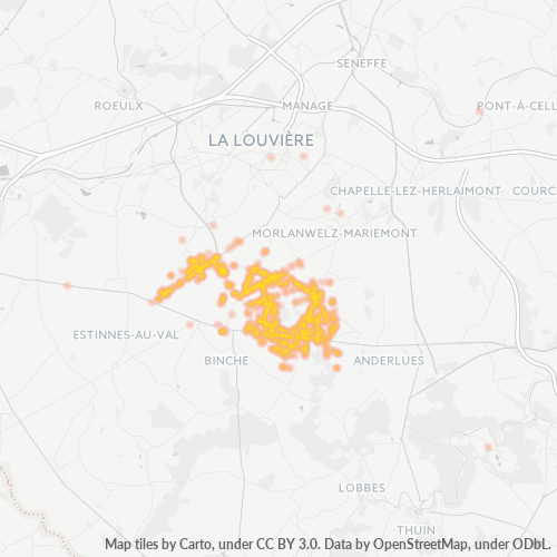
Map of Postal Code 7134 - Thuin, Wallonia
Interactive Map
Postal Code 7134 - Thuin, Wallonia Population
Years 1975 to 2020
| Data | 1975 | 1990 | 2000 | 2015 | 2020 |
|---|---|---|---|---|---|
| Population | 21,227 | 20,141 | 19,851 | 20,524 | 21,076 |
| Population Density | 832 / km² | 789.5 / km² | 778.1 / km² | 804.5 / km² | 826.1 / km² |
Postal Code 7134 - Thuin, Wallonia Population change from 2000 to 2015
Increase of 3.4% from year 2000 to 2015
| Location | Change since 1975 | Change since 1990 | Change since 2000 |
|---|---|---|---|
| Postal Code 7134 - Thuin, Wallonia | -3.3% | +1.9% | +3.4% |
| Thuin | -33.4% | -17.3% | -6.3% |
| Belgium | +15.7% | +13.2% | +10% |
Postal Code 7134 - Thuin, Wallonia Median Age
Median Age: 42.3 years
| Location | Median Age | Median Age (Female) | Median Age (Male) |
|---|---|---|---|
| Postal Code 7134 - Thuin, Wallonia | 42.3 yrs | 44 yrs | 40.4 yrs |
| Thuin | 44.9 yrs | 46.5 yrs | 43.2 yrs |
| Belgium | 41.4 yrs | 42.5 yrs | 40.3 yrs |
Postal Code 7134 Population Density
Population Density: 805 / km²
| Location | Population | Area | Density |
|---|---|---|---|
| Postal Code 7134 | 20,524 | 25.5 km² | 805 / km² |
| Thuin | 4,931 | 3.878 km² | 1,272 / km² |
| Belgium | 11.3 million | 30,664.8 km² | 368 / km² |
Postal Code 7134 - Thuin, Wallonia Historical and Projected Population
Estimated Population from 300 to 2100
- JRC (European Commission's Joint Research Centre) work on the GHS built-up grid
- CIESIN (Center for International Earth Science Information Network)
- [Link] Klein Goldewijk, K., Beusen, A., Doelman, J., and Stehfest, E.: Anthropogenic land use estimates for the Holocene – HYDE 3.2, Earth Syst. Sci. Data, 9, 927–953, https://doi.org/10.5194/essd-9-927-2017, 2017.
Area Codes
Percentage Area Codes used by businesses in Postal Code 7134 - Thuin, Wallonia
Industries
Business Distribution by Industry in Postal Code 7134 - Thuin, Wallonia
| Industry Description | Number of Establishments | Average Age of Business |
|---|---|---|
| Beauty salons | 41 | — |
| Cafes | 28 | — |
| Car repair | 40 | 29 years |
| Construction of buildings | 34 | 22 years |
| Construction of houses | 41 | — |
| Electrical installation | 27 | — |
| Gas station | 26 | — |
| Grocery stores and supermarkets | 56 | — |
| Hairdressers | 40 | — |
| Health and medical | 42 | 21 years |
| Nurses | 26 | — |
| Other construction | 32 | — |
| Restaurants | 52 | — |
| Shopping | 43 | 23.5 years |
| Sports clubs | 34 | — |
| Sports other | 51 | — |
Human Development Index (HDI)
Statistic composite index of life expectancy, education, and per capita income.
Postal Code 7134 CO2 Emissions
Carbon Dioxide (CO2) Emissions Per Capita in Tonnes Per Year
| Location | CO2 Emissions | CO2 Emissions Per Capita | CO2 Emissions Intensity |
|---|---|---|---|
| Postal Code 7134 | 161,882 tn | 7.89 tn | 6,345.2 tons/km² |
| Thuin | 39,327 tn | 7.98 tn | 10,141.4 tons/km² |
| Belgium | 92,691,347 tn | 8.22 tn | 3,022.7 tons/km² |
| 2013 CO2 emissions (tonnes/year) | 161,882 tn |
| 2013 CO2 emissions (tonnes/year) per capita | 7.89 tn |
| 2013 CO2 emissions intensity (tonnes/km²/year) | 6,345.2 tons/km² |
Natural Hazards Risk
Relative risk out of 10
| Hazard | Risk Level |
|---|---|
| Flood | Medium (7) |
| Earthquake | Medium (4) |
Recent Nearby Earthquakes
Magnitude 3.0 and greater
| Date▼ | Time↕ | Magnitude↕ | Distance↕ | Depth↕ | Location↕ | Link |
|---|---|---|---|---|---|---|
| 9/12/08 | 6:14 PM | 3.3 | 38.3 km | 5,000 m | Belgium | usgs.gov |
| 7/13/08 | 6:45 AM | 3.8 | 35.8 km | 4,000 m | Belgium | usgs.gov |
| 7/13/08 | 6:33 PM | 3.2 | 29.1 km | 4,000 m | Belgium | usgs.gov |
| 2/27/05 | 12:16 AM | 3.1 | 85.3 km | 4,000 m | France | usgs.gov |
| 6/19/95 | 6:54 PM | 4.3 | 21.9 km | 20,000 m | Belgium | usgs.gov |
| 7/20/94 | 11:01 AM | 3.1 | 17.6 km | 5,000 m | Belgium | usgs.gov |
| 7/20/94 | 11:01 AM | 3.5 | 19.7 km | 5,000 m | Belgium | usgs.gov |
| 8/29/92 | 2:22 AM | 4.1 | 23.8 km | 17,900 m | Belgium | usgs.gov |
| 8/26/92 | 4:41 PM | 3.9 | 32.3 km | 10,000 m | Belgium | usgs.gov |
| 5/9/90 | 8:54 PM | 3.1 | 76.5 km | 11,200 m | Belgium | usgs.gov |
Primary City
Thuin (French pronunciation: [tɥɛ̃]) is a Walloon municipality located in the Belgian province of Hainaut. The Thuin municipality includes the old communes of Leers-et-Fosteau, Biesme-sous-Thuin, Ragnies, Biercée, Gozée, Donstiennes, and Thuillies.
Thuin Wikipedia Page
Cities
Percentage of businesses by city in Postal Code 7134 - Thuin, Wallonia
About Our Data
The data on this page is estimated using a number of publicly available tools and resources. It is provided without warranty, and could contain inaccuracies. Use at your own risk.