Postal Code T4B - Airdrie, Alberta
| Primary City | Airdrie, Alberta |
| Area of Postal Code T4B | 387.1 km² |
| Population | 44,420 |
| Male Population | 22,336 (50.3%) |
| Female Population | 22,084 (49.7%) |
| Population change from 1975 to 2020 | +218.0% |
| Population change from 2000 to 2020 | +66.3% |
| Median Age | 32.6 years |
| Male Median Age | 32.3 years |
| Female Median Age | 33 years |
| Area Codes | 403, 780 |
| Postal Code Extensions | T4B 0A1, T4B 0A2, T4B 0A3, T4B 0A4, T4B 0A5, T4B 0A6, T4B 0A7, T4B 0A8, T4B 0A9, T4B 0B1 More |
| Associated Cities | Calgary, Rocky View County |
| Neighborhoods | Northeast Calgary, Northwest Calgary, Reunion, Southwest Calgary, Williamstown |
| Timezone | Mountain Daylight Time |
| Coordinates | 51.28563642225955° / -114.0171674291198° |
| Related Postal Codes | T4A, T4E, T4G, T4H, T4J, T4L, T4N, T4P, T4R, T4S |
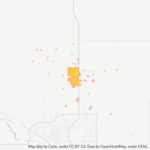
Map of Postal Code T4B - Airdrie, Alberta
Interactive Map
Postal Code T4B - Airdrie, Alberta Population
Years 1975 to 2030
| Data | 1975 | 1990 | 2000 | 2015 | 2020 | 2025* | 2030* |
|---|---|---|---|---|---|---|---|
| Population | 13,967 | 20,898 | 26,713 | 37,973 | 44,420 | 48,511 | 51,370 |
| Population Density | 36.1 / km² | 54 / km² | 69 / km² | 98.1 / km² | 114.7 / km² | 125.3 / km² | 132.7 / km² |
Postal Code T4B - Airdrie, Alberta Population change from 2000 to 2020
Increase of 66.3% from year 2000 to 2020
| Location | Change since 1975 | Change since 1990 | Change since 2000 |
|---|---|---|---|
| Postal Code T4B - Airdrie, Alberta | +218% | +112.6% | +66.3% |
| Airdrie | +216.2% | +111% | +65.3% |
| Alberta | +158.8% | +86.6% | +52.8% |
| Canada | — | — | — |
Postal Code T4B - Airdrie, Alberta Median Age
Median Age: 32.6 years
| Location | Median Age | Median Age (Female) | Median Age (Male) |
|---|---|---|---|
| Postal Code T4B - Airdrie, Alberta | 32.6 yrs | 33 yrs | 32.3 yrs |
| Airdrie | 32.5 yrs | 32.9 yrs | 32.2 yrs |
| Alberta | 36.5 yrs | 37.1 yrs | 35.9 yrs |
| Canada | 40.6 yrs | 41.5 yrs | 39.6 yrs |
Postal Code T4B Population Density
Population Density: 115 / km²
| Location | Population | Area | Density |
|---|---|---|---|
| Postal Code T4B | 44,420 | 387.1 km² | 115 / km² |
| Airdrie, Alberta | 56,813 | 86.1 km² | 660 / km² |
| Alberta | 4.6 million | 663,102.6 km² | 7 / km² |
| Canada | 35.5 million | 9,875,295.4 km² | 3.6 / km² |
Postal Code T4B - Airdrie, Alberta Historical and Projected Population
Estimated Population from 1910 to 2100
- JRC (European Commission's Joint Research Centre) work on the GHS built-up grid
- CIESIN (Center for International Earth Science Information Network)
- [Link] Klein Goldewijk, K., Beusen, A., Doelman, J., and Stehfest, E.: Anthropogenic land use estimates for the Holocene – HYDE 3.2, Earth Syst. Sci. Data, 9, 927–953, https://doi.org/10.5194/essd-9-927-2017, 2017.
Neighborhoods
Business Distribution by neighborhood in Postal Code T4B - Airdrie, Alberta
Area Codes
Percentage Area Codes used by businesses in Postal Code T4B - Airdrie, Alberta
Industries
Business Distribution by Industry in Postal Code T4B - Airdrie, Alberta
| Industry Description | Number of Establishments | Average Age of Business |
|---|---|---|
| Beauty salons | 71 | 17.7 years |
| Construction of buildings | 97 | 20.6 years |
| Corporate management | 71 | 22.4 years |
| Dentists | 59 | 19.1 years |
| Education | 55 | 24.6 years |
| General contractors | 106 | 21.2 years |
| Hairdressers | 61 | 22.6 years |
| Real estate | 129 | 22.4 years |
| Restaurants | 157 | 23 years |
| Shopping | 115 | 20.8 years |
| Shopping other | 52 | 22 years |
Business distribution by price for Postal Code T4B - Airdrie, Alberta
Human Development Index (HDI)
Statistic composite index of life expectancy, education, and per capita income.
Postal Code T4B - Airdrie, Alberta Gross Domestic Product (GDP)
GDP per capita, PPP (constant 2017 international $)
| Data | 1990 | 1995 | 2000 | 2005 | 2010 | 2015 | 2020 | 2022 |
|---|---|---|---|---|---|---|---|---|
| GDP per capita | $57,949 | $53,354 | $65,575 | $74,499 | $68,694 | $68,349 | $56,811 | $63,333 |
| Total GDP | $1.4B | $1.5B | $2.1B | $2.7B | $2.7B | $3.1B | $3B | $3.4B |
Postal Code T4B CO2 Emissions
Carbon Dioxide (CO2) Emissions Per Capita in Tonnes Per Year
| Location | CO2 Emissions | CO2 Emissions Per Capita | CO2 Emissions Intensity |
|---|---|---|---|
| Postal Code T4B | 789,638 tn | 17.78 tn | 2,039.7 tons/km² |
| Airdrie, Alberta | 1,006,196 tn | 17.71 tn | 11,686 tons/km² |
| Alberta | 74,477,019 tn | 16.12 tn | 112.3 tons/km² |
| Canada | 521,999,336 tn | 14.7 tn | 52.9 tons/km² |
| 2013 CO2 emissions (tonnes/year) | 789,638 tn |
| 2013 CO2 emissions (tonnes/year) per capita | 17.78 tn |
| 2013 CO2 emissions intensity (tonnes/km²/year) | 2,039.7 tons/km² |
Natural Hazards Risk
Relative risk out of 10
| Hazard | Risk Level |
|---|---|
| Drought | Medium (7) |
Recent Nearby Earthquakes
Magnitude 3.0 and greater
| Date▼ | Time↕ | Magnitude↕ | Distance↕ | Depth↕ | Location↕ | Link |
|---|---|---|---|---|---|---|
| 7/28/02 | 9:49 AM | 3.6 | 92.4 km | 1,000 m | British Columbia, Canada | usgs.gov |
| 6/18/91 | 10:57 AM | 3.5 | 82.9 km | 5,000 m | Alberta, Canada | usgs.gov |
| 3/21/83 | 8:55 PM | 3.6 | 80.7 km | 5,000 m | Alberta, Canada | usgs.gov |
Primary City
Airdrie is a city in Alberta, Canada within the Calgary Region. It is located north of Calgary within the Calgary–Edmonton Corridor at the intersection of Queen Elizabeth II Highway (Highway 2) and Highway 567. City of Airdrie is part of the Calgary..
Airdrie, Alberta Wikipedia Page
About Our Data
The data on this page is estimated using a number of publicly available tools and resources. It is provided without warranty, and could contain inaccuracies. Use at your own risk.