Postal Code 10000 - Zagreb
| Primary City | Zagreb |
| Area of Postal Code 10000 | 154.1 km² |
| Population | 274,109 |
| Male Population | 128,180 (46.8%) |
| Female Population | 145,929 (53.2%) |
| Population change from 1975 to 2015 | +7.7% |
| Population change from 2000 to 2015 | +1.6% |
| Median Age | 41.2 years |
| Male Median Age | 38.8 years |
| Female Median Age | 43.3 years |
| Neighborhoods | Donji Grad, Gornji Grad – Medveščak, Grad Zagreb, Maksimir, Trešnjevka - sjever |
| Timezone | Central European Summer Time |
| Coordinates | 45.84411324182818° / 15.98762481895351° |
| Related Postal Codes | 10010, 10020, 10040, 10090, 10110, 10150, 10250, 10251, 10253, 10255 |
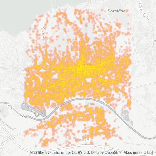
Map of Postal Code 10000 - Zagreb
Interactive Map
Postal Code 10000 - Zagreb Population
Years 1975 to 2020
| Data | 1975 | 1990 | 2000 | 2015 | 2020 |
|---|---|---|---|---|---|
| Population | 254,584 | 284,212 | 269,746 | 274,109 | 274,112 |
| Population Density | 1,652.3 / km² | 1,844.6 / km² | 1,750.7 / km² | 1,779 / km² | 1,779 / km² |
Postal Code 10000 - Zagreb Population change from 2000 to 2015
Increase of 1.6% from year 2000 to 2015
| Location | Change since 1975 | Change since 1990 | Change since 2000 |
|---|---|---|---|
| Postal Code 10000 - Zagreb | +7.7% | -3.6% | +1.6% |
| Zagreb | +6.2% | -5% | +0.4% |
| Zagreb County | +19.9% | +1.6% | +3.3% |
| Croatia | -6.1% | -11.4% | -4.3% |
Postal Code 10000 - Zagreb Median Age
Median Age: 41.2 years
| Location | Median Age | Median Age (Female) | Median Age (Male) |
|---|---|---|---|
| Postal Code 10000 - Zagreb | 41.2 yrs | 43.3 yrs | 38.8 yrs |
| Zagreb | 41.2 yrs | 43.3 yrs | 38.8 yrs |
| Zagreb County | 41.2 yrs | 43.3 yrs | 38.8 yrs |
| Croatia | 42.1 yrs | 44.1 yrs | 40 yrs |
Postal Code 10000 Population Density
Population Density: 1,779 / km²
| Location | Population | Area | Density |
|---|---|---|---|
| Postal Code 10000 | 274,109 | 154.1 km² | 1,779 / km² |
| Zagreb | 645,504 | 154.5 km² | 4,179 / km² |
| Zagreb County | 786,815 | 641.3 km² | 1,227 / km² |
| Croatia | 4.2 million | 56,366.2 km² | 73.9 / km² |
Postal Code 10000 - Zagreb Historical and Projected Population
Estimated Population from 1200 to 2100
- JRC (European Commission's Joint Research Centre) work on the GHS built-up grid
- CIESIN (Center for International Earth Science Information Network)
- [Link] Klein Goldewijk, K., Beusen, A., Doelman, J., and Stehfest, E.: Anthropogenic land use estimates for the Holocene – HYDE 3.2, Earth Syst. Sci. Data, 9, 927–953, https://doi.org/10.5194/essd-9-927-2017, 2017.
Neighborhoods
Business Distribution by neighborhood in Postal Code 10000 - Zagreb
Area Codes
Percentage Area Codes used by businesses in Postal Code 10000 - Zagreb
Industries
Business Distribution by Industry in Postal Code 10000 - Zagreb
| Industry Description | Number of Establishments | Average Age of Business |
|---|---|---|
| Beauty salons | 1,848 | 24.9 years |
| Cafes | 1,367 | 34.9 years |
| Construction of buildings | 1,073 | 48 years |
| Corporate management | 1,447 | 26.5 years |
| Electronics stores | 1,397 | 26.1 years |
| Grocery stores and supermarkets | 1,499 | 31.2 years |
| Restaurants | 1,983 | 20.4 years |
| Shopping | 2,596 | 28 years |
Business distribution by price for Postal Code 10000 - Zagreb
Human Development Index (HDI)
Statistic composite index of life expectancy, education, and per capita income.
Postal Code 10000 CO2 Emissions
Carbon Dioxide (CO2) Emissions Per Capita in Tonnes Per Year
| Location | CO2 Emissions | CO2 Emissions Per Capita | CO2 Emissions Intensity |
|---|---|---|---|
| Postal Code 10000 | 1,810,004 tn | 6.6 tn | 11,747.2 tons/km² |
| Zagreb | 4,298,039 tn | 6.66 tn | 27,823.6 tons/km² |
| Zagreb County | 5,185,692 tn | 6.59 tn | 8,086.2 tons/km² |
| Croatia | 23,288,703 tn | 5.59 tn | 413.2 tons/km² |
| 2013 CO2 emissions (tonnes/year) | 1,810,004 tn |
| 2013 CO2 emissions (tonnes/year) per capita | 6.6 tn |
| 2013 CO2 emissions intensity (tonnes/km²/year) | 11,747.2 tons/km² |
Natural Hazards Risk
Relative risk out of 10
| Hazard | Risk Level |
|---|---|
| Earthquake | High (7.5) |
| Landslide | Medium (7) |
Recent Nearby Earthquakes
Magnitude 3.0 and greater
| Date▼ | Time↕ | Magnitude↕ | Distance↕ | Depth↕ | Location↕ | Link |
|---|---|---|---|---|---|---|
| 11/1/15 | 12:52 AM | 4.3 | 33.9 km | 2,360 m | 5km SSW of Brezice, Slovenia | usgs.gov |
| 10/1/14 | 9:43 PM | 3.9 | 81 km | 10,000 m | 7km WNW of Dobrljin, Bosnia and Herzegovina | usgs.gov |
| 3/13/14 | 10:31 AM | 4.4 | 89.1 km | 2,000 m | 9km E of Ribnica, Slovenia | usgs.gov |
| 6/16/13 | 1:04 PM | 4 | 87.1 km | 10,000 m | 5km WSW of Zuzemberk, Slovenia | usgs.gov |
| 6/25/08 | 7:09 AM | 3.1 | 73.8 km | 9,400 m | Slovenia | usgs.gov |
| 4/18/08 | 6:49 PM | 3.9 | 84.5 km | 10,000 m | Slovenia | usgs.gov |
| 3/5/08 | 11:41 AM | 3.5 | 20 km | 10,000 m | Croatia | usgs.gov |
| 12/17/07 | 7:26 PM | 3.1 | 53.8 km | 5,000 m | Croatia | usgs.gov |
| 9/28/07 | 6:24 PM | 3.4 | 47.9 km | 11,000 m | Slovenia | usgs.gov |
| 9/26/07 | 12:47 PM | 3.2 | 34 km | 10,000 m | Slovenia | usgs.gov |
Primary City
Zagreb (Croatian pronunciation: [zǎːɡreb]; names in other languages) is the capital and the largest city of the Republic of Croatia. It is located in the northwest of the country, along the Sava river, at the southern slopes of the Medvednica mountai..
Zagreb Wikipedia Page
About Our Data
The data on this page is estimated using a number of publicly available tools and resources. It is provided without warranty, and could contain inaccuracies. Use at your own risk.