Postal Code 4863 - Eskilstrup, Region Zealand
| Primary City | Eskilstrup |
| Area of Postal Code 4863 | 44.8 km² |
| Population | 2,391 |
| Male Population | 1,232 (51.5%) |
| Female Population | 1,159 (48.5%) |
| Population change from 1975 to 2020 | +6.7% |
| Population change from 2000 to 2020 | -11.2% |
| Median Age | 43.5 years |
| Male Median Age | 43 years |
| Female Median Age | 44 years |
| Timezone | Central European Summer Time |
| Coordinates | 54.85197105574231° / 11.895413255827998° |
| Related Postal Codes | 4800, 4840, 4850, 4862, 4871, 4873, 4874, 4880, 4891, 4892 |
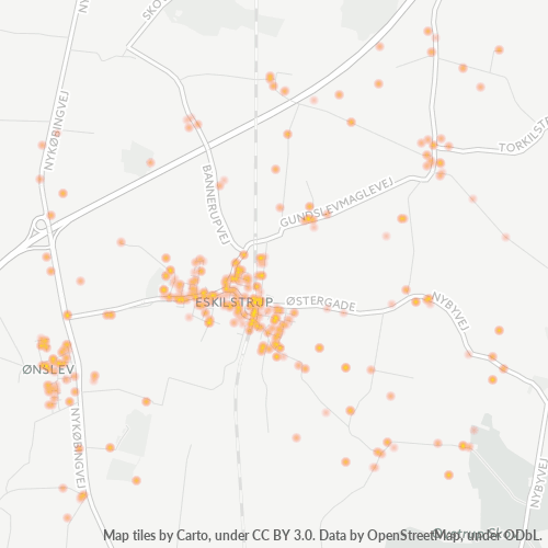
Map of Postal Code 4863 - Eskilstrup, Region Zealand
Interactive Map
Postal Code 4863 - Eskilstrup, Region Zealand Population
Years 1975 to 2030
| Data | 1975 | 1990 | 2000 | 2015 | 2020 | 2025* | 2030* |
|---|---|---|---|---|---|---|---|
| Population | 2,241 | 2,703 | 2,694 | 2,739 | 2,391 | 2,406 | 2,400 |
| Population Density | 50 / km² | 60.3 / km² | 60.1 / km² | 61.1 / km² | 53.4 / km² | 53.7 / km² | 53.6 / km² |
Postal Code 4863 - Eskilstrup, Region Zealand Population change from 2000 to 2020
Decrease of 11.2% from year 2000 to 2020
| Location | Change since 1975 | Change since 1990 | Change since 2000 |
|---|---|---|---|
| Postal Code 4863 - Eskilstrup, Region Zealand | +6.7% | -11.5% | -11.2% |
| Eskilstrup | -55.4% | -55.7% | -54% |
| Region Zealand | +3.1% | +2.6% | +1.5% |
| Denmark | — | — | — |
Postal Code 4863 - Eskilstrup, Region Zealand Median Age
Median Age: 43.5 years
| Location | Median Age | Median Age (Female) | Median Age (Male) |
|---|---|---|---|
| Postal Code 4863 - Eskilstrup, Region Zealand | 43.5 yrs | 44 yrs | 43 yrs |
| Region Zealand | 43 yrs | 43.7 yrs | 42.2 yrs |
| Denmark | 40.5 yrs | 41.3 yrs | 39.6 yrs |
Postal Code 4863 Population Density
Population Density: 53.4 / km²
| Location | Population | Area | Density |
|---|---|---|---|
| Postal Code 4863 | 2,391 | 44.8 km² | 53.4 / km² |
| Eskilstrup | 380 | 0.83 km² | 458 / km² |
| Region Zealand | 809,474 | 7,343.5 km² | 110 / km² |
| Denmark | 5.5 million | 43,072 km² | 129 / km² |
Postal Code 4863 - Eskilstrup, Region Zealand Historical and Projected Population
Estimated Population from 0 to 2100
- JRC (European Commission's Joint Research Centre) work on the GHS built-up grid
- CIESIN (Center for International Earth Science Information Network)
- [Link] Klein Goldewijk, K., Beusen, A., Doelman, J., and Stehfest, E.: Anthropogenic land use estimates for the Holocene – HYDE 3.2, Earth Syst. Sci. Data, 9, 927–953, https://doi.org/10.5194/essd-9-927-2017, 2017.
Industries
Business Distribution by Industry in Postal Code 4863 - Eskilstrup, Region Zealand
| Industry Description | Number of Establishments |
|---|---|
| Construction of buildings | 1 |
| Kitchen and bath cabinets and remodel | 1 |
| Painting and paint contractors | 9 |
| Shopping | 3 |
| Sports clubs | 1 |
| Unreachable | 3 |
| Businesses | 1,328 |
| Estimated total revenue | ~€23.4M |
| Median revenue per business | ~€74.1K |
| Estimated jobs | 448 |
| Estimated payroll | ~€19.5M |
| Industries | Businesses | Total revenue | Median | Jobs |
|---|---|---|---|---|
| Agriculture, forestry and fishing | 27 | ~€2.0M | ~€116.0K | 28 |
| Human health and social work activities | 12 | ~€1.9M | ~€44.2K | 33 |
| Wholesale and retail trade; repair of motor vehicles and motorcycles | 41 | ~€1.7M | ~€37.5K | 38 |
| Arts, entertainment and recreation | 45 | ~€1.7M | ~€74.1K | 28 |
| Construction | 58 | ~€1.4M | ~€69.6K | 32 |
| Education | 17 | ~€1.4M | ~€83.8K | 29 |
| Transportation and storage | 28 | ~€1.3M | ~€77.4K | 27 |
| Other service activities | 82 | ~€969.8K | ~€54.1K | 36 |
Largest businesses by estimated revenue
- Eskilstrup Maskinstation v/Brødrene Fredslund I/S — Eskilstrup · ~€1.1M
- Let-Køb — Eskilstrup · ~€831.6K
- Jørgensen Jørgen (Medical Practitioner) — Eskilstrup · ~€816.5K
- Danmarks Traktormuseum — Eskilstrup · ~€473.5K
Postal Code 4863 - Eskilstrup, Region Zealand — Revenue trend
Median business revenue by year
| Year | 2019 | 2020 | 2021 | 2022 | 2023 | 2024 |
|---|---|---|---|---|---|---|
| Median revenue per business | ~€80.6K | ~€82.0K | ~€77.5K | ~€75.9K | ~€75.5K | ~€77.2K |
Business distribution by price for Postal Code 4863 - Eskilstrup, Region Zealand
Human Development Index (HDI)
Statistic composite index of life expectancy, education, and per capita income.
Postal Code 4863 - Eskilstrup, Region Zealand Gross Domestic Product (GDP)
GDP per capita, PPP (constant 2017 international $)
| Data | 1990 | 1995 | 2000 | 2005 | 2010 | 2015 | 2020 | 2022 |
|---|---|---|---|---|---|---|---|---|
| GDP per capita | $38,193 | $39,234 | $40,169 | $35,965 | $35,538 | $36,971 | $39,256 | $42,065 |
| Total GDP | $181.3M | $185.3M | $189.7M | $168.9M | $167.8M | $172.7M | $179.8M | $191M |
Postal Code 4863 CO2 Emissions
Carbon Dioxide (CO2) Emissions Per Capita in Tonnes Per Year
| Location | CO2 Emissions | CO2 Emissions Per Capita | CO2 Emissions Intensity |
|---|---|---|---|
| Postal Code 4863 | 25,912 tn | 10.84 tn | 578.3 tons/km² |
| Eskilstrup | 4,117 tn | 10.83 tn | 4,960.5 tons/km² |
| Region Zealand | 8,533,262 tn | 10.54 tn | 1,162 tons/km² |
| Denmark | 59,647,725 tn | 10.75 tn | 1,384.8 tons/km² |
| 2013 CO2 emissions (tonnes/year) | 25,912 tn |
| 2013 CO2 emissions (tonnes/year) per capita | 10.84 tn |
| 2013 CO2 emissions intensity (tonnes/km²/year) | 578.3 tons/km² |
Primary City
Eskilstrup is a town some 12 kilometres (7.5 mi) north of Nykobing Falster on the Danish island of Falster. As of 2015, it has a population of 1,082.
Eskilstrup Wikipedia Page
About Our Data
The data on this page is estimated using a number of publicly available tools and resources. It is provided without warranty, and could contain inaccuracies. Use at your own risk.