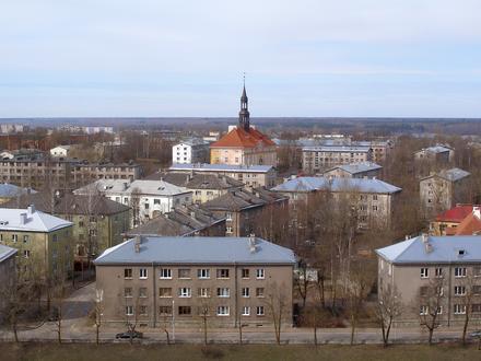
Postal Code 20601 - Narva, Ida-Viru County
Ida-Viru County | Estonia
| Primary City | Narva |
| Population | 66,980 |
| Timezone | Eastern European Summer Time |
| Coordinates | 59.45147° / 28.09212° |
| Related Postal Codes | 20207, 20301, 20501, 20603, 20604, 20605, 20606, 20607, 20608, 20609 |
Map of Postal Code 20601 - Narva, Ida-Viru County
Interactive Map
Narva Population Density
Population Density: 1,865 / km²
| Location | Population | Area | Density |
|---|---|---|---|
| Narva | 51,107 | 27.4 km² | 1,865 / km² |
| Ida-Viru County | 129,073 | 3,366.7 km² | 38.3 / km² |
| Estonia | 1.3 million | 45,265.4 km² | 28.6 / km² |
Sources: JRC (European Commission's Joint Research Centre) work on the GHS built-up grid
Narva CO2 Emissions
Carbon Dioxide (CO2) Emissions Per Capita in Tonnes Per Year
| Location | CO2 Emissions | CO2 Emissions Per Capita | CO2 Emissions Intensity |
|---|---|---|---|
| Narva | 444,258 tn | 8.69 tn | 16,211.6 tons/km² |
| Ida-Viru County | 1,047,854 tn | 8.12 tn | 311.2 tons/km² |
| Estonia | 11,346,165 tn | 8.75 tn | 250.7 tons/km² |
Sources: [Link] Moran, D., Kanemoto K; Jiborn, M., Wood, R., Többen, J., and Seto, K.C. (2018) Carbon footprints of 13,000 cities. Environmental Research Letters DOI: 10.1088/1748-9326/aac72a
Narva CO2 Emissions
| 2013 CO2 emissions (tonnes/year) | 444,258 tn |
| 2013 CO2 emissions (tonnes/year) per capita | 8.69 tn |
| 2013 CO2 emissions intensity (tonnes/km²/year) | 16,211.6 tons/km² |
Primary City
Narva (Russian: Нарва) is the third largest city in Estonia. It is located at the eastern extreme point of Estonia, at the Russian border, on the Narva River which drains Lake Peipus.
Narva Wikipedia Page