Postal Code 59430 - Saint-Pol-sur-Mer, Nord-Pas-de-Calais
| Primary City | Saint-Pol-sur-Mer |
| Area of Postal Code 59430 | 6.7 km² |
| Population | 18,664 |
| Male Population | 8,982 (48.1%) |
| Female Population | 9,682 (51.9%) |
| Population change from 1975 to 2020 | -28.7% |
| Population change from 2000 to 2020 | -5.1% |
| Median Age | 38.9 years |
| Male Median Age | 36.3 years |
| Female Median Age | 41.4 years |
| Associated Cities | Dunkirk |
| Timezone | Central European Summer Time |
| Coordinates | 51.031534983851365° / 2.3306173960530994° |
| Related Postal Codes | 59419 CEDEX, 59420, 59431 CEDEX, 59432 CEDEX, 59433 CEDEX, 59435 CEDEX, 59436 CEDEX, 59437 CEDEX, 59440, 59441 CEDEX |
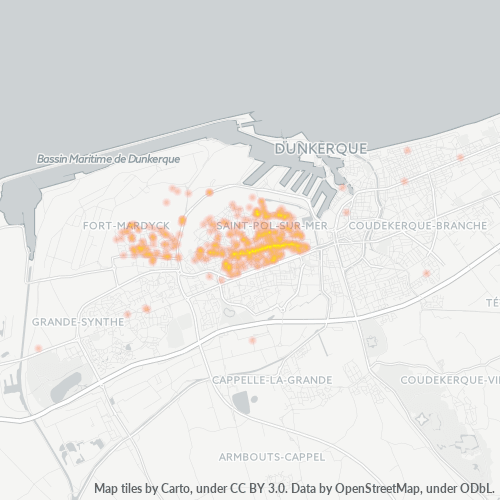
Map of Postal Code 59430 - Saint-Pol-sur-Mer, Nord-Pas-de-Calais
Interactive Map
Postal Code 59430 - Saint-Pol-sur-Mer, Nord-Pas-de-Calais Population
Years 1975 to 2030
| Data | 1975 | 1990 | 2000 | 2015 | 2020 | 2025* | 2030* |
|---|---|---|---|---|---|---|---|
| Population | 26,159 | 21,302 | 19,665 | 17,351 | 18,664 | 18,650 | 18,993 |
| Population Density | 3,901.4 / km² | 3,177.1 / km² | 2,932.9 / km² | 2,587.8 / km² | 2,783.6 / km² | 2,781.5 / km² | 2,832.7 / km² |
Postal Code 59430 - Saint-Pol-sur-Mer, Nord-Pas-de-Calais Population change from 2000 to 2020
Decrease of 5.1% from year 2000 to 2020
| Location | Change since 1975 | Change since 1990 | Change since 2000 |
|---|---|---|---|
| Postal Code 59430 - Saint-Pol-sur-Mer, Nord-Pas-de-Calais | -28.7% | -12.4% | -5.1% |
| Saint-Pol-sur-Mer | -16.3% | -5.1% | +2.7% |
| France | — | — | — |
Postal Code 59430 - Saint-Pol-sur-Mer, Nord-Pas-de-Calais Median Age
Median Age: 38.9 years
| Location | Median Age | Median Age (Female) | Median Age (Male) |
|---|---|---|---|
| Postal Code 59430 - Saint-Pol-sur-Mer, Nord-Pas-de-Calais | 38.9 yrs | 41.4 yrs | 36.3 yrs |
| Saint-Pol-sur-Mer | 38.9 yrs | 41.4 yrs | 36.3 yrs |
| France | 39.6 yrs | 41 yrs | 38.1 yrs |
Postal Code 59430 Population Density
Population Density: 2,784 / km²
| Location | Population | Area | Density |
|---|---|---|---|
| Postal Code 59430 | 18,664 | 6.7 km² | 2,784 / km² |
| Saint-Pol-sur-Mer | 15,410 | 5.1 km² | 3,013 / km² |
| France | 65.9 million | 638,022.5 km² | 103 / km² |
Postal Code 59430 - Saint-Pol-sur-Mer, Nord-Pas-de-Calais Historical and Projected Population
Estimated Population from 1975 to 2100
- JRC (European Commission's Joint Research Centre) work on the GHS built-up grid
- CIESIN (Center for International Earth Science Information Network)
- [Link] Klein Goldewijk, K., Beusen, A., Doelman, J., and Stehfest, E.: Anthropogenic land use estimates for the Holocene – HYDE 3.2, Earth Syst. Sci. Data, 9, 927–953, https://doi.org/10.5194/essd-9-927-2017, 2017.
Area Codes
Percentage Area Codes used by businesses in Postal Code 59430 - Saint-Pol-sur-Mer, Nord-Pas-de-Calais
Industries
Business Distribution by Industry in Postal Code 59430 - Saint-Pol-sur-Mer, Nord-Pas-de-Calais
| Industry Description | Number of Establishments | Average Age of Business |
|---|---|---|
| Bakeries | 30 | — |
| Banks | 21 | — |
| Beauty salons | 38 | — |
| Car repair | 41 | 29.7 years |
| Construction of buildings | 26 | — |
| Corporate management | 32 | 24.7 years |
| Dentists | 22 | — |
| Education | 32 | — |
| General practitioners | 40 | — |
| Grocery stores and supermarkets | 29 | — |
| Hairdressers | 25 | 14.4 years |
| Health and medical | 52 | — |
| Nurses | 30 | — |
| Public administration | 32 | — |
| Real estate | 27 | — |
| Restaurants | 45 | 20.2 years |
| Shopping | 46 | — |
Human Development Index (HDI)
Statistic composite index of life expectancy, education, and per capita income.
Postal Code 59430 CO2 Emissions
Carbon Dioxide (CO2) Emissions Per Capita in Tonnes Per Year
| Location | CO2 Emissions | CO2 Emissions Per Capita | CO2 Emissions Intensity |
|---|---|---|---|
| Postal Code 59430 | 130,871 tn | 7.01 tn | 19,518.6 tons/km² |
| Saint-Pol-sur-Mer | 108,054 tn | 7.01 tn | 21,128.6 tons/km² |
| France | 485,797,691 tn | 7.38 tn | 761.4 tons/km² |
| 2013 CO2 emissions (tonnes/year) | 130,871 tn |
| 2013 CO2 emissions (tonnes/year) per capita | 7.01 tn |
| 2013 CO2 emissions intensity (tonnes/km²/year) | 19,518.6 tons/km² |
Natural Hazards Risk
Relative risk out of 10
| Hazard | Risk Level |
|---|---|
| Flood | Medium (4) |
| Earthquake | Low (2) |
Recent Nearby Earthquakes
Magnitude 3.0 and greater
| Date▼ | Time↕ | Magnitude↕ | Distance↕ | Depth↕ | Location↕ | Link |
|---|---|---|---|---|---|---|
| 5/21/15 | 6:52 PM | 3.7 | 69.4 km | 12,000 m | 3km SSE of Ramsgate, United Kingdom | usgs.gov |
| 3/3/09 | 6:35 AM | 3.5 | 81.3 km | 3,500 m | England, United Kingdom | usgs.gov |
| 4/28/07 | 12:18 AM | 4.6 | 92.8 km | 10,000 m | England, United Kingdom | usgs.gov |
| 1/23/07 | 9:32 AM | 4.1 | 69.8 km | 10,000 m | North Sea | usgs.gov |
| 2/27/05 | 12:16 AM | 3.1 | 76 km | 4,000 m | France | usgs.gov |
| 7/2/01 | 9:06 AM | 3.1 | 28.6 km | 5,000 m | Belgium | usgs.gov |
| 1/27/98 | 12:36 AM | 3.8 | 99.3 km | 2,000 m | France | usgs.gov |
| 2/13/97 | 6:31 AM | 3.2 | 97.2 km | 5,000 m | France | usgs.gov |
| 9/14/94 | 11:36 PM | 3.9 | 76.4 km | 10,000 m | England, United Kingdom | usgs.gov |
| 1/26/92 | 6:43 PM | 3.5 | 58.7 km | 10,000 m | France | usgs.gov |
Primary City
-Pol-sur-Mer is a former commune in the Nord department in northern France. Since 9 December 2010, it is part of the commune of Dunkirk. In 2006 it had 22,354 inhabitants. It is the second-largest suburb of the city of Dunkirk, and is almost encircl..
Saint-Pol-sur-Mer Wikipedia Page
Cities
Percentage of businesses by city in Postal Code 59430 - Saint-Pol-sur-Mer, Nord-Pas-de-Calais
About Our Data
The data on this page is estimated using a number of publicly available tools and resources. It is provided without warranty, and could contain inaccuracies. Use at your own risk.