Postal Code 88600 - Viménil, Lorraine
| Primary City | Viménil |
| Area of Postal Code 88600 | 266.4 km² |
| Population | 14,776 |
| Male Population | 7,193 (48.7%) |
| Female Population | 7,583 (51.3%) |
| Population change from 1975 to 2020 | +11.4% |
| Population change from 2000 to 2020 | +3.9% |
| Median Age | 41.3 years |
| Male Median Age | 40.2 years |
| Female Median Age | 42.3 years |
| Associated Cities | Bruyères |
| Timezone | Central European Summer Time |
| Coordinates | 48.22267923761097° / 6.698002955916542° |
| Related Postal Codes | 88510, 88520, 88550, 88560, 88580, 88630, 88640, 88650, 88700, 88800 |
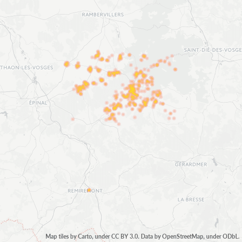
Map of Postal Code 88600 - Viménil, Lorraine
Interactive Map
Postal Code 88600 - Viménil, Lorraine Population
Years 1975 to 2030
| Data | 1975 | 1990 | 2000 | 2015 | 2020 | 2025* | 2030* |
|---|---|---|---|---|---|---|---|
| Population | 13,264 | 13,848 | 14,225 | 15,065 | 14,776 | 14,505 | 14,185 |
| Population Density | 49.8 / km² | 52 / km² | 53.4 / km² | 56.5 / km² | 55.5 / km² | 54.4 / km² | 53.2 / km² |
Postal Code 88600 - Viménil, Lorraine Population change from 2000 to 2020
Increase of 3.9% from year 2000 to 2020
| Location | Change since 1975 | Change since 1990 | Change since 2000 |
|---|---|---|---|
| Postal Code 88600 - Viménil, Lorraine | +11.4% | +6.7% | +3.9% |
| Viménil | +77.1% | +43.2% | +26.1% |
| France | — | — | — |
Postal Code 88600 - Viménil, Lorraine Median Age
Median Age: 41.3 years
| Location | Median Age | Median Age (Female) | Median Age (Male) |
|---|---|---|---|
| Postal Code 88600 - Viménil, Lorraine | 41.3 yrs | 42.3 yrs | 40.2 yrs |
| Viménil | 35.9 yrs | 37.5 yrs | 34.4 yrs |
| France | 39.6 yrs | 41 yrs | 38.1 yrs |
Postal Code 88600 Population Density
Population Density: 55.5 / km²
| Location | Population | Area | Density |
|---|---|---|---|
| Postal Code 88600 | 14,776 | 266.4 km² | 55.5 / km² |
| Viménil | 232 | 8.2 km² | 28.4 / km² |
| France | 65.9 million | 638,022.5 km² | 103 / km² |
Postal Code 88600 - Viménil, Lorraine Historical and Projected Population
Estimated Population from 0 to 2100
- JRC (European Commission's Joint Research Centre) work on the GHS built-up grid
- CIESIN (Center for International Earth Science Information Network)
- [Link] Klein Goldewijk, K., Beusen, A., Doelman, J., and Stehfest, E.: Anthropogenic land use estimates for the Holocene – HYDE 3.2, Earth Syst. Sci. Data, 9, 927–953, https://doi.org/10.5194/essd-9-927-2017, 2017.
Area Codes
Percentage Area Codes used by businesses in Postal Code 88600 - Viménil, Lorraine
Industries
Business Distribution by Industry in Postal Code 88600 - Viménil, Lorraine
| Industry Description | Number of Establishments | Average Age of Business |
|---|---|---|
| Agricultural wholesale | 21 | — |
| Bakeries | 20 | — |
| Banks | 20 | — |
| Beauty salons | 21 | — |
| Car repair | 43 | 26.9 years |
| Corporate management | 26 | 21 years |
| Education | 38 | 43.2 years |
| Grocery stores and supermarkets | 31 | 25.1 years |
| Other accommodation | 36 | — |
| Public administration | 59 | 26.8 years |
| Real estate | 24 | 30.9 years |
| Restaurants | 30 | 13.9 years |
| Shopping | 40 | 23.9 years |
| Shopping other | 34 | 26.3 years |
Business distribution by price for Postal Code 88600 - Viménil, Lorraine
Human Development Index (HDI)
Statistic composite index of life expectancy, education, and per capita income.
Postal Code 88600 - Viménil, Lorraine Gross Domestic Product (GDP)
GDP per capita, PPP (constant 2017 international $)
| Data | 1990 | 1995 | 2000 | 2005 | 2010 | 2015 | 2020 | 2022 |
|---|---|---|---|---|---|---|---|---|
| GDP per capita | $27,666 | $28,766 | $32,490 | $32,635 | $30,228 | $30,959 | $30,739 | $33,298 |
| Total GDP | $263.7M | $273.7M | $309.9M | $317.7M | $300.7M | $308.5M | $305.4M | $328.4M |
Postal Code 88600 CO2 Emissions
Carbon Dioxide (CO2) Emissions Per Capita in Tonnes Per Year
| Location | CO2 Emissions | CO2 Emissions Per Capita | CO2 Emissions Intensity |
|---|---|---|---|
| Postal Code 88600 | 112,978 tn | 7.65 tn | 424.1 tons/km² |
| Viménil | 1,774 tn | 7.65 tn | 216.8 tons/km² |
| France | 485,797,691 tn | 7.38 tn | 761.4 tons/km² |
| 2013 CO2 emissions (tonnes/year) | 112,978 tn |
| 2013 CO2 emissions (tonnes/year) per capita | 7.65 tn |
| 2013 CO2 emissions intensity (tonnes/km²/year) | 424.1 tons/km² |
Natural Hazards Risk
Relative risk out of 10
| Hazard | Risk Level |
|---|---|
| Flood | High (8) |
| Earthquake | Medium (3.8) |
Recent Nearby Earthquakes
Magnitude 3.0 and greater
| Date▼ | Time↕ | Magnitude↕ | Distance↕ | Depth↕ | Location↕ | Link |
|---|---|---|---|---|---|---|
| 5/4/18 | 2:36 PM | 3.1 | 81.1 km | 15,230 m | 2km W of Schliengen, Germany | usgs.gov |
| 5/4/09 | 6:39 PM | 3.6 | 98.6 km | 10,000 m | Switzerland | usgs.gov |
| 8/19/07 | 12:32 AM | 3.9 | 13.1 km | 11,300 m | France | usgs.gov |
| 8/16/07 | 10:43 PM | 3.5 | 14.3 km | 10,000 m | France | usgs.gov |
| 8/6/07 | 11:46 PM | 3.1 | 11.8 km | 13,000 m | France | usgs.gov |
| 5/26/07 | 6:40 AM | 3.7 | 16 km | 10,000 m | France | usgs.gov |
| 5/16/07 | 8:34 PM | 3.2 | 15.7 km | 10,000 m | France | usgs.gov |
| 4/8/07 | 12:30 PM | 3.1 | 14.3 km | 10,000 m | France | usgs.gov |
| 4/3/07 | 6:43 AM | 3.2 | 13.7 km | 11,700 m | France | usgs.gov |
| 3/21/07 | 9:45 AM | 3.1 | 96.2 km | 8,000 m | Switzerland | usgs.gov |
Primary City
Viménil is a commune in the Vosges department in Lorraine in northeastern France.
Viménil Wikipedia PageCities
Percentage of businesses by city in Postal Code 88600 - Viménil, Lorraine
About Our Data
The data on this page is estimated using a number of publicly available tools and resources. It is provided without warranty, and could contain inaccuracies. Use at your own risk.