Postal Code 164 52 - Greece
Greece
| Area of Postal Code 164 52 | 1.723 km² |
| Population | 17,995 |
| Male Population | 8,583 (47.7%) |
| Female Population | 9,412 (52.3%) |
| Population change from 1975 to 2015 | +17.8% |
| Population change from 2000 to 2015 | -1.2% |
| Median Age | 41.7 years |
| Male Median Age | 40.7 years |
| Female Median Age | 42.6 years |
| Neighborhoods | Argyroupoli |
| Timezone | Eastern European Summer Time |
| Coordinates | 37.90631493634109° / 23.747605598658517° |
| Related Postal Codes | 162 31, 162 32, 162 33, 163 41, 163 42, 163 43, 163 44, 163 45, 163 46, 164 51 |
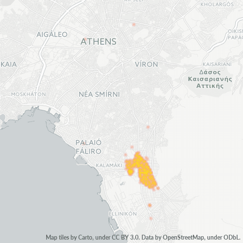
Map of Postal Code 164 52 - Greece
Interactive Map
Postal Code 164 52 - Greece Population
Years 1975 to 2020
| Data | 1975 | 1990 | 2000 | 2015 | 2020 |
|---|---|---|---|---|---|
| Population | 15,277 | 17,003 | 18,216 | 17,995 | 18,429 |
| Population Density | 8,865.3 / km² | 9,866.9 / km² | 10,570.8 / km² | 10,442.6 / km² | 10,694.4 / km² |
Sources: JRC (European Commission's Joint Research Centre) work on the GHS built-up grid
Postal Code 164 52 - Greece Population change from 2000 to 2015
Decrease of 1.2% from year 2000 to 2015
| Location | Change since 1975 | Change since 1990 | Change since 2000 |
|---|---|---|---|
| Postal Code 164 52 - Greece | +17.8% | +5.8% | -1.2% |
| Greece | +21.3% | +8.1% | +0% |
Sources: JRC (European Commission's Joint Research Centre) work on the GHS built-up grid
Postal Code 164 52 - Greece Median Age
Median Age: 41.7 years
| Location | Median Age | Median Age (Female) | Median Age (Male) |
|---|---|---|---|
| Postal Code 164 52 - Greece | 41.7 yrs | 42.6 yrs | 40.7 yrs |
| Greece | 41.8 yrs | 43.1 yrs | 40.5 yrs |
Sources: CIESIN (Center for International Earth Science Information Network)
Postal Code 164 52 Population Density
Population Density: 10,443 / km²
| Location | Population | Area | Density |
|---|---|---|---|
| Postal Code 164 52 | 17,995 | 1.723 km² | 10,443 / km² |
| Greece | 10.7 million | 132,689.5 km² | 80.4 / km² |
Sources: JRC (European Commission's Joint Research Centre) work on the GHS built-up grid
Postal Code 164 52 - Greece Historical and Projected Population
Estimated Population from 0 to 2100
Sources:
- JRC (European Commission's Joint Research Centre) work on the GHS built-up grid
- CIESIN (Center for International Earth Science Information Network)
- [Link] Klein Goldewijk, K., Beusen, A., Doelman, J., and Stehfest, E.: Anthropogenic land use estimates for the Holocene – HYDE 3.2, Earth Syst. Sci. Data, 9, 927–953, https://doi.org/10.5194/essd-9-927-2017, 2017.
Business Concentration in Postal Code 164 52 - Greece
Business distribution by price for Postal Code 164 52 - Greece
Human Development Index (HDI)
Statistic composite index of life expectancy, education, and per capita income.
Source: [Link] Kummu, M., Taka, M. &Guillaume, J. Gridded global datasets for Gross Domestic Product and Human Development Index over 1990–2015. Sci Data 5, 180004 (2018) doi:10.1038/sdata.2018.4
Postal Code 164 52 CO2 Emissions
Carbon Dioxide (CO2) Emissions Per Capita in Tonnes Per Year
| Location | CO2 Emissions | CO2 Emissions Per Capita | CO2 Emissions Intensity |
|---|---|---|---|
| Postal Code 164 52 | 195,265 tn | 10.85 tn | 113,312.8 tons/km² |
| Greece | 105,407,278 tn | 9.89 tn | 794.4 tons/km² |
Sources: [Link] Moran, D., Kanemoto K; Jiborn, M., Wood, R., Többen, J., and Seto, K.C. (2018) Carbon footprints of 13,000 cities. Environmental Research Letters DOI: 10.1088/1748-9326/aac72a
Postal Code 164 52 CO2 Emissions
| 2013 CO2 emissions (tonnes/year) | 195,265 tn |
| 2013 CO2 emissions (tonnes/year) per capita | 10.85 tn |
| 2013 CO2 emissions intensity (tonnes/km²/year) | 113,312.8 tons/km² |
Natural Hazards Risk
Relative risk out of 10
| Hazard | Risk Level |
|---|---|
| Drought | Medium (7) |
| Flood | Medium (4) |
| Earthquake | Medium (4) |
* Risk, particularly concerning flood or landslide, may not be for the entire area.
Recent Nearby Earthquakes
Magnitude 3.0 and greater
| Date▼ | Time↕ | Magnitude↕ | Distance↕ | Depth↕ | Location↕ | Link |
|---|---|---|---|---|---|---|
| 7/28/19 | 9:09 AM | 4.6 | 30.8 km | 10,000 m | 6km NNE of Magoula, Greece | usgs.gov |
| 7/19/19 | 4:42 AM | 4.3 | 29.3 km | 10,000 m | 7km N of Aspropirgos, Greece | usgs.gov |
| 7/19/19 | 5:11 AM | 4.2 | 23.2 km | 10,000 m | 1km WNW of Fili, Greece | usgs.gov |
| 7/19/19 | 4:13 AM | 5.3 | 28.5 km | 10,000 m | 1km NNE of Magoula, Greece | usgs.gov |
| 12/23/18 | 2:34 PM | 4.4 | 69.4 km | 10,000 m | 41km E of Ydra, Greece | usgs.gov |
| 11/26/18 | 8:06 AM | 4.4 | 47.1 km | 7,090 m | 7km ENE of Erithrai, Greece | usgs.gov |
| 5/1/18 | 1:50 PM | 4.3 | 34.8 km | 3,840 m | 3km WSW of Kapandrition, Greece | usgs.gov |
| 1/19/18 | 2:10 AM | 4.4 | 39 km | 133,920 m | 21km SW of Palaia Fokaia, Greece | usgs.gov |
| 1/15/18 | 12:24 PM | 4.3 | 36.5 km | 10,000 m | 2km SE of Varnavas, Greece | usgs.gov |
| 6/25/17 | 6:54 AM | 4.3 | 58.7 km | 10,000 m | 6km ENE of Thivai, Greece | usgs.gov |
Showing 1-10 of 500
…
Source: U.S. Geological Survey (USGS)
About Our Data
The data on this page is estimated using a number of publicly available tools and resources. It is provided without warranty, and could contain inaccuracies. Use at your own risk.