Postal Code 415 00 - Nikaia, Larissa
| Primary City | Nikaia, Larissa |
| Area of Postal Code 415 00 | 1,178.9 km² |
| Population | 150,723 |
| Male Population | 74,407 (49.4%) |
| Female Population | 76,316 (50.6%) |
| Population change from 1975 to 2015 | +10.9% |
| Population change from 2000 to 2015 | -2.1% |
| Median Age | 40.4 years |
| Male Median Age | 39.4 years |
| Female Median Age | 41.4 years |
| Timezone | Eastern European Summer Time |
| Coordinates | 39.53918632597988° / 22.46529858598122° |
| Related Postal Codes | 410 00, 410 04, 411 10, 412 21, 412 23, 413 34, 413 35, 413 36, 414 47, 421 00 |
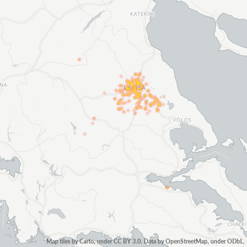
Map of Postal Code 415 00 - Nikaia, Larissa
Interactive Map
Postal Code 415 00 - Nikaia, Larissa Population
Years 1975 to 2020
| Data | 1975 | 1990 | 2000 | 2015 | 2020 |
|---|---|---|---|---|---|
| Population | 135,892 | 147,259 | 154,018 | 150,723 | 152,659 |
| Population Density | 115.3 / km² | 124.9 / km² | 130.6 / km² | 127.9 / km² | 129.5 / km² |
Postal Code 415 00 - Nikaia, Larissa Population change from 2000 to 2015
Decrease of 2.1% from year 2000 to 2015
| Location | Change since 1975 | Change since 1990 | Change since 2000 |
|---|---|---|---|
| Postal Code 415 00 - Nikaia, Larissa | +10.9% | +2.4% | -2.1% |
| ΝΙΚΑΙΑ | -14.4% | -19.1% | -12.6% |
| Thessaly | +22.3% | +8.4% | +0.1% |
| Greece | +21.3% | +8.1% | +0% |
Postal Code 415 00 - Nikaia, Larissa Median Age
Median Age: 40.4 years
| Location | Median Age | Median Age (Female) | Median Age (Male) |
|---|---|---|---|
| Postal Code 415 00 - Nikaia, Larissa | 40.4 yrs | 41.4 yrs | 39.4 yrs |
| ΝΙΚΑΙΑ | 46.8 yrs | 49 yrs | 44.7 yrs |
| Thessaly | 43.4 yrs | 44.5 yrs | 42.2 yrs |
| Greece | 41.8 yrs | 43.1 yrs | 40.5 yrs |
Postal Code 415 00 Population Density
Population Density: 128 / km²
| Location | Population | Area | Density |
|---|---|---|---|
| Postal Code 415 00 | 150,723 | 1,178.9 km² | 128 / km² |
| Nikaia, Larissa | 2,096 | 2.474 km² | 847 / km² |
| Thessaly | 700,193 | 14,051.8 km² | 49.8 / km² |
| Greece | 10.7 million | 132,689.5 km² | 80.4 / km² |
Postal Code 415 00 - Nikaia, Larissa Historical and Projected Population
Estimated Population from 0 to 2100
- JRC (European Commission's Joint Research Centre) work on the GHS built-up grid
- CIESIN (Center for International Earth Science Information Network)
- [Link] Klein Goldewijk, K., Beusen, A., Doelman, J., and Stehfest, E.: Anthropogenic land use estimates for the Holocene – HYDE 3.2, Earth Syst. Sci. Data, 9, 927–953, https://doi.org/10.5194/essd-9-927-2017, 2017.
Industries
Business Distribution by Industry in Postal Code 415 00 - Nikaia, Larissa
| Industry Description | Number of Establishments | Average Age of Business |
|---|---|---|
| Cafes | 406 | — |
| Car repair | 152 | 26.8 years |
| Clothing stores | 216 | — |
| Education | 181 | 29.4 years |
| Furniture stores | 138 | — |
| Gas station | 138 | — |
| Grocery stores and supermarkets | 208 | — |
| Health and medical | 217 | — |
| Pharmacies and drug stores | 196 | 16.1 years |
| Restaurants | 358 | 25.8 years |
| Shopping | 482 | 27 years |
| Technical construction services | 175 | 17.9 years |
Human Development Index (HDI)
Statistic composite index of life expectancy, education, and per capita income.
Postal Code 415 00 CO2 Emissions
Carbon Dioxide (CO2) Emissions Per Capita in Tonnes Per Year
| Location | CO2 Emissions | CO2 Emissions Per Capita | CO2 Emissions Intensity |
|---|---|---|---|
| Postal Code 415 00 | 1,491,227 tn | 9.89 tn | 1,264.9 tons/km² |
| Nikaia, Larissa | 20,693 tn | 9.87 tn | 8,363.4 tons/km² |
| Thessaly | 6,718,756 tn | 9.6 tn | 478.1 tons/km² |
| Greece | 105,407,278 tn | 9.89 tn | 794.4 tons/km² |
| 2013 CO2 emissions (tonnes/year) | 1,491,227 tn |
| 2013 CO2 emissions (tonnes/year) per capita | 9.89 tn |
| 2013 CO2 emissions intensity (tonnes/km²/year) | 1,264.9 tons/km² |
Natural Hazards Risk
Relative risk out of 10
| Hazard | Risk Level |
|---|---|
| Drought | High (7.6) |
| Earthquake | Medium (7) |
Recent Nearby Earthquakes
Magnitude 3.0 and greater
| Date▼ | Time↕ | Magnitude↕ | Distance↕ | Depth↕ | Location↕ | Link |
|---|---|---|---|---|---|---|
| 10/26/18 | 5:03 AM | 4.9 | 62.7 km | 10,000 m | 10km NE of Lamia, Greece | usgs.gov |
| 9/27/16 | 10:53 AM | 4.2 | 57.4 km | 10,000 m | 6km SSE of Omvriaki, Greece | usgs.gov |
| 5/20/16 | 1:45 AM | 4.1 | 50.6 km | 9,500 m | 10km ESE of Nea Ankhialos, Greece | usgs.gov |
| 12/19/14 | 2:40 PM | 4.2 | 26.2 km | 19,700 m | 14km WSW of Velestinon, Greece | usgs.gov |
| 10/28/14 | 2:32 AM | 4.5 | 49 km | 87,700 m | 6km ESE of Domokos, Greece | usgs.gov |
| 12/11/13 | 5:00 AM | 4.7 | 56 km | 17,160 m | 9km SE of Omvriaki, Greece | usgs.gov |
| 11/22/13 | 7:12 AM | 4.4 | 56.4 km | 23,200 m | 12km SE of Domokos, Greece | usgs.gov |
| 11/19/13 | 12:16 AM | 4.1 | 44.4 km | 11,900 m | 5km SSW of Oichalia, Greece | usgs.gov |
| 1/13/10 | 8:25 PM | 4.5 | 37.2 km | 88,000 m | Greece | usgs.gov |
| 9/16/09 | 12:13 AM | 4.5 | 62.2 km | 10,000 m | Greece | usgs.gov |
Primary City
Nikaia (Greek: Νίκαια) is a town and a former municipality in the Larissa regional unit, Thessaly, Greece. Located 4 km south of Larissa city, it forms a part of Larissa's metropolitan area, that lies in the vast Thessalian plain. Since the 2011 loca..
Nikaia, Larissa Wikipedia PageCities
Percentage of businesses by city in Postal Code 415 00 - Nikaia, Larissa
About Our Data
The data on this page is estimated using a number of publicly available tools and resources. It is provided without warranty, and could contain inaccuracies. Use at your own risk.