Postal Code 640 04 - Potamiá, Eastern Macedonia and Thrace
| Primary City | Potamiá |
| Area of Postal Code 640 04 | 120.3 km² |
| Population | 5,667 |
| Male Population | 2,792 (49.3%) |
| Female Population | 2,875 (50.7%) |
| Population change from 1975 to 2020 | +25.2% |
| Population change from 2000 to 2020 | -5.4% |
| Median Age | 45.5 years |
| Male Median Age | 44.6 years |
| Female Median Age | 46.4 years |
| Timezone | Eastern European Summer Time |
| Coordinates | 40.72620793789274° / 24.703634600250407° |
| Related Postal Codes | 640 01, 640 02, 640 03, 640 05, 640 06, 640 07, 640 08, 640 09, 640 10, 640 11 |
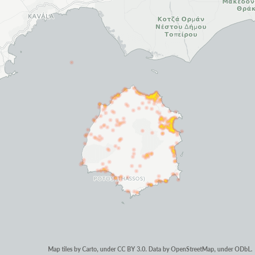
Map of Postal Code 640 04 - Potamiá, Eastern Macedonia and Thrace
Interactive Map
Postal Code 640 04 - Potamiá, Eastern Macedonia and Thrace Population
Years 1975 to 2030
| Data | 1975 | 1990 | 2000 | 2015 | 2020 | 2025* | 2030* |
|---|---|---|---|---|---|---|---|
| Population | 4,527 | 5,390 | 5,992 | 6,054 | 5,667 | 5,548 | 5,400 |
| Population Density | 37.6 / km² | 44.8 / km² | 49.8 / km² | 50.3 / km² | 47.1 / km² | 46.1 / km² | 44.9 / km² |
Postal Code 640 04 - Potamiá, Eastern Macedonia and Thrace Population change from 2000 to 2020
Decrease of 5.4% from year 2000 to 2020
| Location | Change since 1975 | Change since 1990 | Change since 2000 |
|---|---|---|---|
| Postal Code 640 04 - Potamiá, Eastern Macedonia and Thrace | +25.2% | +5.1% | -5.4% |
| ΠΟΤΑΜΙΑ | -8.5% | -11.9% | -7.4% |
| Eastern Macedonia and Thrace | +23.3% | +7.5% | -1.9% |
| Greece | — | — | — |
Postal Code 640 04 - Potamiá, Eastern Macedonia and Thrace Median Age
Median Age: 45.5 years
| Location | Median Age | Median Age (Female) | Median Age (Male) |
|---|---|---|---|
| Postal Code 640 04 - Potamiá, Eastern Macedonia and Thrace | 45.5 yrs | 46.4 yrs | 44.6 yrs |
| ΠΟΤΑΜΙΑ | 45.5 yrs | 46.4 yrs | 44.6 yrs |
| Eastern Macedonia and Thrace | 42.4 yrs | 44.1 yrs | 40.7 yrs |
| Greece | 41.8 yrs | 43.1 yrs | 40.5 yrs |
Postal Code 640 04 Population Density
Population Density: 47.1 / km²
| Location | Population | Area | Density |
|---|---|---|---|
| Postal Code 640 04 | 5,667 | 120.3 km² | 47.1 / km² |
| Potamiá | 311 | 2.441 km² | 127 / km² |
| Eastern Macedonia and Thrace | 585,652 | 14,241.8 km² | 41.1 / km² |
| Greece | 10.7 million | 132,689.5 km² | 80.4 / km² |
Postal Code 640 04 - Potamiá, Eastern Macedonia and Thrace Historical and Projected Population
Estimated Population from 0 to 2100
- JRC (European Commission's Joint Research Centre) work on the GHS built-up grid
- CIESIN (Center for International Earth Science Information Network)
- [Link] Klein Goldewijk, K., Beusen, A., Doelman, J., and Stehfest, E.: Anthropogenic land use estimates for the Holocene – HYDE 3.2, Earth Syst. Sci. Data, 9, 927–953, https://doi.org/10.5194/essd-9-927-2017, 2017.
Area Codes
Percentage Area Codes used by businesses in Postal Code 640 04 - Potamiá, Eastern Macedonia and Thrace
Industries
Business Distribution by Industry in Postal Code 640 04 - Potamiá, Eastern Macedonia and Thrace
| Industry Description | Number of Establishments |
|---|---|
| Bars, pubs and taverns | 136 |
| Cafes | 43 |
| Churches | 37 |
| Grocery stores and supermarkets | 21 |
| Hotels and motels | 532 |
| Restaurants | 237 |
| Shopping | 32 |
| Businesses | 4,187 |
| Estimated total revenue | ~€71.0M |
| Median revenue per business | ~€19.9K |
| Estimated jobs | 5,926 |
| Estimated payroll | ~€55.1M |
| Industries | Businesses | Total revenue | Median | Jobs |
|---|---|---|---|---|
| Accommodation and food service activities | 1,804 | ~€31.1M | ~€20.3K | 2,954 |
| Wholesale and retail trade; repair of motor vehicles and motorcycles | 367 | ~€13.9M | ~€21.7K | 967 |
| Real estate activities | 397 | ~€6.3M | ~€15.6K | 541 |
| Transportation and storage | 49 | ~€4.2M | ~€54.0K | 252 |
| Arts, entertainment and recreation | 201 | ~€2.2M | ~€18.1K | 177 |
| Professional, scientific and technical activities | 56 | ~€2.1M | ~€27.3K | 135 |
| Administrative and support service activities | 77 | ~€1.9M | ~€23.2K | 104 |
| Human health and social work activities | 41 | ~€1.3M | ~€20.0K | 112 |
Largest businesses by estimated revenue
- Lidl — Potamiá · ~€1.5M
- ACS Courier — Potamiá · ~€903.5K
- Supermarket Latsouris — Potamiá · ~€886.7K
- Masoutis — Potamiá · ~€809.9K
- Agrotika Proionta Thasou "Olis" S.A. — Potamiá · ~€487.7K
Postal Code 640 04 - Potamiá, Eastern Macedonia and Thrace — Revenue trend
Median business revenue by year
| Year | 2019 | 2020 | 2021 | 2022 | 2023 | 2024 |
|---|---|---|---|---|---|---|
| Median revenue per business | ~€21.5K | ~€21.7K | ~€21.6K | ~€21.6K | ~€21.7K | ~€21.4K |
Business distribution by price for Postal Code 640 04 - Potamiá, Eastern Macedonia and Thrace
Human Development Index (HDI)
Statistic composite index of life expectancy, education, and per capita income.
Postal Code 640 04 - Potamiá, Eastern Macedonia and Thrace Gross Domestic Product (GDP)
GDP per capita, PPP (constant 2017 international $)
| Data | 1990 | 1995 | 2000 | 2005 | 2010 | 2015 | 2020 | 2022 |
|---|---|---|---|---|---|---|---|---|
| GDP per capita | $20,712 | $21,331 | $24,966 | $29,352 | $29,177 | $23,044 | $22,036 | $25,846 |
| Total GDP | $30.4M | $31M | $35.6M | $39.6M | $37.4M | $27.8M | $26.3M | $30.9M |
Postal Code 640 04 CO2 Emissions
Carbon Dioxide (CO2) Emissions Per Capita in Tonnes Per Year
| Location | CO2 Emissions | CO2 Emissions Per Capita | CO2 Emissions Intensity |
|---|---|---|---|
| Postal Code 640 04 | 51,986 tn | 9.17 tn | 432.3 tons/km² |
| Potamiá | 3,116 tn | 10.02 tn | 1,277 tons/km² |
| Eastern Macedonia and Thrace | 5,572,449 tn | 9.51 tn | 391.3 tons/km² |
| Greece | 105,407,278 tn | 9.89 tn | 794.4 tons/km² |
| 2013 CO2 emissions (tonnes/year) | 51,986 tn |
| 2013 CO2 emissions (tonnes/year) per capita | 9.17 tn |
| 2013 CO2 emissions intensity (tonnes/km²/year) | 432.3 tons/km² |
Natural Hazards Risk
Relative risk out of 10
| Hazard | Risk Level |
|---|---|
| Drought | Low (2) |
| Earthquake | Medium (5.4) |
Recent Nearby Earthquakes
Magnitude 3.0 and greater
| Date▼ | Time↕ | Magnitude↕ | Distance↕ | Depth↕ | Location↕ | Link |
|---|---|---|---|---|---|---|
| 4/10/18 | 4:42 AM | 4.1 | 48.8 km | 10,000 m | 27km SSW of Elaiokhorion, Greece | usgs.gov |
| 12/29/16 | 5:56 PM | 4 | 24.3 km | 10,000 m | 3km WNW of Khrisokhorion, Greece | usgs.gov |
| 7/26/15 | 11:40 AM | 4.1 | 69 km | 11,300 m | 9km NE of Ierissos, Greece | usgs.gov |
| 12/2/14 | 12:15 PM | 3.9 | 66.6 km | 14,500 m | 36km SW of Kamariotissa, Greece | usgs.gov |
| 9/4/14 | 10:43 AM | 4.9 | 70.7 km | 12,330 m | 29km NNW of Myrina, Greece | usgs.gov |
| 6/9/14 | 3:29 AM | 4.3 | 76.5 km | 16,670 m | 25km SE of Karyes, Greece | usgs.gov |
| 5/28/14 | 11:00 PM | 4.5 | 79.2 km | 10,200 m | 27km SSE of Karyes, Greece | usgs.gov |
| 5/26/14 | 2:28 PM | 4 | 67.6 km | 13,500 m | 36km SW of Kamariotissa, Greece | usgs.gov |
| 5/24/14 | 5:08 PM | 4.5 | 86.4 km | 11,000 m | 29km SSE of Karyes, Greece | usgs.gov |
| 5/24/14 | 2:25 AM | 6.9 | 75.7 km | 6,430 m | 22km SSW of Kamariotissa, Greece | usgs.gov |
About Our Data
The data on this page is estimated using a number of publicly available tools and resources. It is provided without warranty, and could contain inaccuracies. Use at your own risk.