Postal Code 61153 - Gresik Regency, East Java
East Java | Indonesia
| Primary City | Gresik Regency |
| Population | 73,629 |
| Area Codes | 31 |
| Neighborhoods | Kauman, Gresik, Mriyunan, Gresik, Wadeng, Gresik, Wadeng, Sidayu |
| Timezone | Western Indonesia Time |
| Coordinates | -6.994347564270904° / 112.5615696951052° |
| Related Postal Codes | 61116, 61117, 61118, 61119, 61121, 61151, 61152, 61154, 61155, 61156 |
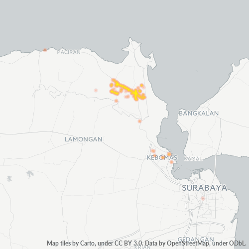
Map of Postal Code 61153 - Gresik Regency, East Java
Interactive Map
Gresik Regency Population Density
Population Density: 1,573 / km²
| Location | Population | Area | Density |
|---|---|---|---|
| Gresik Regency | 1 million | 637.7 km² | 1,573 / km² |
| East Java | 38.7 million | 47,774.1 km² | 810 / km² |
| Indonesia | 252.8 million | 1,893,657.8 km² | 134 / km² |
Sources: JRC (European Commission's Joint Research Centre) work on the GHS built-up grid
Area Codes
Percentage Area Codes used by businesses in Postal Code 61153 - Gresik Regency, East Java
Business Concentration in Postal Code 61153 - Gresik Regency, East Java
Industries
Business Distribution by Industry in Postal Code 61153 - Gresik Regency, East Java
| Industry Description | Number of Establishments |
|---|---|
| All food and beverage | 54 |
| Cafes | 324 |
| Car repair | 69 |
| Clothing stores | 89 |
| Corporate management | 44 |
| Education | 200 |
| Electronics stores | 54 |
| Grocery stores and supermarkets | 88 |
| Mosques | 49 |
| Religion | 118 |
| Restaurants | 238 |
| Shopping | 580 |
Gresik Regency CO2 Emissions
Carbon Dioxide (CO2) Emissions Per Capita in Tonnes Per Year
| Location | CO2 Emissions | CO2 Emissions Per Capita | CO2 Emissions Intensity |
|---|---|---|---|
| Gresik Regency | 1,878,893 tn | 1.87 tn | 2,946.6 tons/km² |
| East Java | 74,393,055 tn | 1.92 tn | 1,557.2 tons/km² |
| Indonesia | 478,610,416 tn | 1.89 tn | 252.7 tons/km² |
Sources: [Link] Moran, D., Kanemoto K; Jiborn, M., Wood, R., Többen, J., and Seto, K.C. (2018) Carbon footprints of 13,000 cities. Environmental Research Letters DOI: 10.1088/1748-9326/aac72a
Gresik Regency CO2 Emissions
| 2013 CO2 emissions (tonnes/year) | 1,878,893 tn |
| 2013 CO2 emissions (tonnes/year) per capita | 1.87 tn |
| 2013 CO2 emissions intensity (tonnes/km²/year) | 2,946.6 tons/km² |
Recent Nearby Earthquakes
Magnitude 3.0 and greater
| Date▼ | Time↕ | Magnitude↕ | Distance↕ | Depth↕ | Location↕ | Link |
|---|---|---|---|---|---|---|
| 7/23/17 | 5:28 AM | 4.3 | 24.7 km | 10,000 m | 8km N of Waru Lor, Indonesia | usgs.gov |
| 4/16/17 | 1:56 PM | 4.1 | 47.2 km | 233,610 m | 18km SSE of Babat, Indonesia | usgs.gov |
| 11/25/16 | 7:32 PM | 4.3 | 97.5 km | 590,840 m | 90km NE of Krajan Pangkah Kulon, Indonesia | usgs.gov |
| 10/16/16 | 10:45 AM | 4.4 | 62.6 km | 166,430 m | 9km NE of Jombang, Indonesia | usgs.gov |
| 2/28/15 | 7:19 AM | 4.1 | 81.5 km | 44,060 m | 28km NE of Pasuruan, Indonesia | usgs.gov |
| 3/13/14 | 12:17 PM | 4.5 | 79.2 km | 184,190 m | 4km N of Ngoro, Indonesia | usgs.gov |
| 2/2/14 | 3:17 AM | 4.3 | 90.5 km | 234,060 m | 8km ESE of Mojosawit, Indonesia | usgs.gov |
| 6/24/12 | 11:43 PM | 3.7 | 30.7 km | 10,000 m | Java, Indonesia | usgs.gov |
| 5/8/11 | 1:05 AM | 4.5 | 67.1 km | 229,000 m | Java, Indonesia | usgs.gov |
| 9/16/09 | 4:36 AM | 4.4 | 75.3 km | 270,800 m | Java, Indonesia | usgs.gov |
Showing 1-10 of 43
…
Source: U.S. Geological Survey (USGS)
Primary City
Gresik Regency (older spelling Grissee) (Javanese:Nggersik) is a regency within East Java Province of Indonesia. It includes the offshore Bawean Island, some 125 km to the north of Java and Madura. The regency's administrative centre is the town of G..
Gresik Regency Wikipedia Page