Postal Code 299 - Chiba Prefecture
Chiba Prefecture | Japan
| Population | 6,201,046 |
| Area Codes | 468, 470 |
| Postal Code Extensions | 299-0101, 299-0102, 299-0103, 299-0104, 299-0105, 299-0106, 299-0107, 299-0108, 299-0109, 299-0111 More |
| Associated Cities | Chiba, Chiba, Ichihara, Chiba, Nagareyama, Kisarazu |
| Neighborhoods | Anesaki |
| Timezone | Japan Standard Time |
| Coordinates | 35.2903330505009° / 140.09888434646834° |
| Related Postal Codes | 288, 289, 290, 292, 293, 294, 295, 296, 297, 298 |
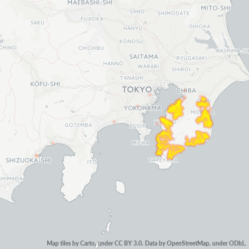
Map of Postal Code 299 - Chiba Prefecture
Interactive Map
Chiba Prefecture Population Density
Population Density: 1,193 / km²
| Location | Population | Area | Density |
|---|---|---|---|
| Chiba Prefecture | 6.2 million | 5,162.6 km² | 1,193 / km² |
| Japan | 122.9 million | 373,410.9 km² | 329 / km² |
Sources: JRC (European Commission's Joint Research Centre) work on the GHS built-up grid
Area Codes
Percentage Area Codes used by businesses in Postal Code 299 - Chiba Prefecture
Business Concentration in Postal Code 299 - Chiba Prefecture
Industries
Business Distribution by Industry in Postal Code 299 - Chiba Prefecture
| Industry Description | Number of Establishments | Average Age of Business |
|---|---|---|
| All food and beverage | 388 | — |
| Construction of buildings | 600 | — |
| Corporate management | 696 | — |
| Education | 337 | — |
| Hairdressers | 619 | — |
| Japanese restaurants | 312 | — |
| Other accommodation | 441 | — |
| Other membership organizations | 596 | — |
| Public administration | 448 | — |
| Public parks | 442 | — |
| Real estate | 357 | — |
| Religion | 950 | — |
| Restaurants | 1,345 | — |
| Shopping | 889 | 24.1 years |
Business distribution by price for Postal Code 299 - Chiba Prefecture
Chiba Prefecture CO2 Emissions
Carbon Dioxide (CO2) Emissions Per Capita in Tonnes Per Year
| Location | CO2 Emissions | CO2 Emissions Per Capita | CO2 Emissions Intensity |
|---|---|---|---|
| Chiba Prefecture | 32,833,624 tn | 5.33 tn | 6,359.9 tons/km² |
| Japan | 541,995,101 tn | 4.41 tn | 1,451.5 tons/km² |
Sources: [Link] Moran, D., Kanemoto K; Jiborn, M., Wood, R., Többen, J., and Seto, K.C. (2018) Carbon footprints of 13,000 cities. Environmental Research Letters DOI: 10.1088/1748-9326/aac72a
Chiba Prefecture CO2 Emissions
| 2013 CO2 emissions (tonnes/year) | 32,833,624 tn |
| 2013 CO2 emissions (tonnes/year) per capita | 5.33 tn |
| 2013 CO2 emissions intensity (tonnes/km²/year) | 6,359.9 tons/km² |
Recent Nearby Earthquakes
Magnitude 3.0 and greater
| Date▼ | Time↕ | Magnitude↕ | Distance↕ | Depth↕ | Location↕ | Link |
|---|---|---|---|---|---|---|
| 7/22/19 | 11:28 PM | 4.4 | 33 km | 63,050 m | 9km ESE of Chiba-shi, Japan | usgs.gov |
| 7/18/19 | 10:19 PM | 3.7 | 36.2 km | 10,000 m | 6km SE of Yotsukaido, Japan | usgs.gov |
| 7/3/19 | 5:04 PM | 4.4 | 27.8 km | 76,000 m | 2km N of Ichihara, Japan | usgs.gov |
| 6/23/19 | 5:11 PM | 5.3 | 40.7 km | 43,720 m | 15km ESE of Tateyama, Japan | usgs.gov |
| 6/19/19 | 9:55 AM | 4.7 | 34.5 km | 69,640 m | 14km SE of Kawaguchi, Japan | usgs.gov |
| 6/2/19 | 3:41 AM | 3.2 | 29.1 km | 73,930 m | 11km NNE of Tateyama, Japan | usgs.gov |
| 5/31/19 | 3:58 PM | 4.5 | 27.1 km | 33,250 m | 4km NNE of Ohara, Japan | usgs.gov |
| 5/24/19 | 11:20 PM | 4.9 | 21.3 km | 30,010 m | 7km NW of Ohara, Japan | usgs.gov |
| 5/19/19 | 3:48 PM | 4.5 | 36.5 km | 7,360 m | 17km SSW of Katsuura, Japan | usgs.gov |
| 1/7/19 | 8:35 AM | 4.6 | 32.4 km | 46,820 m | 12km SSW of Kawaguchi, Japan | usgs.gov |
Showing 1-10 of 500
…
Source: U.S. Geological Survey (USGS)
Postal Code Extensions (508)
Cities
Percentage of businesses by city in Postal Code 299 - Chiba Prefecture