Postal Code 652 - Hyōgo Prefecture
Hyōgo Prefecture | Japan
| Population | 5,582,978 |
| Area Codes | 78, 797, 798 |
| Postal Code Extensions | 652-0000, 652-0001, 652-0002, 652-0003, 652-0004, 652-0005, 652-0006, 652-0007, 652-0008, 652-0011 More |
| Associated Cities | Kobe, Ashiya, Hyōgo |
| Neighborhoods | Hyogo |
| Timezone | Japan Standard Time |
| Coordinates | 34.673256726342466° / 135.16840033991681° |
| Related Postal Codes | 642, 650, 651, 653, 654, 655, 656, 657, 658, 659 |
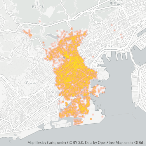
Map of Postal Code 652 - Hyōgo Prefecture
Interactive Map
Hyōgo Prefecture Population Density
Population Density: 645 / km²
| Location | Population | Area | Density |
|---|---|---|---|
| Hyōgo Prefecture | 5.4 million | 8,396.6 km² | 645 / km² |
| Japan | 122.9 million | 373,410.9 km² | 329 / km² |
Sources: JRC (European Commission's Joint Research Centre) work on the GHS built-up grid
Business Concentration in Postal Code 652 - Hyōgo Prefecture
Industries
Business Distribution by Industry in Postal Code 652 - Hyōgo Prefecture
| Industry Description | Number of Establishments | Average Google Rating |
|---|---|---|
| Accountants | 57 | 3.7 |
| Acupuncture | 14 | 4.6 |
| Adult entertainment | 13 | 3.4 |
| Advertising and marketing | 8 | 2.3 |
| All food and beverage | 319 | 3.7 |
| American restaurants | 26 | 3.8 |
| Animal and pet stores | 13 | 4.3 |
| Architects | 11 | — |
| Art galleries | 13 | 3.5 |
| Atm's | 11 | 4.2 |
| Automotive | 48 | 3.8 |
| Bakeries | 32 | 4 |
| Banks | 43 | 3.9 |
| Barbers | 46 | 3.9 |
| Bars, pubs and taverns | 30 | 3.7 |
| Beauty salons | 125 | 4.1 |
| Body repair | 8 | 4.7 |
| Book stores and newsstands | 20 | 3.9 |
| Bottled water and beverages | 12 | 4.2 |
| Buddhist temple | 58 | 4 |
| Buses and trains | 17 | 3.7 |
| Butcher | 43 | 3.8 |
| Cafes | 111 | 4 |
| Car parts | 62 | 3.6 |
| Car rental | 12 | 3.8 |
Showing 1-25 of 100
…
Business distribution by price for Postal Code 652 - Hyōgo Prefecture
Hyōgo Prefecture CO2 Emissions
Carbon Dioxide (CO2) Emissions Per Capita in Tonnes Per Year
| Location | CO2 Emissions | CO2 Emissions Per Capita | CO2 Emissions Intensity |
|---|---|---|---|
| Hyōgo Prefecture | 5,432,186 tn | 1 tn | 647 tons/km² |
| Japan | 541,995,101 tn | 4.41 tn | 1,451.5 tons/km² |
Sources: [Link] Moran, D., Kanemoto K; Jiborn, M., Wood, R., Többen, J., and Seto, K.C. (2018) Carbon footprints of 13,000 cities. Environmental Research Letters DOI: 10.1088/1748-9326/aac72a
Hyōgo Prefecture CO2 Emissions
| 2013 CO2 emissions (tonnes/year) | 5,432,186 tn |
| 2013 CO2 emissions (tonnes/year) per capita | 1 tn |
| 2013 CO2 emissions intensity (tonnes/km²/year) | 647 tons/km² |
Recent Nearby Earthquakes
Magnitude 3.0 and greater
| Date▼ | Time↕ | Magnitude↕ | Distance↕ | Depth↕ | Location↕ | Link |
|---|---|---|---|---|---|---|
| 6/10/19 | 12:30 PM | 4.2 | 57.7 km | 366,200 m | 5km NW of Muko, Japan | usgs.gov |
| 5/23/19 | 9:25 PM | 4.2 | 78.7 km | 57,450 m | 18km SSW of Koya, Japan | usgs.gov |
| 3/12/19 | 9:48 PM | 5.2 | 99.8 km | 37,250 m | 22km ESE of Anan, Japan | usgs.gov |
| 1/28/19 | 7:39 AM | 4.1 | 77.4 km | 421,990 m | 12km SSE of Koya, Japan | usgs.gov |
| 10/27/18 | 4:51 AM | 4.4 | 70.5 km | 68,080 m | 1km SSW of Yoshino-cho, Japan | usgs.gov |
| 7/7/18 | 11:45 PM | 3.8 | 48.4 km | 10,000 m | 4km SSW of Kameoka, Japan | usgs.gov |
| 6/23/18 | 7:08 AM | 3.9 | 49.1 km | 10,000 m | 2km NE of Hirakata, Japan | usgs.gov |
| 6/18/18 | 8:31 AM | 4.6 | 42.4 km | 10,000 m | 2km NNW of Neyagawa, Japan | usgs.gov |
| 6/18/18 | 3:52 PM | 3.7 | 45.1 km | 10,000 m | 1km ENE of Neyagawa, Japan | usgs.gov |
| 6/17/18 | 3:58 PM | 5.5 | 46.2 km | 10,340 m | 1km NW of Hirakata, Japan | usgs.gov |
Showing 1-10 of 270
…
Source: U.S. Geological Survey (USGS)
Postal Code Extensions (104)