Postal Code 5342 - Oss, North Brabant
| Primary City | Oss |
| Area of Postal Code 5342 | 6.3 km² |
| Population | 9,462 |
| Male Population | 4,731 (50.0%) |
| Female Population | 4,731 (50.0%) |
| Population change from 1975 to 2020 | -3.1% |
| Population change from 2000 to 2020 | +27.0% |
| Median Age | 41.7 years |
| Male Median Age | 41 years |
| Female Median Age | 42.5 years |
| Area Codes | 412 |
| Postal Code Extensions | 5342 AA, 5342 AB, 5342 AC, 5342 AD, 5342 AE, 5342 AG, 5342 AH, 5342 AJ, 5342 AK, 5342 AL More |
| Associated Cities | Heesch, Netherlands, Berghem |
| Timezone | Central European Summer Time |
| Coordinates | 51.75636373940979° / 5.536263534558217° |
| Related Postal Codes | 5321, 5324, 5341, 5343, 5344, 5345, 5346, 5347, 5348, 5349 |
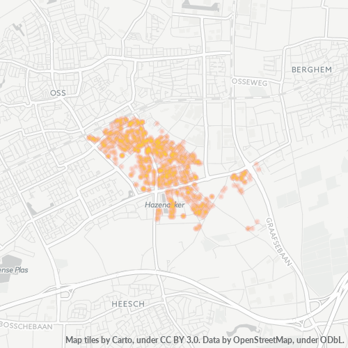
Map of Postal Code 5342 - Oss, North Brabant
Interactive Map
Postal Code 5342 - Oss, North Brabant Population
Years 1975 to 2030
| Data | 1975 | 1990 | 2000 | 2015 | 2020 | 2025* | 2030* |
|---|---|---|---|---|---|---|---|
| Population | 9,767 | 8,139 | 7,452 | 7,432 | 9,462 | 9,374 | 9,297 |
| Population Density | 1,548 / km² | 1,290 / km² | 1,181.1 / km² | 1,177.9 / km² | 1,499.7 / km² | 1,485.7 / km² | 1,473.5 / km² |
Postal Code 5342 - Oss, North Brabant Population change from 2000 to 2020
Increase of 27% from year 2000 to 2020
| Location | Change since 1975 | Change since 1990 | Change since 2000 |
|---|---|---|---|
| Postal Code 5342 - Oss, North Brabant | -3.1% | +16.3% | +27% |
| Oss | +23.6% | +19.2% | +16.6% |
| North Brabant | +25.5% | +14.9% | +8.4% |
| Netherlands | — | — | — |
Postal Code 5342 - Oss, North Brabant Median Age
Median Age: 41.7 years
| Location | Median Age | Median Age (Female) | Median Age (Male) |
|---|---|---|---|
| Postal Code 5342 - Oss, North Brabant | 41.7 yrs | 42.5 yrs | 41 yrs |
| Oss | 41.7 yrs | 42.5 yrs | 41 yrs |
| North Brabant | 41.8 yrs | 42.5 yrs | 41.1 yrs |
| Netherlands | 41 yrs | 41.7 yrs | 40.2 yrs |
Postal Code 5342 Population Density
Population Density: 1,500 / km²
| Location | Population | Area | Density |
|---|---|---|---|
| Postal Code 5342 | 9,462 | 6.3 km² | 1,500 / km² |
| Oss | 57,673 | 34.3 km² | 1,682 / km² |
| North Brabant | 2.6 million | 5,084.3 km² | 504 / km² |
| Netherlands | 16.9 million | 41,398.3 km² | 409 / km² |
Postal Code 5342 - Oss, North Brabant Historical and Projected Population
Estimated Population from 0 to 2100
- JRC (European Commission's Joint Research Centre) work on the GHS built-up grid
- CIESIN (Center for International Earth Science Information Network)
- [Link] Klein Goldewijk, K., Beusen, A., Doelman, J., and Stehfest, E.: Anthropogenic land use estimates for the Holocene – HYDE 3.2, Earth Syst. Sci. Data, 9, 927–953, https://doi.org/10.5194/essd-9-927-2017, 2017.
Area Codes
Percentage Area Codes used by businesses in Postal Code 5342 - Oss, North Brabant
Industries
Business Distribution by Industry in Postal Code 5342 - Oss, North Brabant
| Industry Description | Number of Establishments | Average Age of Business |
|---|---|---|
| Accountants | 31 | — |
| Beauty salons | 26 | — |
| Construction of buildings | 73 | — |
| Corporate management | 62 | 27.6 years |
| Electronics stores | 25 | — |
| Other construction | 30 | — |
| Shopping | 26 | — |
| Specialized design | 26 | — |
Human Development Index (HDI)
Statistic composite index of life expectancy, education, and per capita income.
Postal Code 5342 CO2 Emissions
Carbon Dioxide (CO2) Emissions Per Capita in Tonnes Per Year
| Location | CO2 Emissions | CO2 Emissions Per Capita | CO2 Emissions Intensity |
|---|---|---|---|
| Postal Code 5342 | 109,880 tn | 11.61 tn | 17,415.2 tons/km² |
| Oss | 669,053 tn | 11.6 tn | 19,507.3 tons/km² |
| North Brabant | 29,709,268 tn | 11.59 tn | 5,843.3 tons/km² |
| Netherlands | 167,743,568 tn | 9.91 tn | 4,051.9 tons/km² |
| 2013 CO2 emissions (tonnes/year) | 109,880 tn |
| 2013 CO2 emissions (tonnes/year) per capita | 11.61 tn |
| 2013 CO2 emissions intensity (tonnes/km²/year) | 17,415.2 tons/km² |
Natural Hazards Risk
Relative risk out of 10
| Hazard | Risk Level |
|---|---|
| Flood | Medium (4) |
| Earthquake | Low (2) |
Recent Nearby Earthquakes
Magnitude 3.0 and greater
| Date▼ | Time↕ | Magnitude↕ | Distance↕ | Depth↕ | Location↕ | Link |
|---|---|---|---|---|---|---|
| 9/8/11 | 12:02 PM | 4.2 | 34.7 km | 6,000 m | Germany | usgs.gov |
| 7/23/09 | 7:58 PM | 4.1 | 72.8 km | 5,000 m | Germany | usgs.gov |
| 12/25/08 | 5:53 AM | 3.2 | 83 km | 1,000 m | Germany | usgs.gov |
| 12/9/08 | 7:28 PM | 3.3 | 71.8 km | 10,000 m | Germany | usgs.gov |
| 11/21/08 | 11:41 PM | 3.3 | 94 km | 1,000 m | Germany | usgs.gov |
| 11/12/08 | 12:56 PM | 3.4 | 81.9 km | 1,000 m | Germany | usgs.gov |
| 9/18/08 | 7:33 AM | 3.2 | 73.2 km | 1,000 m | Germany | usgs.gov |
| 5/13/08 | 2:55 AM | 3.3 | 72.8 km | 1,000 m | Germany | usgs.gov |
| 5/1/08 | 11:54 PM | 3.1 | 76.4 km | 1,000 m | Germany | usgs.gov |
| 4/23/08 | 5:10 AM | 3.1 | 77.1 km | 1,000 m | Germany | usgs.gov |
Primary City
Oss (Dutch: [ɔs]) is a municipality and a city in the southern Netherlands, in the province of North Brabant.
Oss Wikipedia Page
About Our Data
The data on this page is estimated using a number of publicly available tools and resources. It is provided without warranty, and could contain inaccuracies. Use at your own risk.