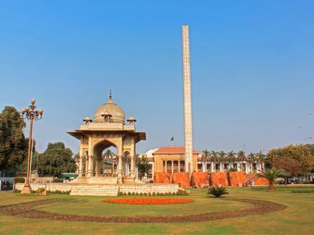
Postal Code 54792 - Lahore, West Punjab
West Punjab | Pakistan
| Primary City | Lahore |
| Population | 6,310,888 |
| Area Codes | 42 |
| Neighborhoods | Block A Divine Gardens, Punjab Small Industries Housing Society, Sector G Dha Phase 1, Sector K Dha Phase 1, Sector R DHA Phase 2, Sector T DHA Phase 2, Sector W DHA Phase 3, Sector Y DHA Phase 3 |
| Timezone | Pakistan Standard Time |
| Coordinates | 31.476802800233543° / 74.37164690134543° |
| Related Postal Codes | 54615, 54650, 54660, 54700, 54760, 54770, 54780, 54781, 54782, 54790 |
Map of Postal Code 54792 - Lahore, West Punjab
Interactive Map
West Punjab Population Density
Population Density: 605 / km²
| Location | Population | Area | Density |
|---|---|---|---|
| West Punjab | 123.3 million | 203,843.5 km² | 605 / km² |
| Pakistan | 188.8 million | 876,288.9 km² | 215 / km² |
Sources: JRC (European Commission's Joint Research Centre) work on the GHS built-up grid
Area Codes
Percentage Area Codes used by businesses in Postal Code 54792 - Lahore, West Punjab
Industries
Business Distribution by Industry in Postal Code 54792 - Lahore, West Punjab
| Industry Description | Number of Establishments | Average Age of Business |
|---|---|---|
| Advertising and marketing | 42 | — |
| Beauty salons | 45 | — |
| Clothing stores | 31 | — |
| Construction of buildings | 57 | — |
| Corporate management | 63 | 27.3 years |
| Electronics stores | 74 | 11.4 years |
| Health and medical | 27 | — |
| Real estate | 164 | — |
| Restaurants | 65 | — |
| Shopping | 47 | — |
West Punjab CO2 Emissions
Carbon Dioxide (CO2) Emissions Per Capita in Tonnes Per Year
| Location | CO2 Emissions | CO2 Emissions Per Capita | CO2 Emissions Intensity |
|---|---|---|---|
| West Punjab | 110,141,150 tn | 0.89 tn | 540.3 tons/km² |
| Pakistan | 148,464,575 tn | 0.79 tn | 169.4 tons/km² |
Sources: [Link] Moran, D., Kanemoto K; Jiborn, M., Wood, R., Többen, J., and Seto, K.C. (2018) Carbon footprints of 13,000 cities. Environmental Research Letters DOI: 10.1088/1748-9326/aac72a
West Punjab CO2 Emissions
| 2013 CO2 emissions (tonnes/year) | 110,141,150 tn |
| 2013 CO2 emissions (tonnes/year) per capita | 0.89 tn |
| 2013 CO2 emissions intensity (tonnes/km²/year) | 540.3 tons/km² |
Recent Nearby Earthquakes
Magnitude 3.0 and greater
| Date▼ | Time↕ | Magnitude↕ | Distance↕ | Depth↕ | Location↕ | Link |
|---|---|---|---|---|---|---|
| 9/22/18 | 10:45 PM | 3.7 | 56.2 km | 10,000 m | 21km E of Chunian, Pakistan | usgs.gov |
| 9/1/18 | 5:21 AM | 3.9 | 39.9 km | 10,000 m | 9km NNW of Kot Radha Kishan, Pakistan | usgs.gov |
| 7/17/16 | 4:53 AM | 4.5 | 16 km | 60,730 m | 8km ESE of Kahna, Pakistan | usgs.gov |
| 11/5/15 | 8:27 AM | 3.1 | 35.7 km | 59,820 m | 15km SSW of Narang, Pakistan | usgs.gov |
| 3/20/14 | 7:14 AM | 4.3 | 53.6 km | 46,030 m | 2km NW of Warburton, Pakistan | usgs.gov |
| 7/17/12 | 3:26 AM | 4.2 | 86.8 km | 48,800 m | Pakistan | usgs.gov |
| 4/8/08 | 7:08 PM | 3.3 | 24.9 km | 49,400 m | India-Pakistan border region | usgs.gov |
| 2/15/05 | 1:48 PM | 4.2 | 71.8 km | 50,400 m | India-Pakistan border region | usgs.gov |
| 10/3/02 | 12:23 AM | 4.6 | 67.8 km | 33,000 m | Pakistan | usgs.gov |
| 2/3/02 | 11:09 AM | 3.7 | 61.7 km | 33,000 m | Pakistan | usgs.gov |
Showing 1-10 of 19
Source: U.S. Geological Survey (USGS)
Primary City
Lahore (/ləˈhɔər/; Punjabi: لہور ALA-LC: Lahor [ləhoːr]; Urdu: لاہور ALA-LC: Lāhor [lɑːhoːr]) is the capital city of the province of Punjab, the second largest metropolitan area in Pakistan and 16th most populous city in the world. It is an importan..
Lahore Wikipedia Page