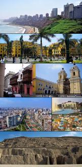
Postal Code 15100 - Lima, Lima Province
Lima Province | Peru
| Primary City | Lima |
| Population | 7,737,002 |
| Area Codes | 1 |
| Timezone | Peru Standard Time |
| Coordinates | -12.0333° / -77.0833° |
| Related Postal Codes | 15101, 15102, 15103, 15106, 15107, 15108, 15109, 15112, 15113, 15116 |
Map of Postal Code 15100 - Lima, Lima Province
Interactive Map
Lima Population Density
Population Density: 3,641 / km²
| Location | Population | Area | Density |
|---|---|---|---|
| Lima | 9.8 million | 2,695.3 km² | 3,641 / km² |
| Lima Province | 10.8 million | 34,986.5 km² | 309 / km² |
| Peru | 31 million | 1,291,975 km² | 24 / km² |
Sources: JRC (European Commission's Joint Research Centre) work on the GHS built-up grid
Industries
Business Distribution by Industry in Postal Code 15100 - Lima, Lima Province
| Industry Description | Number of Establishments |
|---|---|
| Restaurants | 6 |
Lima CO2 Emissions
Carbon Dioxide (CO2) Emissions Per Capita in Tonnes Per Year
| Location | CO2 Emissions | CO2 Emissions Per Capita | CO2 Emissions Intensity |
|---|---|---|---|
| Lima | 31,261,199 tn | 3.19 tn | 11,598.6 tons/km² |
| Lima Province | 33,938,970 tn | 3.14 tn | 970.1 tons/km² |
| Peru | 71,626,946 tn | 2.31 tn | 55.4 tons/km² |
Sources: [Link] Moran, D., Kanemoto K; Jiborn, M., Wood, R., Többen, J., and Seto, K.C. (2018) Carbon footprints of 13,000 cities. Environmental Research Letters DOI: 10.1088/1748-9326/aac72a
Lima CO2 Emissions
| 2013 CO2 emissions (tonnes/year) | 31,261,199 tn |
| 2013 CO2 emissions (tonnes/year) per capita | 3.19 tn |
| 2013 CO2 emissions intensity (tonnes/km²/year) | 11,598.6 tons/km² |
Recent Nearby Earthquakes
Magnitude 3.0 and greater
| Date▼ | Time↕ | Magnitude↕ | Distance↕ | Depth↕ | Location↕ | Link |
|---|---|---|---|---|---|---|
| 8/5/19 | 12:48 AM | 4.5 | 83.3 km | 91,860 m | 21km N of Matucana, Peru | usgs.gov |
| 5/27/19 | 8:14 PM | 4.6 | 60.3 km | 35,000 m | 52km WSW of Callao, Peru | usgs.gov |
| 3/22/19 | 5:50 AM | 4.6 | 85.3 km | 44,770 m | 3km SW of Mala, Peru | usgs.gov |
| 8/17/18 | 12:05 AM | 3.2 | 96.6 km | 35,000 m | 26km SW of Mala, Peru | usgs.gov |
| 5/17/18 | 4:07 AM | 5.2 | 90 km | 56,470 m | 7km E of Mala, Peru | usgs.gov |
| 11/23/17 | 11:24 PM | 3.8 | 22.8 km | 51,580 m | 19km NW of Callao, Peru | usgs.gov |
| 10/31/17 | 8:36 PM | 4.2 | 40.1 km | 70,040 m | 18km S of Chancay, Peru | usgs.gov |
| 10/22/17 | 5:09 PM | 4.3 | 38.3 km | 39,690 m | 31km SSW of San Isidro, Peru | usgs.gov |
| 10/14/17 | 12:36 PM | 4.4 | 73.3 km | 10,000 m | 13km S of Matucana, Peru | usgs.gov |
| 9/25/17 | 5:54 PM | 3.9 | 60.5 km | 37,620 m | 52km W of Callao, Peru | usgs.gov |
Showing 1-10 of 175
…
Source: U.S. Geological Survey (USGS)
Primary City
Lima /ˈliːmə/ is the capital and the largest city of Peru. It is located in the valleys of the Chillón, Rímac and Lurín rivers, in the central coastal part of the country, overlooking the Pacific Ocean. Together with the seaport of Callao, it forms a..
Lima Wikipedia Page