Postal Code 08820 - El Prat de Llobregat, Catalonia
| Primary City | El Prat de Llobregat |
| Area of Postal Code 08820 | 33.8 km² |
| Population | 78,850 |
| Male Population | 38,581 (48.9%) |
| Female Population | 40,269 (51.1%) |
| Population change from 1975 to 2020 | +60.5% |
| Population change from 2000 to 2020 | +36.6% |
| Median Age | 40.9 years |
| Male Median Age | 39.4 years |
| Female Median Age | 42.4 years |
| Area Codes | 931, 932, 933, 934, More |
| Associated Cities | Barcelona |
| Neighborhoods | El Prat de Llobregat |
| Timezone | Central European Summer Time |
| Coordinates | 41.31023975029217° / 2.098913070324359° |
| Related Postal Codes | 08800, 08802, 08805, 08810, 08811, 08812, 08818, 08871, 08872, 08880 |
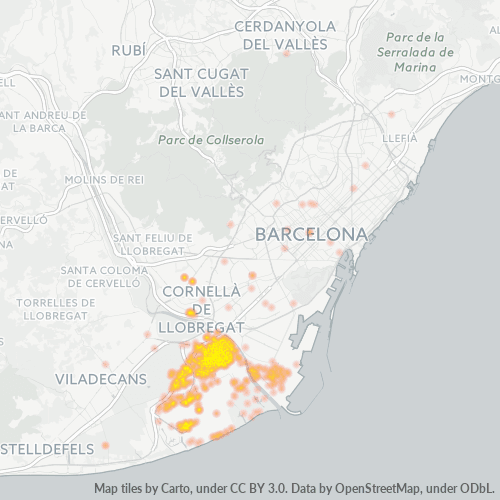
Map of Postal Code 08820 - El Prat de Llobregat, Catalonia
Interactive Map
Postal Code 08820 - El Prat de Llobregat, Catalonia Population
Years 1975 to 2030
| Data | 1975 | 1990 | 2000 | 2015 | 2020 | 2025* | 2030* |
|---|---|---|---|---|---|---|---|
| Population | 49,113 | 54,992 | 57,707 | 65,612 | 78,850 | 81,252 | 81,906 |
| Population Density | 1,452.6 / km² | 1,626.5 / km² | 1,706.8 / km² | 1,940.7 / km² | 2,332.2 / km² | 2,403.2 / km² | 2,422.6 / km² |
Postal Code 08820 - El Prat de Llobregat, Catalonia Population change from 2000 to 2020
Increase of 36.6% from year 2000 to 2020
| Location | Change since 1975 | Change since 1990 | Change since 2000 |
|---|---|---|---|
| Postal Code 08820 - El Prat de Llobregat, Catalonia | +60.5% | +43.4% | +36.6% |
| El Prat de Llobregat | +128.9% | +106% | +108.3% |
| Spain | — | — | — |
Postal Code 08820 - El Prat de Llobregat, Catalonia Median Age
Median Age: 40.9 years
| Location | Median Age | Median Age (Female) | Median Age (Male) |
|---|---|---|---|
| Postal Code 08820 - El Prat de Llobregat, Catalonia | 40.9 yrs | 42.4 yrs | 39.4 yrs |
| El Prat de Llobregat | 40.4 yrs | 41.6 yrs | 39.1 yrs |
| Spain | 40.9 yrs | 42 yrs | 39.7 yrs |
Postal Code 08820 Population Density
Population Density: 2,332 / km²
| Location | Population | Area | Density |
|---|---|---|---|
| Postal Code 08820 | 78,850 | 33.8 km² | 2,332 / km² |
| El Prat de Llobregat | 22,499 | 2.575 km² | 8,737 / km² |
| Spain | 45.3 million | 505,993.5 km² | 89.5 / km² |
Postal Code 08820 - El Prat de Llobregat, Catalonia Historical and Projected Population
Estimated Population from 1780 to 2100
- JRC (European Commission's Joint Research Centre) work on the GHS built-up grid
- CIESIN (Center for International Earth Science Information Network)
- [Link] Klein Goldewijk, K., Beusen, A., Doelman, J., and Stehfest, E.: Anthropogenic land use estimates for the Holocene – HYDE 3.2, Earth Syst. Sci. Data, 9, 927–953, https://doi.org/10.5194/essd-9-927-2017, 2017.
Area Codes
Percentage Area Codes used by businesses in Postal Code 08820 - El Prat de Llobregat, Catalonia
Industries
Business Distribution by Industry in Postal Code 08820 - El Prat de Llobregat, Catalonia
| Industry Description | Number of Establishments | Average Age of Business |
|---|---|---|
| Airlines | 126 | — |
| All food and beverage | 120 | — |
| Bars, pubs and taverns | 230 | — |
| Beauty salons | 113 | — |
| Cafes | 91 | — |
| Car repair | 107 | — |
| Clothing stores | 95 | — |
| Construction of buildings | 81 | — |
| Corporate management | 264 | 27.3 years |
| Education | 80 | — |
| Freight forwarding | 83 | — |
| Grocery stores and supermarkets | 159 | — |
| Hairdressers | 92 | — |
| Real estate | 106 | — |
| Restaurants | 337 | — |
| Shopping | 414 | 57.1 years |
| Shopping other | 80 | — |
| Transportation logistics | 98 | — |
Business distribution by price for Postal Code 08820 - El Prat de Llobregat, Catalonia
Human Development Index (HDI)
Statistic composite index of life expectancy, education, and per capita income.
Postal Code 08820 - El Prat de Llobregat, Catalonia Gross Domestic Product (GDP)
GDP per capita, PPP (constant 2017 international $)
| Data | 1990 | 1995 | 2000 | 2005 | 2010 | 2015 | 2020 | 2022 |
|---|---|---|---|---|---|---|---|---|
| GDP per capita | $33,558 | $35,274 | $42,045 | $44,806 | $43,547 | $44,021 | $42,492 | $47,356 |
| Total GDP | $6.4B | $6.9B | $8.5B | $9.6B | $9.9B | $10.7B | $11.3B | $12.7B |
Postal Code 08820 CO2 Emissions
Carbon Dioxide (CO2) Emissions Per Capita in Tonnes Per Year
| Location | CO2 Emissions | CO2 Emissions Per Capita | CO2 Emissions Intensity |
|---|---|---|---|
| Postal Code 08820 | 616,095 tn | 7.81 tn | 18,222.7 tons/km² |
| El Prat de Llobregat | 183,676 tn | 8.16 tn | 71,323.4 tons/km² |
| Spain | 330,097,501 tn | 7.29 tn | 652.4 tons/km² |
| 2013 CO2 emissions (tonnes/year) | 616,095 tn |
| 2013 CO2 emissions (tonnes/year) per capita | 7.81 tn |
| 2013 CO2 emissions intensity (tonnes/km²/year) | 18,222.7 tons/km² |
Natural Hazards Risk
Relative risk out of 10
| Hazard | Risk Level |
|---|---|
| Flood | Medium (7) |
| Earthquake | Low (2.7) |
Recent Nearby Earthquakes
Magnitude 3.0 and greater
| Date▼ | Time↕ | Magnitude↕ | Distance↕ | Depth↕ | Location↕ | Link |
|---|---|---|---|---|---|---|
| 12/18/10 | 10:08 PM | 4.1 | 84.8 km | — | Spain | usgs.gov |
| 8/16/08 | 3:21 AM | 3.8 | 82.1 km | 7,600 m | Spain | usgs.gov |
| 7/22/08 | 3:38 PM | 3.1 | 73.8 km | 4,000 m | Spain | usgs.gov |
| 7/22/08 | 3:36 PM | 4.3 | 92.4 km | 5,000 m | Pyrenees | usgs.gov |
| 7/21/08 | 11:59 AM | 3.2 | 73.8 km | — | Spain | usgs.gov |
| 6/22/08 | 11:48 AM | 3.6 | 73.8 km | 3,200 m | Spain | usgs.gov |
| 2/21/08 | 7:27 PM | 3.1 | 91.4 km | — | Spain | usgs.gov |
| 10/11/07 | 12:19 AM | 3.3 | 9.1 km | — | Spain | usgs.gov |
| 8/8/07 | 7:28 PM | 3.4 | 36.6 km | — | Spain | usgs.gov |
| 8/8/07 | 9:45 AM | 4.1 | 37.3 km | 1,200 m | Spain | usgs.gov |
Primary City
El Prat de Llobregat (Catalan pronunciation: [əɫ ˈpɾad də ʎuβɾəˈɣat]), commonly known as El Prat [əɫ ˈpɾat], is a municipality in the comarca of Baix Llobregat in Catalonia, Spain. It is situated in the delta of the Llobregat river on the right bank,..
El Prat de Llobregat Wikipedia Page
About Our Data
The data on this page is estimated using a number of publicly available tools and resources. It is provided without warranty, and could contain inaccuracies. Use at your own risk.