Postal Code 234 - Taipei
| Primary City | Taipei |
| Area of Postal Code 234 | 6.2 km² |
| Population | 211,470 |
| Male Population | 102,360 (48.4%) |
| Female Population | 109,110 (51.6%) |
| Population change from 1975 to 2015 | +72.8% |
| Population change from 2000 to 2015 | +12.4% |
| Median Age | 35.5 years |
| Male Median Age | 34.9 years |
| Female Median Age | 36 years |
| Neighborhoods | Dà'ān Qū, Dàtóng Qū, Nèihú Qū, Shìlín Qū, Sōngshān Qū, Wànhúa Qū, Xìnyì Qū, Yonghe District, Zhōngshān Qū, Zhōngzhèng Qū, 二十張, 永和區 |
| Timezone | Taiwan Standard Time |
| Coordinates | 25.008284091529394° / 121.51659606703836° |
| Related Postal Codes | 221, 222, 231, 232, 233, 235, 236, 237, 238, 239 |
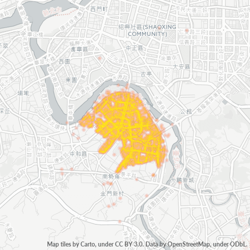
Map of Postal Code 234 - Taipei
Interactive Map
Postal Code 234 - Taipei Population
Years 1975 to 2020
| Data | 1975 | 1990 | 2000 | 2015 | 2020 |
|---|---|---|---|---|---|
| Population | 122,344 | 166,170 | 188,145 | 211,470 | 217,972 |
| Population Density | 19,732.9 / km² | 26,801.6 / km² | 30,345.9 / km² | 34,108 / km² | 35,156.7 / km² |
Postal Code 234 - Taipei Population change from 2000 to 2015
Increase of 12.4% from year 2000 to 2015
| Location | Change since 1975 | Change since 1990 | Change since 2000 |
|---|---|---|---|
| Postal Code 234 - Taipei | +72.8% | +27.3% | +12.4% |
| Taipei | +40.9% | +12% | +4% |
| Taipeicity | +36.8% | +9.8% | +2.9% |
| Taiwan | +45.6% | +15.6% | +6.7% |
Postal Code 234 - Taipei Median Age
Median Age: 35.5 years
| Location | Median Age | Median Age (Female) | Median Age (Male) |
|---|---|---|---|
| Postal Code 234 - Taipei | 35.5 yrs | 36 yrs | 34.9 yrs |
| Taipei | 36.4 yrs | 37 yrs | 35.7 yrs |
| Taipeicity | 36.6 yrs | 37.2 yrs | 35.9 yrs |
| Taiwan | 36 yrs | 36.6 yrs | 35.3 yrs |
Postal Code 234 Population Density
Population Density: 34,108 / km²
| Location | Population | Area | Density |
|---|---|---|---|
| Postal Code 234 | 211,470 | 6.2 km² | 34,108 / km² |
| Taipei | 2.8 million | 228.6 km² | 12,256 / km² |
| Taipeicity | 2.4 million | 288 km² | 8,191 / km² |
| Taiwan | 23.1 million | 36,283.8 km² | 636 / km² |
Postal Code 234 - Taipei Historical and Projected Population
Estimated Population from 1710 to 2100
- JRC (European Commission's Joint Research Centre) work on the GHS built-up grid
- CIESIN (Center for International Earth Science Information Network)
- [Link] Klein Goldewijk, K., Beusen, A., Doelman, J., and Stehfest, E.: Anthropogenic land use estimates for the Holocene – HYDE 3.2, Earth Syst. Sci. Data, 9, 927–953, https://doi.org/10.5194/essd-9-927-2017, 2017.
Area Codes
Percentage Area Codes used by businesses in Postal Code 234 - Taipei
Industries
Business Distribution by Industry in Postal Code 234 - Taipei
| Industry Description | Number of Establishments | Average Age of Business |
|---|---|---|
| All food and beverage | 341 | 17.4 years |
| Beauty salons | 344 | 14.2 years |
| Breakfast and brunch | 227 | — |
| Clothing stores | 234 | — |
| Delis | 238 | — |
| Pharmacies and drug stores | 202 | — |
| Restaurants | 2,343 | 11.3 years |
| Shopping | 782 | 31.2 years |
Business distribution by price for Postal Code 234 - Taipei
Human Development Index (HDI)
Statistic composite index of life expectancy, education, and per capita income.
Postal Code 234 CO2 Emissions
Carbon Dioxide (CO2) Emissions Per Capita in Tonnes Per Year
| Location | CO2 Emissions | CO2 Emissions Per Capita | CO2 Emissions Intensity |
|---|---|---|---|
| Postal Code 234 | 1,393,309 tn | 6.59 tn | 224,727 tons/km² |
| Taipei | 22,492,646 tn | 8.03 tn | 98,390.1 tons/km² |
| Taipeicity | 19,083,460 tn | 8.09 tn | 66,259.7 tons/km² |
| Taiwan | 134,944,416 tn | 5.84 tn | 3,719.1 tons/km² |
| 2013 CO2 emissions (tonnes/year) | 1,393,309 tn |
| 2013 CO2 emissions (tonnes/year) per capita | 6.59 tn |
| 2013 CO2 emissions intensity (tonnes/km²/year) | 224,727 tons/km² |
Natural Hazards Risk
Relative risk out of 10
| Hazard | Risk Level |
|---|---|
| Flood | High (10) |
| Earthquake | High (10) |
| Cyclone | High (10) |
Recent Nearby Earthquakes
Magnitude 3.0 and greater
| Date▼ | Time↕ | Magnitude↕ | Distance↕ | Depth↕ | Location↕ | Link |
|---|---|---|---|---|---|---|
| 8/7/19 | 2:28 PM | 5.9 | 73.4 km | 10,000 m | 16km SE of Su'ao, Taiwan | usgs.gov |
| 7/25/19 | 11:39 PM | 4.2 | 45.3 km | 64,000 m | 10km E of Yilan, Taiwan | usgs.gov |
| 6/29/19 | 9:20 AM | 4.3 | 68.7 km | 155,670 m | 46km ESE of Keelung, Taiwan | usgs.gov |
| 6/26/19 | 7:24 AM | 4.1 | 74.9 km | 144,540 m | 54km ESE of Keelung, Taiwan | usgs.gov |
| 5/13/19 | 1:55 AM | 4.4 | 58.3 km | 93,460 m | 21km NE of Su'ao, Taiwan | usgs.gov |
| 5/2/19 | 3:44 AM | 4.5 | 76.1 km | 35,000 m | 19km SE of Su'ao, Taiwan | usgs.gov |
| 3/31/19 | 7:54 PM | 4.2 | 70.7 km | 128,509 m | 49km ENE of Yilan, Taiwan | usgs.gov |
| 3/27/19 | 7:19 AM | 4.1 | 79.6 km | 220,290 m | 53km ENE of Keelung, Taiwan | usgs.gov |
| 3/18/19 | 9:01 PM | 4.4 | 52.3 km | 85,400 m | 13km NNE of Su'ao, Taiwan | usgs.gov |
| 3/17/19 | 5:44 AM | 4 | 75 km | 20,330 m | 18km SE of Su'ao, Taiwan | usgs.gov |
Primary City
Taipei (/ˌtaɪˈpeɪ/, literally means "North of Tai(wan)"), officially known as Taipei City (Chinese: 臺北市 or 台北市; pinyin: Táiběi Shì; Pe̍h-ōe-jī: Tâi-pak Chhī), is the capital city and a special municipality of Taiwan. Sitting at the northern tip of Ta..
Taipei Wikipedia Page
Cities
Percentage of businesses by city in Postal Code 234 - Taipei
About Our Data
The data on this page is estimated using a number of publicly available tools and resources. It is provided without warranty, and could contain inaccuracies. Use at your own risk.