Postal Code 06750 - Akyurt, Ankara Province
| Primary City | Akyurt |
| Area of Postal Code 06750 | 372.5 km² |
| Population | 91,540 |
| Male Population | 46,172 (50.4%) |
| Female Population | 45,368 (49.6%) |
| Population change from 1975 to 2015 | +441.8% |
| Population change from 2000 to 2015 | +42.0% |
| Median Age | 28 years |
| Male Median Age | 28.2 years |
| Female Median Age | 27.7 years |
| Neighborhoods | Akyurt, Balıkhisar Mahallesi, Beyazıt Mahallesi, Büğdüz Mahallesi, Çubuk, Güzelhisar Mahallesi, Saracalar Mahallesi, Yeşiltepe Mahallesi, Yıldırım Mahallesi |
| Timezone | Türkiye Standard Time |
| Coordinates | 40.116913981714774° / 33.146440786759314° |
| Related Postal Codes | 06714, 06715, 06720, 06723, 06726, 06730, 06732, 06733, 06734, 06740 |
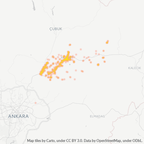
Map of Postal Code 06750 - Akyurt, Ankara Province
Interactive Map
Postal Code 06750 - Akyurt, Ankara Province Population
Years 1975 to 2020
| Data | 1975 | 1990 | 2000 | 2015 | 2020 |
|---|---|---|---|---|---|
| Population | 16,896 | 43,192 | 64,443 | 91,540 | 96,715 |
| Population Density | 45.4 / km² | 116 / km² | 173 / km² | 245.7 / km² | 259.6 / km² |
Postal Code 06750 - Akyurt, Ankara Province Population change from 2000 to 2015
Increase of 42% from year 2000 to 2015
| Location | Change since 1975 | Change since 1990 | Change since 2000 |
|---|---|---|---|
| Postal Code 06750 - Akyurt, Ankara Province | +441.8% | +111.9% | +42% |
| Ankara Province | +244.6% | +98.5% | +49.6% |
| Turkey | +102.3% | +46.5% | +24.7% |
Postal Code 06750 - Akyurt, Ankara Province Median Age
Median Age: 28 years
| Location | Median Age | Median Age (Female) | Median Age (Male) |
|---|---|---|---|
| Postal Code 06750 - Akyurt, Ankara Province | 28 yrs | 27.7 yrs | 28.2 yrs |
| Ankara Province | 31.2 yrs | 31.9 yrs | 30.5 yrs |
| Turkey | 29.2 yrs | 29.8 yrs | 28.7 yrs |
Postal Code 06750 Population Density
Population Density: 246 / km²
| Location | Population | Area | Density |
|---|---|---|---|
| Postal Code 06750 | 91,540 | 372.5 km² | 246 / km² |
| Ankara Province | 5.9 million | 25,507.2 km² | 230 / km² |
| Turkey | 77.8 million | 780,782.9 km² | 99.6 / km² |
Postal Code 06750 - Akyurt, Ankara Province Historical and Projected Population
Estimated Population from 1770 to 2100
- JRC (European Commission's Joint Research Centre) work on the GHS built-up grid
- CIESIN (Center for International Earth Science Information Network)
- [Link] Klein Goldewijk, K., Beusen, A., Doelman, J., and Stehfest, E.: Anthropogenic land use estimates for the Holocene – HYDE 3.2, Earth Syst. Sci. Data, 9, 927–953, https://doi.org/10.5194/essd-9-927-2017, 2017.
Neighborhoods
Business Distribution by neighborhood in Postal Code 06750 - Akyurt, Ankara Province
Industries
Business Distribution by Industry in Postal Code 06750 - Akyurt, Ankara Province
| Industry Description | Number of Establishments | Average Age of Business |
|---|---|---|
| Car repair | 44 | — |
| Corporate management | 44 | — |
| Furniture stores | 40 | — |
| Gas station | 105 | — |
| Grocery stores and supermarkets | 90 | — |
| New car dealers | 193 | — |
| Real estate | 97 | — |
| Religion | 55 | — |
| Restaurants | 87 | — |
| Shopping | 90 | 29.7 years |
| Used car dealers | 69 | — |
| Wholesale of machinery | 37 | — |
| Wholesalers | 37 | — |
Business distribution by price for Postal Code 06750 - Akyurt, Ankara Province
Human Development Index (HDI)
Statistic composite index of life expectancy, education, and per capita income.
Postal Code 06750 CO2 Emissions
Carbon Dioxide (CO2) Emissions Per Capita in Tonnes Per Year
| Location | CO2 Emissions | CO2 Emissions Per Capita | CO2 Emissions Intensity |
|---|---|---|---|
| Postal Code 06750 | 700,224 tn | 7.65 tn | 1,879.8 tons/km² |
| Ankara Province | 44,575,718 tn | 7.59 tn | 1,747.6 tons/km² |
| Turkey | 435,645,812 tn | 5.6 tn | 558 tons/km² |
| 2013 CO2 emissions (tonnes/year) | 700,224 tn |
| 2013 CO2 emissions (tonnes/year) per capita | 7.65 tn |
| 2013 CO2 emissions intensity (tonnes/km²/year) | 1,879.8 tons/km² |
Natural Hazards Risk
Relative risk out of 10
| Hazard | Risk Level |
|---|---|
| Flood | High (8) |
| Earthquake | Medium (6) |
Recent Nearby Earthquakes
Magnitude 3.0 and greater
| Date▼ | Time↕ | Magnitude↕ | Distance↕ | Depth↕ | Location↕ | Link |
|---|---|---|---|---|---|---|
| 2/12/19 | 9:23 AM | 4.2 | 45 km | 10,000 m | 17km SW of Orta, Turkey | usgs.gov |
| 2/12/19 | 9:14 AM | 4.8 | 53.9 km | 10,000 m | 13km WSW of Orta, Turkey | usgs.gov |
| 8/2/16 | 12:30 PM | 4 | 28 km | 10,000 m | 16km S of Sabanozu, Turkey | usgs.gov |
| 6/29/15 | 1:55 PM | 3.3 | 21.4 km | 2,000 m | 8km W of Elmadag, Turkey | usgs.gov |
| 5/11/15 | 4:40 PM | 4 | 16 km | 6,800 m | 8km N of Elmadag, Turkey | usgs.gov |
| 10/5/12 | 3:25 AM | 4.4 | 97.6 km | 4,900 m | central Turkey | usgs.gov |
| 10/19/10 | 7:32 AM | 4 | 81.5 km | 5,000 m | central Turkey | usgs.gov |
| 4/30/10 | 9:36 AM | 3.9 | 40.5 km | 4,000 m | central Turkey | usgs.gov |
| 10/9/08 | 11:36 PM | 4.2 | 73.6 km | 7,300 m | central Turkey | usgs.gov |
| 9/23/08 | 2:09 AM | 4.5 | 73.1 km | 4,400 m | central Turkey | usgs.gov |
Primary City
Akyurt, formerly Ravlı, is a district of Ankara Province of Turkey. According to 2010 census, population of the district is 26,006 of which 25,353 live in the urban center of Akyurt. The district covers an area of 212 km2 (82 sq mi) km², and the aver..
Akyurt Wikipedia Page
Cities
Percentage of businesses by city in Postal Code 06750 - Akyurt, Ankara Province
About Our Data
The data on this page is estimated using a number of publicly available tools and resources. It is provided without warranty, and could contain inaccuracies. Use at your own risk.