Postal Code 32300 - Isparta, Isparta Province
| Primary City | Isparta |
| Area of Postal Code 32300 | 27.6 km² |
| Population | 32,576 |
| Male Population | 18,643 (57.2%) |
| Female Population | 13,933 (42.8%) |
| Population change from 1975 to 2015 | +900.8% |
| Population change from 2000 to 2015 | +91.8% |
| Median Age | 27.5 years |
| Male Median Age | 24.5 years |
| Female Median Age | 31.5 years |
| Neighborhoods | Davraz Mahallesi, İstiklal Mahallesi, Karaağaç Mahallesi, Kepeci Mahallesi |
| Timezone | Türkiye Standard Time |
| Coordinates | 37.730496376025954° / 30.54283455510501° |
| Related Postal Codes | 32000, 32040, 32090, 32092, 32100, 32110, 32200, 32400, 32425, 32430 |
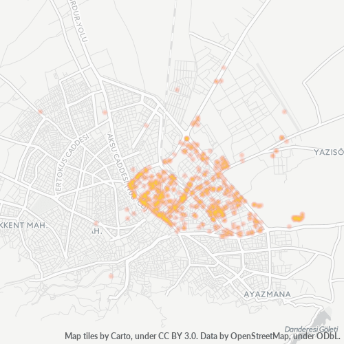
Map of Postal Code 32300 - Isparta, Isparta Province
Interactive Map
Postal Code 32300 - Isparta, Isparta Province Population
Years 1975 to 2020
| Data | 1975 | 1990 | 2000 | 2015 | 2020 |
|---|---|---|---|---|---|
| Population | 3,255 | 10,271 | 16,984 | 32,576 | 34,273 |
| Population Density | 117.9 / km² | 372 / km² | 615.2 / km² | 1,180 / km² | 1,241.5 / km² |
Postal Code 32300 - Isparta, Isparta Province Population change from 2000 to 2015
Increase of 91.8% from year 2000 to 2015
| Location | Change since 1975 | Change since 1990 | Change since 2000 |
|---|---|---|---|
| Postal Code 32300 - Isparta, Isparta Province | +900.8% | +217.2% | +91.8% |
| Isparta | +881.7% | +226.9% | +90.6% |
| Isparta Province | -16.9% | -9.9% | +1.9% |
| Turkey | +102.3% | +46.5% | +24.7% |
Postal Code 32300 - Isparta, Isparta Province Median Age
Median Age: 27.5 years
| Location | Median Age | Median Age (Female) | Median Age (Male) |
|---|---|---|---|
| Postal Code 32300 - Isparta, Isparta Province | 27.5 yrs | 31.5 yrs | 24.5 yrs |
| Isparta | 27.4 yrs | 31.4 yrs | 24.4 yrs |
| Isparta Province | 30.2 yrs | 34 yrs | 27 yrs |
| Turkey | 29.2 yrs | 29.8 yrs | 28.7 yrs |
Postal Code 32300 Population Density
Population Density: 1,180 / km²
| Location | Population | Area | Density |
|---|---|---|---|
| Postal Code 32300 | 32,576 | 27.6 km² | 1,180 / km² |
| Isparta | 223,201 | 29.5 km² | 7,561 / km² |
| Isparta Province | 466,073 | 8,820.5 km² | 52.8 / km² |
| Turkey | 77.8 million | 780,782.9 km² | 99.6 / km² |
Postal Code 32300 - Isparta, Isparta Province Historical and Projected Population
Estimated Population from 1830 to 2100
- JRC (European Commission's Joint Research Centre) work on the GHS built-up grid
- CIESIN (Center for International Earth Science Information Network)
- [Link] Klein Goldewijk, K., Beusen, A., Doelman, J., and Stehfest, E.: Anthropogenic land use estimates for the Holocene – HYDE 3.2, Earth Syst. Sci. Data, 9, 927–953, https://doi.org/10.5194/essd-9-927-2017, 2017.
Neighborhoods
Business Distribution by neighborhood in Postal Code 32300 - Isparta, Isparta Province
Area Codes
Percentage Area Codes used by businesses in Postal Code 32300 - Isparta, Isparta Province
Industries
Business Distribution by Industry in Postal Code 32300 - Isparta, Isparta Province
| Industry Description | Number of Establishments |
|---|---|
| Atm's | 24 |
| Beauty salons | 26 |
| Cafes | 31 |
| Construction of buildings | 24 |
| Construction of houses | 39 |
| Corporate management | 27 |
| Education | 48 |
| Grocery stores and supermarkets | 115 |
| Pharmacies and drug stores | 36 |
| Public administration | 25 |
| Real estate | 30 |
| Religion | 21 |
| Restaurants | 82 |
| Shopping | 68 |
Business distribution by price for Postal Code 32300 - Isparta, Isparta Province
Human Development Index (HDI)
Statistic composite index of life expectancy, education, and per capita income.
Postal Code 32300 CO2 Emissions
Carbon Dioxide (CO2) Emissions Per Capita in Tonnes Per Year
| Location | CO2 Emissions | CO2 Emissions Per Capita | CO2 Emissions Intensity |
|---|---|---|---|
| Postal Code 32300 | 192,398 tn | 5.91 tn | 6,969.2 tons/km² |
| Isparta | 1,275,643 tn | 5.72 tn | 43,212.8 tons/km² |
| Isparta Province | 2,773,038 tn | 5.95 tn | 314.4 tons/km² |
| Turkey | 435,645,812 tn | 5.6 tn | 558 tons/km² |
| 2013 CO2 emissions (tonnes/year) | 192,398 tn |
| 2013 CO2 emissions (tonnes/year) per capita | 5.91 tn |
| 2013 CO2 emissions intensity (tonnes/km²/year) | 6,969.2 tons/km² |
Natural Hazards Risk
Relative risk out of 10
| Hazard | Risk Level |
|---|---|
| Drought | Medium (5) |
| Flood | Medium (4) |
| Earthquake | High (8.8) |
| Landslide | Medium (7) |
Recent Nearby Earthquakes
Magnitude 3.0 and greater
| Date▼ | Time↕ | Magnitude↕ | Distance↕ | Depth↕ | Location↕ | Link |
|---|---|---|---|---|---|---|
| 8/8/19 | 4:19 AM | 4.3 | 83.7 km | 10,000 m | 5km SSE of Baklan, Turkey | usgs.gov |
| 8/8/19 | 4:25 AM | 5.8 | 78.3 km | 10,000 m | 8km ESE of Baklan, Turkey | usgs.gov |
| 3/25/19 | 7:35 AM | 4.4 | 96.5 km | 10,000 m | 16km NE of Acipayam, Turkey | usgs.gov |
| 3/20/19 | 10:42 AM | 4.3 | 96.8 km | 10,000 m | 19km WNW of Tefenni, Turkey | usgs.gov |
| 3/19/19 | 11:34 PM | 5.7 | 96.3 km | 8,000 m | 16km E of Acipayam, Turkey | usgs.gov |
| 9/27/18 | 5:26 PM | 4.1 | 74.7 km | 110,890 m | 23km NW of Antalya, Turkey | usgs.gov |
| 9/10/18 | 4:02 PM | 5.1 | 55.9 km | 108,140 m | 25km S of Bucak, Turkey | usgs.gov |
| 7/22/18 | 7:40 PM | 4.9 | 60.1 km | 10,000 m | 13km E of Yesilova, Turkey | usgs.gov |
| 9/29/17 | 9:08 AM | 4.5 | 84.9 km | 90,440 m | 8km NNW of Antalya, Turkey | usgs.gov |
| 3/29/17 | 11:10 AM | 4.5 | 66.7 km | 10,000 m | 7km NNE of Gelendost, Turkey | usgs.gov |
Primary City
Isparta (Greek: Σπάρτη, also Baris/Βάρις in Byzantine Greek) is a city in western Turkey and the capital of Isparta Province. The city's population was 222,556 in 2010 and its elevation is 1035 m. It is also known as the "City of Roses". main econom..
Isparta Wikipedia PageAbout Our Data
The data on this page is estimated using a number of publicly available tools and resources. It is provided without warranty, and could contain inaccuracies. Use at your own risk.