Postal Code 35680 - Foça, İzmir Province
| Primary City | Foça |
| Area of Postal Code 35680 | 211.4 km² |
| Population | 42,355 |
| Male Population | 30,576 (72.2%) |
| Female Population | 11,779 (27.8%) |
| Population change from 1975 to 2020 | +370.4% |
| Population change from 2000 to 2020 | +23.5% |
| Median Age | 26.8 years |
| Male Median Age | 23.5 years |
| Female Median Age | 35.5 years |
| Neighborhoods | Atatürk Mahallesi, Fevzipaşa Mahallesi, Ilıpınar Mahallesi, İsmetpaşa Mahallesi, Kozbeyli Mahallesi, Yenibağarası Mahallesi |
| Timezone | Türkiye Standard Time |
| Coordinates | 38.67756936421612° / 26.841844737903052° |
| Related Postal Codes | 35650, 35660, 35663, 35665, 35667, 35670, 35672, 35683, 35685, 35687 |
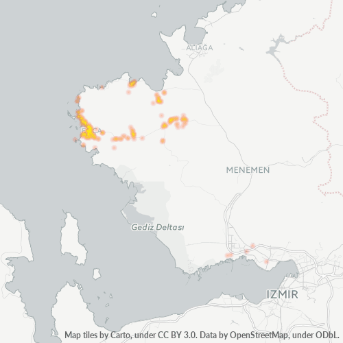
Map of Postal Code 35680 - Foça, İzmir Province
Interactive Map
Postal Code 35680 - Foça, İzmir Province Population
Years 1975 to 2030
| Data | 1975 | 1990 | 2000 | 2015 | 2020 | 2025* | 2030* |
|---|---|---|---|---|---|---|---|
| Population | 9,004 | 22,418 | 34,307 | 48,518 | 42,355 | 42,865 | 43,988 |
| Population Density | 42.6 / km² | 106.1 / km² | 162.3 / km² | 229.5 / km² | 200.4 / km² | 202.8 / km² | 208.1 / km² |
Postal Code 35680 - Foça, İzmir Province Population change from 2000 to 2020
Increase of 23.5% from year 2000 to 2020
| Location | Change since 1975 | Change since 1990 | Change since 2000 |
|---|---|---|---|
| Postal Code 35680 - Foça, İzmir Province | +370.4% | +88.9% | +23.5% |
| İzmir Province | +46.7% | +20.9% | +11.9% |
| Turkey | — | — | — |
Postal Code 35680 - Foça, İzmir Province Median Age
Median Age: 26.8 years
| Location | Median Age | Median Age (Female) | Median Age (Male) |
|---|---|---|---|
| Postal Code 35680 - Foça, İzmir Province | 26.8 yrs | 35.5 yrs | 23.5 yrs |
| İzmir Province | 33.1 yrs | 34 yrs | 32.2 yrs |
| Turkey | 29.2 yrs | 29.8 yrs | 28.7 yrs |
Postal Code 35680 Population Density
Population Density: 200 / km²
| Location | Population | Area | Density |
|---|---|---|---|
| Postal Code 35680 | 42,355 | 211.4 km² | 200 / km² |
| İzmir Province | 3.9 million | 12,157.3 km² | 322 / km² |
| Turkey | 77.8 million | 780,782.9 km² | 99.6 / km² |
Postal Code 35680 - Foça, İzmir Province Historical and Projected Population
Estimated Population from 0 to 2100
- JRC (European Commission's Joint Research Centre) work on the GHS built-up grid
- CIESIN (Center for International Earth Science Information Network)
- [Link] Klein Goldewijk, K., Beusen, A., Doelman, J., and Stehfest, E.: Anthropogenic land use estimates for the Holocene – HYDE 3.2, Earth Syst. Sci. Data, 9, 927–953, https://doi.org/10.5194/essd-9-927-2017, 2017.
Neighborhoods
Business Distribution by neighborhood in Postal Code 35680 - Foça, İzmir Province
Industries
Business Distribution by Industry in Postal Code 35680 - Foça, İzmir Province
| Industry Description | Number of Establishments |
|---|---|
| All food and beverage | 24 |
| Bars, pubs and taverns | 31 |
| Cafes | 75 |
| Clothing stores | 24 |
| Construction of houses | 55 |
| Corporate management | 36 |
| Grocery stores and supermarkets | 69 |
| Hotels and motels | 56 |
| Other accommodation | 87 |
| Real estate | 33 |
| Restaurants | 184 |
| Shopping | 45 |
Business distribution by price for Postal Code 35680 - Foça, İzmir Province
Human Development Index (HDI)
Statistic composite index of life expectancy, education, and per capita income.
Postal Code 35680 - Foça, İzmir Province Gross Domestic Product (GDP)
GDP per capita, PPP (constant 2017 international $)
| Data | 1990 | 1995 | 2000 | 2005 | 2010 | 2015 | 2020 | 2022 |
|---|---|---|---|---|---|---|---|---|
| GDP per capita | $10,962 | $11,279 | $14,045 | $17,909 | $20,166 | $25,636 | $32,161 | $31,952 |
| Total GDP | $54.4M | $67.1M | $103.7M | $162.7M | $216.4M | $331.2M | $456.7M | $456.9M |
Postal Code 35680 CO2 Emissions
Carbon Dioxide (CO2) Emissions Per Capita in Tonnes Per Year
| Location | CO2 Emissions | CO2 Emissions Per Capita | CO2 Emissions Intensity |
|---|---|---|---|
| Postal Code 35680 | 298,062 tn | 7.04 tn | 1,410.2 tons/km² |
| İzmir Province | 27,214,435 tn | 6.96 tn | 2,238.5 tons/km² |
| Turkey | 435,645,812 tn | 5.6 tn | 558 tons/km² |
| 2013 CO2 emissions (tonnes/year) | 298,062 tn |
| 2013 CO2 emissions (tonnes/year) per capita | 7.04 tn |
| 2013 CO2 emissions intensity (tonnes/km²/year) | 1,410.2 tons/km² |
Natural Hazards Risk
Relative risk out of 10
| Hazard | Risk Level |
|---|---|
| Drought | Medium (4) |
| Earthquake | High (9.6) |
| Landslide | Medium (6) |
Recent Nearby Earthquakes
Magnitude 3.0 and greater
| Date▼ | Time↕ | Magnitude↕ | Distance↕ | Depth↕ | Location↕ | Link |
|---|---|---|---|---|---|---|
| 1/25/19 | 12:20 PM | 4.2 | 21.5 km | 21,700 m | 2km NNE of Menemen, Turkey | usgs.gov |
| 11/7/18 | 2:38 AM | 4.1 | 27.3 km | 10,000 m | 9km NNE of Karaburun, Turkey | usgs.gov |
| 7/12/18 | 12:56 PM | 3.1 | 34.3 km | 10,000 m | 7km NW of Karaburun, Turkey | usgs.gov |
| 12/24/17 | 9:13 PM | 4.6 | 13.9 km | 10,000 m | 9km S of Foca, Turkey | usgs.gov |
| 8/4/17 | 8:20 PM | 4.2 | 40.1 km | 10,000 m | 13km ESE of Vareia, Greece | usgs.gov |
| 6/25/17 | 10:54 PM | 4.1 | 34.9 km | 10,000 m | 17km NNW of Karaburun, Turkey | usgs.gov |
| 6/21/17 | 7:48 PM | 4.8 | 36.5 km | 10,000 m | 18km SSE of Plomarion, Greece | usgs.gov |
| 6/17/17 | 12:33 PM | 4.2 | 31 km | 12,710 m | 16km N of Karaburun, Turkey | usgs.gov |
| 6/5/16 | 1:26 PM | 4.2 | 14.3 km | 17,000 m | 8km SW of Foca, Turkey | usgs.gov |
| 1/30/16 | 10:15 PM | 3.6 | 28.1 km | 17,000 m | 12km N of Urla, Turkey | usgs.gov |
Primary City
Foça (from Greek: Φώκαια, "Phocaea") is a town and district in Turkey's İzmir Province, on the Aegean coast. town of Foça is situated at about 69 km (43 mi) northwest of İzmir's city center. The district also has a township with its own municipality..
Foça Wikipedia Page
Cities
Percentage of businesses by city in Postal Code 35680 - Foça, İzmir Province
About Our Data
The data on this page is estimated using a number of publicly available tools and resources. It is provided without warranty, and could contain inaccuracies. Use at your own risk.