Postal Code 42010 - Meram, Konya Province
| Primary City | Meram |
| Area of Postal Code 42010 | 50 km² |
| Population | 171,927 |
| Male Population | 85,420 (49.7%) |
| Female Population | 86,507 (50.3%) |
| Population change from 1975 to 2015 | +474.9% |
| Population change from 2000 to 2015 | +51.8% |
| Median Age | 27.3 years |
| Male Median Age | 26.9 years |
| Female Median Age | 27.7 years |
| Neighborhoods | Alpaslan Mahallesi, Arifbilge Mahallesi, Batı Hadimi Mahallesi, Gazanfer Mahallesi, Harmancık Mahallesi, Kalfalar Mahallesi, Karaaslan Aybahçe Mahallesi, Kurtuluş Mahallesi, Loras Mahallesi, Mehmet Vehbi Mahallesi, Muradiye Mahallesi, Turgut Reis Mahallesi, Yaylapınar Süleymaniye Mahallesi |
| Timezone | Türkiye Standard Time |
| Coordinates | 37.810697996945365° / 32.48999102242751° |
| Related Postal Codes | 42000, 42002, 42003, 42005, 42040, 42050, 42060, 42070, 42080, 42084 |
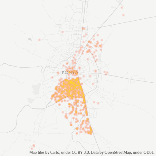
Map of Postal Code 42010 - Meram, Konya Province
Interactive Map
Postal Code 42010 - Meram, Konya Province Population
Years 1975 to 2020
| Data | 1975 | 1990 | 2000 | 2015 | 2020 |
|---|---|---|---|---|---|
| Population | 29,907 | 73,212 | 113,240 | 171,927 | 181,550 |
| Population Density | 597.6 / km² | 1,462.9 / km² | 2,262.8 / km² | 3,435.5 / km² | 3,627.7 / km² |
Postal Code 42010 - Meram, Konya Province Population change from 2000 to 2015
Increase of 51.8% from year 2000 to 2015
| Location | Change since 1975 | Change since 1990 | Change since 2000 |
|---|---|---|---|
| Postal Code 42010 - Meram, Konya Province | +474.9% | +134.8% | +51.8% |
| Konya Province | -44.8% | -2.5% | +8.3% |
| Turkey | +102.3% | +46.5% | +24.7% |
Postal Code 42010 - Meram, Konya Province Median Age
Median Age: 27.3 years
| Location | Median Age | Median Age (Female) | Median Age (Male) |
|---|---|---|---|
| Postal Code 42010 - Meram, Konya Province | 27.3 yrs | 27.7 yrs | 26.9 yrs |
| Konya Province | 28.6 yrs | 29.2 yrs | 28 yrs |
| Turkey | 29.2 yrs | 29.8 yrs | 28.7 yrs |
Postal Code 42010 Population Density
Population Density: 3,436 / km²
| Location | Population | Area | Density |
|---|---|---|---|
| Postal Code 42010 | 171,927 | 50 km² | 3,436 / km² |
| Konya Province | 2.3 million | 40,802.4 km² | 57 / km² |
| Turkey | 77.8 million | 780,782.9 km² | 99.6 / km² |
Postal Code 42010 - Meram, Konya Province Historical and Projected Population
Estimated Population from 1890 to 2100
- JRC (European Commission's Joint Research Centre) work on the GHS built-up grid
- CIESIN (Center for International Earth Science Information Network)
- [Link] Klein Goldewijk, K., Beusen, A., Doelman, J., and Stehfest, E.: Anthropogenic land use estimates for the Holocene – HYDE 3.2, Earth Syst. Sci. Data, 9, 927–953, https://doi.org/10.5194/essd-9-927-2017, 2017.
Industries
Business Distribution by Industry in Postal Code 42010 - Meram, Konya Province
| Industry Description | Number of Establishments |
|---|---|
| Beauty salons | 67 |
| Car repair | 87 |
| Construction of buildings | 60 |
| Grocery stores and supermarkets | 229 |
| Pharmacies and drug stores | 57 |
| Real estate | 99 |
| Religion | 129 |
| Restaurants | 205 |
| Shopping | 146 |
Business distribution by price for Postal Code 42010 - Meram, Konya Province
Human Development Index (HDI)
Statistic composite index of life expectancy, education, and per capita income.
Postal Code 42010 CO2 Emissions
Carbon Dioxide (CO2) Emissions Per Capita in Tonnes Per Year
| Location | CO2 Emissions | CO2 Emissions Per Capita | CO2 Emissions Intensity |
|---|---|---|---|
| Postal Code 42010 | 954,667 tn | 5.55 tn | 19,076.2 tons/km² |
| Konya Province | 13,543,163 tn | 5.82 tn | 331.9 tons/km² |
| Turkey | 435,645,812 tn | 5.6 tn | 558 tons/km² |
| 2013 CO2 emissions (tonnes/year) | 954,667 tn |
| 2013 CO2 emissions (tonnes/year) per capita | 5.55 tn |
| 2013 CO2 emissions intensity (tonnes/km²/year) | 19,076.2 tons/km² |
Natural Hazards Risk
Relative risk out of 10
| Hazard | Risk Level |
|---|---|
| Drought | Medium (4.6) |
| Earthquake | Medium (6) |
Recent Nearby Earthquakes
Magnitude 3.0 and greater
| Date▼ | Time↕ | Magnitude↕ | Distance↕ | Depth↕ | Location↕ | Link |
|---|---|---|---|---|---|---|
| 4/16/18 | 7:12 AM | 4.3 | 93.3 km | 10,000 m | 13km ENE of Akseki, Turkey | usgs.gov |
| 4/13/18 | 10:14 AM | 4.8 | 87.5 km | 10,000 m | 17km NE of Akseki, Turkey | usgs.gov |
| 4/13/18 | 10:55 AM | 4.2 | 92.6 km | 10,000 m | 15km ENE of Akseki, Turkey | usgs.gov |
| 3/11/14 | 3:23 AM | 4.2 | 88.1 km | 21,880 m | 15km NW of Ilgin, Turkey | usgs.gov |
| 7/27/11 | 2:58 AM | 4.8 | 73.4 km | 10,000 m | western Turkey | usgs.gov |
| 9/10/09 | 11:29 AM | 4.9 | 15.8 km | 5,000 m | central Turkey | usgs.gov |
| 9/10/09 | 6:58 PM | 4.9 | 14.6 km | 5,400 m | central Turkey | usgs.gov |
| 12/23/07 | 9:44 AM | 3.6 | 87.5 km | 3,100 m | central Turkey | usgs.gov |
| 5/18/07 | 4:27 PM | 4.5 | 89.2 km | 6,400 m | central Turkey | usgs.gov |
| 3/31/06 | 6:13 AM | 4.1 | 96.7 km | 27,300 m | western Turkey | usgs.gov |
Primary City
Meram is a town and district of Konya Province in the Central Anatolia region of Turkey. Meram is one of the central districts of Konya along with the districts of Karatay and Selçuklu. According to 2000 census, population of the district is 267,878 ..
Meram Wikipedia Page
Cities
Percentage of businesses by city in Postal Code 42010 - Meram, Konya Province
About Our Data
The data on this page is estimated using a number of publicly available tools and resources. It is provided without warranty, and could contain inaccuracies. Use at your own risk.