Postal Code 42400 - Karapınar, Konya Province
| Primary City | Karapınar |
| Area of Postal Code 42400 | 4,268.8 km² |
| Population | 192,185 |
| Male Population | 95,750 (49.8%) |
| Female Population | 96,435 (50.2%) |
| Population change from 1975 to 2020 | +352.3% |
| Population change from 2000 to 2020 | +96.1% |
| Median Age | 26.6 years |
| Male Median Age | 26.3 years |
| Female Median Age | 26.9 years |
| Neighborhoods | Adalet Mahallesi, Alaaddin Mahallesi, Apak Mahallesi, Hacı İsa Mahallesi, Hacı Ömerli Mahallesi, Hankapı Mahallesi, İpekçi Mahallesi, İsmet Paşa Mahallesi, Kale Mahallesi |
| Timezone | Türkiye Standard Time |
| Coordinates | 37.814675204312444° / 33.293816314785396° |
| Related Postal Codes | 42415, 42420, 42425, 42430, 42435, 42440, 42450, 42460, 42470, 42480 |
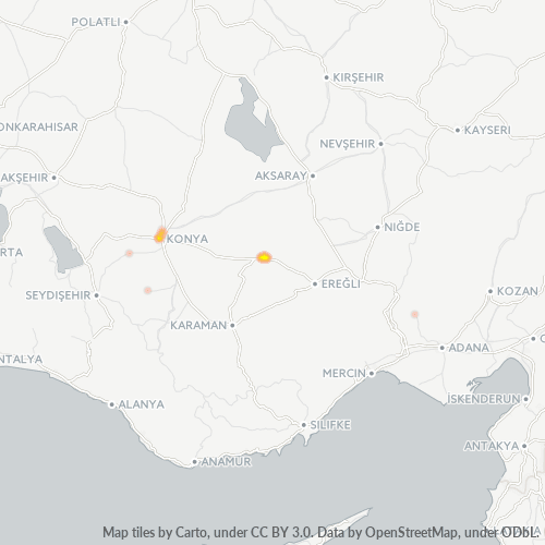
Map of Postal Code 42400 - Karapınar, Konya Province
Interactive Map
Postal Code 42400 - Karapınar, Konya Province Population
Years 1975 to 2030
| Data | 1975 | 1990 | 2000 | 2015 | 2020 | 2025* | 2030* |
|---|---|---|---|---|---|---|---|
| Population | 42,490 | 77,793 | 98,017 | 112,158 | 192,185 | 204,146 | 212,396 |
| Population Density | 10 / km² | 18.2 / km² | 23 / km² | 26.3 / km² | 45 / km² | 47.8 / km² | 49.8 / km² |
Postal Code 42400 - Karapınar, Konya Province Population change from 2000 to 2020
Increase of 96.1% from year 2000 to 2020
| Location | Change since 1975 | Change since 1990 | Change since 2000 |
|---|---|---|---|
| Postal Code 42400 - Karapınar, Konya Province | +352.3% | +147% | +96.1% |
| Konya Province | -38.4% | +8.9% | +20.9% |
| Turkey | — | — | — |
Postal Code 42400 - Karapınar, Konya Province Median Age
Median Age: 26.6 years
| Location | Median Age | Median Age (Female) | Median Age (Male) |
|---|---|---|---|
| Postal Code 42400 - Karapınar, Konya Province | 26.6 yrs | 26.9 yrs | 26.3 yrs |
| Konya Province | 28.6 yrs | 29.2 yrs | 28 yrs |
| Turkey | 29.2 yrs | 29.8 yrs | 28.7 yrs |
Postal Code 42400 Population Density
Population Density: 45 / km²
| Location | Population | Area | Density |
|---|---|---|---|
| Postal Code 42400 | 192,185 | 4,268.8 km² | 45 / km² |
| Konya Province | 2.3 million | 40,802.4 km² | 57 / km² |
| Turkey | 77.8 million | 780,782.9 km² | 99.6 / km² |
Postal Code 42400 - Karapınar, Konya Province Historical and Projected Population
Estimated Population from 0 to 2100
- JRC (European Commission's Joint Research Centre) work on the GHS built-up grid
- CIESIN (Center for International Earth Science Information Network)
- [Link] Klein Goldewijk, K., Beusen, A., Doelman, J., and Stehfest, E.: Anthropogenic land use estimates for the Holocene – HYDE 3.2, Earth Syst. Sci. Data, 9, 927–953, https://doi.org/10.5194/essd-9-927-2017, 2017.
Neighborhoods
Business Distribution by neighborhood in Postal Code 42400 - Karapınar, Konya Province
Industries
Business Distribution by Industry in Postal Code 42400 - Karapınar, Konya Province
| Industry Description | Number of Establishments |
|---|---|
| Car repair | 96 |
| Department stores | 36 |
| Education | 65 |
| Gas station | 80 |
| Grocery stores and supermarkets | 100 |
| Religion | 45 |
| Restaurants | 101 |
| Shopping | 95 |
Business distribution by price for Postal Code 42400 - Karapınar, Konya Province
Human Development Index (HDI)
Statistic composite index of life expectancy, education, and per capita income.
Postal Code 42400 - Karapınar, Konya Province Gross Domestic Product (GDP)
GDP per capita, PPP (constant 2017 international $)
| Data | 1990 | 1995 | 2000 | 2005 | 2010 | 2015 | 2020 | 2022 |
|---|---|---|---|---|---|---|---|---|
| GDP per capita | $7,357 | $7,650 | $9,543 | $10,928 | $11,549 | $19,536 | $20,502 | $20,852 |
| Total GDP | $710.6M | $865.7M | $1.2B | $1.6B | $1.9B | $3.6B | $3.8B | $3.7B |
Postal Code 42400 CO2 Emissions
Carbon Dioxide (CO2) Emissions Per Capita in Tonnes Per Year
| Location | CO2 Emissions | CO2 Emissions Per Capita | CO2 Emissions Intensity |
|---|---|---|---|
| Postal Code 42400 | 1,115,796 tn | 5.81 tn | 261.4 tons/km² |
| Konya Province | 13,543,163 tn | 5.82 tn | 331.9 tons/km² |
| Turkey | 435,645,812 tn | 5.6 tn | 558 tons/km² |
| 2013 CO2 emissions (tonnes/year) | 1,115,796 tn |
| 2013 CO2 emissions (tonnes/year) per capita | 5.81 tn |
| 2013 CO2 emissions intensity (tonnes/km²/year) | 261.4 tons/km² |
Natural Hazards Risk
Relative risk out of 10
| Hazard | Risk Level |
|---|---|
| Drought | Medium (4.1) |
| Earthquake | Medium (4.2) |
Recent Nearby Earthquakes
Magnitude 3.0 and greater
| Date▼ | Time↕ | Magnitude↕ | Distance↕ | Depth↕ | Location↕ | Link |
|---|---|---|---|---|---|---|
| 9/10/09 | 11:29 AM | 4.9 | 73 km | 5,000 m | central Turkey | usgs.gov |
| 9/10/09 | 6:58 PM | 4.9 | 76.5 km | 5,400 m | central Turkey | usgs.gov |
| 5/18/07 | 4:27 PM | 4.5 | 55.6 km | 6,400 m | central Turkey | usgs.gov |
| 1/30/07 | 10:28 PM | 3.3 | 75.3 km | 7,600 m | central Turkey | usgs.gov |
| 7/13/06 | 12:17 PM | 3.9 | 52.4 km | 5,000 m | central Turkey | usgs.gov |
| 7/3/06 | 11:38 PM | 3.5 | 47.5 km | 29,100 m | central Turkey | usgs.gov |
| 7/24/04 | 8:15 PM | 3.4 | 54.6 km | 36,000 m | central Turkey | usgs.gov |
| 5/21/04 | 10:36 PM | 3.3 | 77.8 km | 12,000 m | central Turkey | usgs.gov |
| 3/6/03 | 10:12 PM | 4.1 | 76.1 km | 10,000 m | central Turkey | usgs.gov |
| 3/11/01 | 11:21 AM | 4 | 97.1 km | 12,000 m | central Turkey | usgs.gov |
Primary City
Karapınar is a town and district of Konya Province in the Central Anatolia region of Turkey. According to 2000 census, population of the district is 55,734 of which 35,285 live in the town of Karapınar. Volcanic Karapınar Field is located nearby.
Karapınar Wikipedia PageCities
Percentage of businesses by city in Postal Code 42400 - Karapınar, Konya Province
About Our Data
The data on this page is estimated using a number of publicly available tools and resources. It is provided without warranty, and could contain inaccuracies. Use at your own risk.