Postal Code 43500 - Simav, Kütahya Province
| Primary City | Simav |
| Area of Postal Code 43500 | 222.2 km² |
| Population | 33,745 |
| Male Population | 16,440 (48.7%) |
| Female Population | 17,305 (51.3%) |
| Population change from 1975 to 2020 | +71.6% |
| Population change from 2000 to 2020 | -19.6% |
| Median Age | 38 years |
| Male Median Age | 36.8 years |
| Female Median Age | 39.2 years |
| Neighborhoods | 4 Eylül Mahallesi, Esenevler Mahallesi, Fatih Mahallesi, Hisarardı Mahallesi, Tabakhane Mahallesi, Tepecik Mahallesi, Yeni Mahallesi |
| Timezone | Türkiye Standard Time |
| Coordinates | 39.150245541346656° / 28.904872795939298° |
| Related Postal Codes | 43300, 43502, 43510, 43520, 43530, 43532, 43584, 43586, 43587, 43593 |
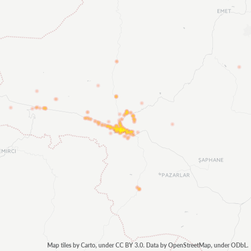
Map of Postal Code 43500 - Simav, Kütahya Province
Interactive Map
Postal Code 43500 - Simav, Kütahya Province Population
Years 1975 to 2030
| Data | 1975 | 1990 | 2000 | 2015 | 2020 | 2025* | 2030* |
|---|---|---|---|---|---|---|---|
| Population | 19,670 | 50,112 | 41,967 | 28,160 | 33,745 | 32,559 | 31,917 |
| Population Density | 88.5 / km² | 225.6 / km² | 188.9 / km² | 126.8 / km² | 151.9 / km² | 146.6 / km² | 143.7 / km² |
Postal Code 43500 - Simav, Kütahya Province Population change from 2000 to 2020
Decrease of 19.6% from year 2000 to 2020
| Location | Change since 1975 | Change since 1990 | Change since 2000 |
|---|---|---|---|
| Postal Code 43500 - Simav, Kütahya Province | +71.6% | -32.7% | -19.6% |
| Kütahya Province | +25.5% | +6.2% | +5.7% |
| Turkey | — | — | — |
Postal Code 43500 - Simav, Kütahya Province Median Age
Median Age: 38 years
| Location | Median Age | Median Age (Female) | Median Age (Male) |
|---|---|---|---|
| Postal Code 43500 - Simav, Kütahya Province | 38 yrs | 39.2 yrs | 36.8 yrs |
| Kütahya Province | 32.3 yrs | 34.5 yrs | 30.3 yrs |
| Turkey | 29.2 yrs | 29.8 yrs | 28.7 yrs |
Postal Code 43500 Population Density
Population Density: 152 / km²
| Location | Population | Area | Density |
|---|---|---|---|
| Postal Code 43500 | 33,745 | 222.2 km² | 152 / km² |
| Kütahya Province | 609,021 | 11,646.5 km² | 52.3 / km² |
| Turkey | 77.8 million | 780,782.9 km² | 99.6 / km² |
Postal Code 43500 - Simav, Kütahya Province Historical and Projected Population
Estimated Population from 0 to 2100
- JRC (European Commission's Joint Research Centre) work on the GHS built-up grid
- CIESIN (Center for International Earth Science Information Network)
- [Link] Klein Goldewijk, K., Beusen, A., Doelman, J., and Stehfest, E.: Anthropogenic land use estimates for the Holocene – HYDE 3.2, Earth Syst. Sci. Data, 9, 927–953, https://doi.org/10.5194/essd-9-927-2017, 2017.
Neighborhoods
Business Distribution by neighborhood in Postal Code 43500 - Simav, Kütahya Province
Industries
Business Distribution by Industry in Postal Code 43500 - Simav, Kütahya Province
| Industry Description | Number of Establishments |
|---|---|
| All food and beverage | 23 |
| Cafes | 47 |
| Car repair | 66 |
| Clothing stores | 43 |
| Education | 45 |
| Gas station | 42 |
| Grocery stores and supermarkets | 75 |
| Mosques | 28 |
| Pharmacies and drug stores | 34 |
| Public administration | 27 |
| Religion | 30 |
| Restaurants | 107 |
| Shopping | 42 |
Business distribution by price for Postal Code 43500 - Simav, Kütahya Province
Human Development Index (HDI)
Statistic composite index of life expectancy, education, and per capita income.
Postal Code 43500 - Simav, Kütahya Province Gross Domestic Product (GDP)
GDP per capita, PPP (constant 2017 international $)
| Data | 1990 | 1995 | 2000 | 2005 | 2010 | 2015 | 2020 | 2022 |
|---|---|---|---|---|---|---|---|---|
| GDP per capita | $14,448 | $14,900 | $10,343 | $6,766 | $6,881 | $6,970 | $7,320 | $9,213 |
| Total GDP | $333.2M | $343.1M | $226M | $130M | $112.5M | $111M | $115.7M | $144.2M |
Postal Code 43500 CO2 Emissions
Carbon Dioxide (CO2) Emissions Per Capita in Tonnes Per Year
| Location | CO2 Emissions | CO2 Emissions Per Capita | CO2 Emissions Intensity |
|---|---|---|---|
| Postal Code 43500 | 197,042 tn | 5.84 tn | 886.9 tons/km² |
| Kütahya Province | 3,570,129 tn | 5.86 tn | 306.5 tons/km² |
| Turkey | 435,645,812 tn | 5.6 tn | 558 tons/km² |
| 2013 CO2 emissions (tonnes/year) | 197,042 tn |
| 2013 CO2 emissions (tonnes/year) per capita | 5.84 tn |
| 2013 CO2 emissions intensity (tonnes/km²/year) | 886.9 tons/km² |
Natural Hazards Risk
Relative risk out of 10
| Hazard | Risk Level |
|---|---|
| Drought | Medium (4) |
| Flood | Medium (4) |
| Earthquake | High (9) |
| Landslide | High (10) |
Recent Nearby Earthquakes
Magnitude 3.0 and greater
| Date▼ | Time↕ | Magnitude↕ | Distance↕ | Depth↕ | Location↕ | Link |
|---|---|---|---|---|---|---|
| 4/21/17 | 6:09 AM | 5 | 44.3 km | 10,000 m | 17km E of Selendi, Turkey | usgs.gov |
| 4/20/17 | 7:11 AM | 4.2 | 48 km | 10,000 m | 19km SW of Dursunbey, Turkey | usgs.gov |
| 10/24/16 | 2:04 PM | 4.1 | 74.4 km | 8,000 m | 20km W of Yenice, Turkey | usgs.gov |
| 10/13/15 | 4:18 PM | 4.2 | 10.4 km | 8,260 m | 1km SE of Simav, Turkey | usgs.gov |
| 9/21/15 | 11:25 PM | 4.1 | 19.2 km | 10,000 m | 14km ENE of Simav, Turkey | usgs.gov |
| 11/27/14 | 6:30 PM | 4.5 | 20.2 km | 10,000 m | 23km W of Emet, Turkey | usgs.gov |
| 11/25/14 | 4:04 PM | 4.1 | 24.6 km | 2,300 m | 17km W of Emet, Turkey | usgs.gov |
| 9/16/14 | 4:18 PM | 3.9 | 19.5 km | 5,000 m | 12km ESE of Demirci, Turkey | usgs.gov |
| 7/15/14 | 5:25 AM | 4.1 | 16.2 km | 5,000 m | 13km NE of Simav, Turkey | usgs.gov |
| 8/6/13 | 10:20 PM | 4.4 | 47.6 km | 9,600 m | 17km NNE of Gediz, Turkey | usgs.gov |
Primary City
Simav is a town and a district of Kütahya Province in the Aegean region of Turkey. The town is located on the Simav River.
Simav Wikipedia PageCities
Percentage of businesses by city in Postal Code 43500 - Simav, Kütahya Province
About Our Data
The data on this page is estimated using a number of publicly available tools and resources. It is provided without warranty, and could contain inaccuracies. Use at your own risk.