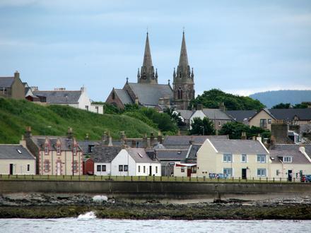
Postal Code AB56 1FS - Buckie, Scotland
Scotland | United Kingdom
| Primary City | Buckie |
| Population | 7,860 |
| Timezone | British Summer Time |
| Coordinates | 57.673008° / -2.97684° |
| Related Postal Codes | AB43, AB5, AB51, AB52, AB53, AB54, AB55, AB56, AB9, AB99 |
Map of Postal Code AB56 1FS - Buckie, Scotland
Interactive Map
Buckie Population Density
Population Density: 1,853 / km²
| Location | Population | Area | Density |
|---|---|---|---|
| Buckie | 3,390 | 1.829 km² | 1,853 / km² |
| United Kingdom | 64.5 million | 247,916.6 km² | 260 / km² |
Sources: JRC (European Commission's Joint Research Centre) work on the GHS built-up grid
Buckie CO2 Emissions
Carbon Dioxide (CO2) Emissions Per Capita in Tonnes Per Year
| Location | CO2 Emissions | CO2 Emissions Per Capita | CO2 Emissions Intensity |
|---|---|---|---|
| Buckie | 37,961 tn | 11.2 tn | 20,752.3 tons/km² |
| United Kingdom | 735,672,544 tn | 11.4 tn | 2,967.4 tons/km² |
Sources: [Link] Moran, D., Kanemoto K; Jiborn, M., Wood, R., Többen, J., and Seto, K.C. (2018) Carbon footprints of 13,000 cities. Environmental Research Letters DOI: 10.1088/1748-9326/aac72a
Buckie CO2 Emissions
| 2013 CO2 emissions (tonnes/year) | 37,961 tn |
| 2013 CO2 emissions (tonnes/year) per capita | 11.2 tn |
| 2013 CO2 emissions intensity (tonnes/km²/year) | 20,752.3 tons/km² |
Primary City
(Scottish Gaelic: Bucaidh) is a burgh town (defined as such in 1888) on the Moray Firth coast of Scotland in Moray. Buckie was the largest town in Banffshire by some thousands of inhabitants before regionalisation in 1975 removed that political div..
Buckie Wikipedia Page