5 Postal Districts in Barry, Vale of Glamorgan
View a list of Postal Districts in Barry, Vale of Glamorgan| Timezone | United Kingdom Time |
| Area | 19.8 km² |
| Population | 52,290 (More Details) |
| Male Population | 25,211 (48.2%) |
| Female Population | 27,079 (51.8%) |
| Median Age | 38.6 |
| Postal Districts | CF11, CF6, CF62 (2 more) |
| Postal Codes | 6,653 |
| Area Codes | 1446 |
Interactive Map
5 Postal Districts in Barry, Vale of Glamorgan
Barry, Vale of Glamorgan Demographic Information
| Population | 52,290 |
| Population Density | 2,646 / km² |
| Male Population | 25,211 (48.2%) |
| Female Population | 27,079 (51.8%) |
| Median Age | 38.6 |
| Male Median Age | 37.2 |
| Female Median Age | 39.9 |
| Businesses in Barry, Vale of Glamorgan | 6,826 |
| Population (1975) | 47,617 |
| Population (2000) | 48,655 |
| Population change from 1975 to 2015 | +9.8% |
| Population change from 2000 to 2015 | +7.5% |
Barry, Vale of Glamorgan
(Welsh: Y Barri) is a town in the Vale of Glamorgan, Wales, on the north coast of the Bristol Channel approximately 7 miles (11 km) south-southwest of Cardiff. Barry is a seaside resort, with attractions including several beaches and formerly Barry..
Barry, Vale of Glamorgan Wikipedia Page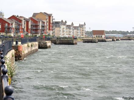
Nearby Cities
| City▲ | Administrative Region↕ | Country Or Region | City Population↕ | Postal Codes |
|---|---|---|---|---|
| Bridgend | Wales | United Kingdom | 39,429 | CF31, CF32, CF33, CF35, CF39, CF7 |
| Cardiff | Wales | United Kingdom | 302,139 | CF1, CF10, CF11, CF14, CF15, CF2, CF23, CF24, CF3, CF30, CF37, CF39, CF4, CF40, CF41, CF5, CF6, CF64, CF7, CF71, CF72, CF8, CF81, CF83, CF91, CF95, CF99, NP1, NP12, NP2 |
| Coity | Wales | United Kingdom | 41,352 | CF31, CF32, CF35 |
| Penarth | Wales | United Kingdom | 23,437 | CF6, CF64 |
| Weston-super-Mare | England | United Kingdom | 82,903 | BS0, BS18, BS19, BS22, BS23, BS24, BS25, BS26, BS28, BS29, BS49, BS80 |