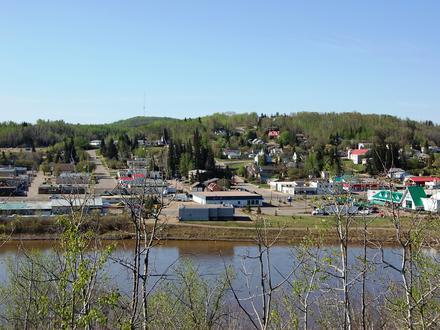
2 Forward Sortation Areas (FSA) in Athabasca, Alberta
View a list of Forward Sortation Areas (FSA) in Athabasca, Alberta| Timezone | Mountain Time |
| Area | 17.5 km² |
| Population | 3,249 (More Details) |
| Male Population | 1,555 (47.9%) |
| Female Population | 1,694 (52.1%) |
| Median Age | 39.0 |
| Forward Sortation Areas (FSA) | T0G, T9S |
| Postal Codes | 217 |
| Area Codes | 780 |
Interactive Map
2 Forward Sortation Areas (FSA) in Athabasca, Alberta
| Forward Sortation Area (FSA)▲ | City↕ | Population↕ | Area |
|---|---|---|---|
| T0G | — | 46,286 | 65,449.4 km² |
| T9S | Athabasca, Alberta | 7,038 | 1,637.2 km² |
Athabasca, Alberta Demographic Information
| Population | 3,249 |
| Population Density | 186 / km² |
| Male Population | 1,555 (47.9%) |
| Female Population | 1,694 (52.1%) |
| Median Age | 39.0 |
| Male Median Age | 37.2 |
| Female Median Age | 40.6 |
| Businesses in Athabasca, Alberta | 1,138 |
| Population (1975) | 2,437 |
| Population (2000) | 3,020 |
| Population change from 1975 to 2015 | +33.3% |
| Population change from 2000 to 2015 | +7.6% |
Athabasca, Alberta
Athabasca (2011 population 2,990), originally named Athabasca Landing, is a town in northern Alberta, Canada. It is located 145 km (90 mi) north of Edmonton at the intersection of Highway 2 and Highway 55, on the banks of the Athabasca River. It is t..
Athabasca, Alberta Wikipedia Page