1 Forward Sortation Areas (FSA) in Kitwanga
View a list of Forward Sortation Areas (FSA) in Kitwanga| Timezone | Pacific Time |
| Area | 182,288 km² |
| Population | 60,599 (More Details) |
| Median Age | 39.7 |
| Forward Sortation Area (FSA) | V0J |
| Postal Codes | 68 |
1 Forward Sortation Areas (FSA) in Kitwanga
| Forward Sortation Area (FSA)▲ | City↕ | Population↕ | Area |
|---|---|---|---|
| V0J | — | 55,982 | 182,288.2 km² |
Kitwanga Demographic Information
| Population | 60,599 |
| Population Density | 0.3 / km² |
| Median Age | 39.7 |
| Businesses in Kitwanga | 62 |
| Population (1975) | 49,397 |
| Population (2000) | 54,381 |
| Population change from 1975 to 2015 | +22.7% |
| Population change from 2000 to 2015 | +11.4% |
Kitwanga
Kitwanga /ˈkɪtwəŋɡə/ or Gitwangak or Gitwangax ("people of the place of rabbits" in the Gitxsan language) is located where the Kitwanga River runs into the Skeena River in British Columbia. A long-standing village before contact, the village is withi..
Kitwanga Wikipedia Page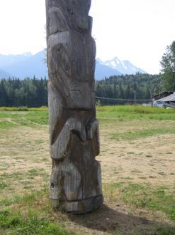
Nearby Cities
| City▲ | Administrative Region↕ | Country Or Region | City Population↕ | Postal Codes |
|---|---|---|---|---|
| Cedarvale, British Columbia | British Columbia | Canada | — | V0J |
| Hazelton, British Columbia | British Columbia | Canada | — | V0J |
| Kispiox | British Columbia | Canada | — | V0J |
| New Hazelton | British Columbia | Canada | 627 | V0J |
| Terrace, British Columbia | British Columbia | Canada | 19,443 | V8G |