10 Postal Codes in Iwate Prefecture
View a list of Postal Areas in Iwate Prefecture| Timezone | Japan Standard Time |
| Area | 15,279 km² |
| Population | 1.2 million (More Details) |
| Population Density | 80.9 / km² |
| Male Population | 590,138 (47.7%) |
| Female Population | 646,118 (52.3%) |
| Median Age | 49.6 |
| Postal Areas | 020, 021, 022 (7 more) |
| Area Codes | 19, 191, 192 (6 more) |
| Businesses in Iwate Prefecture | 95,807 |
| Cities | 28 |
10 Postal Areas in Iwate Prefecture
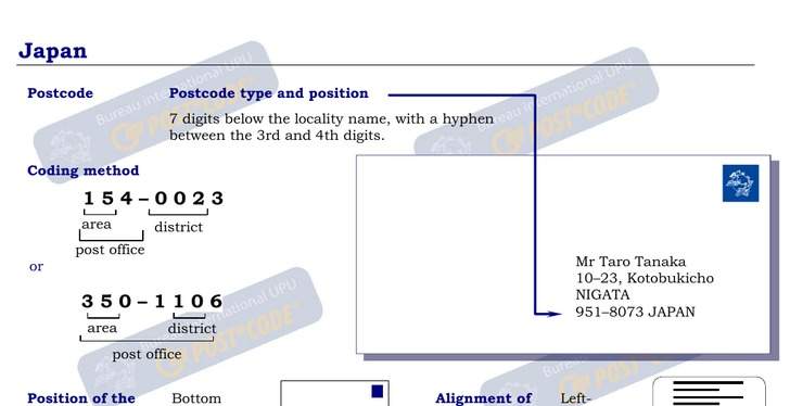
Address Example
Iwate Prefecture Demographic Information
| Population | 1.2 million |
| Population Density | 80.9 / km² |
| Male Population | 590,138 (47.7%) |
| Female Population | 646,118 (52.3%) |
| Median Age | 49.6 |
| Male Median Age | 47.1 |
| Female Median Age | 51.8 |
| Businesses in Iwate Prefecture | 95,807 |
| Population (1975) | 1,510,514 |
| Population (2000) | 1,395,337 |
| Population change from 1975 to 2015 | -18.2% |
| Population change from 2000 to 2015 | -11.4% |
Most populated cities in Iwate Prefecture
Iwate Prefecture
Iwate Prefecture (岩手県, Iwate-ken) is a prefecture of Japan. It is located in the Tōhoku region of Honshu island and contains the island's easternmost point. The capital is Morioka. Iwate has the lowest population density of any prefecture outside Hok..
Iwate Prefecture Wikipedia Page