Postal Code 44515 - Nepal
Nepal
| Neighborhoods | Chandranigahapur, Santapur Matiaun |
| Timezone | Nepal Time |
| Coordinates | 27.117983084200485° / 85.3569436107503° |
| Related Postal Codes | 44502, 44503, 44504, 44506, 44508, 44509, 44510, 44511, 44512, 44513 |
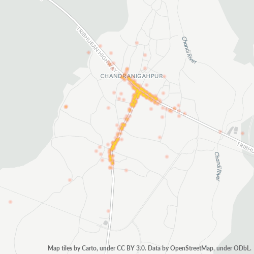
Map of Postal Code 44515 - Nepal
Interactive Map
Nepal Population Density
Population Density: 194 / km²
| Location | Population | Area | Density |
|---|---|---|---|
| Nepal | 28.7 million | 147,926.4 km² | 194 / km² |
Sources: JRC (European Commission's Joint Research Centre) work on the GHS built-up grid
Neighborhoods
Business Distribution by neighborhood in Postal Code 44515 - Nepal
Business Concentration in Postal Code 44515 - Nepal
Industries
Business Distribution by Industry in Postal Code 44515 - Nepal
| Industry Description | Number of Establishments |
|---|---|
| Banks | 28 |
| Car repair | 29 |
| Clothing stores | 53 |
| Education | 89 |
| Electronics stores | 60 |
| Hardware store | 34 |
| Hindu temple | 45 |
| Hotels and motels | 40 |
| Other accommodation | 33 |
| Other membership organizations | 29 |
| Public administration | 32 |
| Restaurants | 47 |
| Shopping | 168 |
| Shopping other | 92 |
Nepal CO2 Emissions
Carbon Dioxide (CO2) Emissions Per Capita in Tonnes Per Year
| Location | CO2 Emissions | CO2 Emissions Per Capita | CO2 Emissions Intensity |
|---|---|---|---|
| Nepal | 11,136,221 tn | 0.39 tn | 75.3 tons/km² |
Sources: [Link] Moran, D., Kanemoto K; Jiborn, M., Wood, R., Többen, J., and Seto, K.C. (2018) Carbon footprints of 13,000 cities. Environmental Research Letters DOI: 10.1088/1748-9326/aac72a
Nepal CO2 Emissions
| 2013 CO2 emissions (tonnes/year) | 11,136,221 tn |
| 2013 CO2 emissions (tonnes/year) per capita | 0.39 tn |
| 2013 CO2 emissions intensity (tonnes/km²/year) | 75.3 tons/km² |
Recent Nearby Earthquakes
Magnitude 3.0 and greater
| Date▼ | Time↕ | Magnitude↕ | Distance↕ | Depth↕ | Location↕ | Link |
|---|---|---|---|---|---|---|
| 4/23/19 | 5:44 PM | 4.7 | 77.2 km | 27,340 m | 22km WNW of Kirtipur, Nepal | usgs.gov |
| 12/22/18 | 3:21 PM | 4.1 | 75.5 km | 10,000 m | 7km NNE of Nagarkot, Nepal | usgs.gov |
| 8/21/17 | 5:03 AM | 4.5 | 92 km | 10,000 m | 29km N of Ramechhap, Nepal | usgs.gov |
| 7/1/17 | 6:58 PM | 4.8 | 76.4 km | 10,000 m | 10km SSE of Ramechhap, Nepal | usgs.gov |
| 2/26/17 | 7:37 PM | 4.7 | 79.2 km | 11,230 m | 11km N of Ramechhap, Nepal | usgs.gov |
| 2/26/17 | 8:21 PM | 4.6 | 63.5 km | 20,280 m | 16km WNW of Ramechhap, Nepal | usgs.gov |
| 9/18/16 | 10:14 AM | 4.2 | 78.6 km | 25,200 m | 12km NNW of Nagarkot, Nepal | usgs.gov |
| 6/20/16 | 10:49 PM | 3.5 | 78.9 km | 10,000 m | 33km W of Kirtipur, Nepal | usgs.gov |
| 5/28/16 | 2:39 AM | 4.6 | 99 km | 10,000 m | 34km NNW of Nagarkot, Nepal | usgs.gov |
| 5/23/16 | 12:09 PM | 4.3 | 70.1 km | 10,000 m | 18km W of Kirtipur, Nepal | usgs.gov |
Showing 1-10 of 248
…
Source: U.S. Geological Survey (USGS)