6 Postal Districts in Sprang-Capelle
View a list of Postal Districts in Sprang-Capelle| Timezone | Central European Time |
| Area | 7.6 km² |
| Population | 6,457 (More Details) |
| Male Population | 3,212 (49.7%) |
| Female Population | 3,245 (50.3%) |
| Median Age | 42.7 |
| Postal Districts | 5141, 5144, 5145 (3 more) |
| Postal Codes | 1,088 |
| Area Codes | 416 |
Interactive Map
6 Postal Districts in Sprang-Capelle
Sprang-Capelle Demographic Information
| Population | 6,457 |
| Population Density | 849 / km² |
| Male Population | 3,212 (49.7%) |
| Female Population | 3,245 (50.3%) |
| Median Age | 42.7 |
| Male Median Age | 41.8 |
| Female Median Age | 43.5 |
| Businesses in Sprang-Capelle | 2,631 |
| Population (1975) | 4,571 |
| Population (2000) | 5,699 |
| Population change from 1975 to 2015 | +41.3% |
| Population change from 2000 to 2015 | +13.3% |
Sprang-Capelle
Sprang-Capelle is a former municipality in the North Brabant province of the Netherlands. It was formed in 1923 as a merger of the municipalities of Sprang, Vrijhoeve-Capelle and 's Grevelduin-Capelle. Therefore Sprang-Capelle consists of three villa..
Sprang-Capelle Wikipedia Page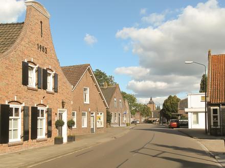
Nearby Cities
| City▲ | Administrative Region↕ | Country Or Region | City Population↕ | Postal Codes |
|---|---|---|---|---|
| 's-Hertogenbosch | North Brabant | Netherlands | 134,520 | 2502, 5211, 5212, 5213, 5215, 5216, 5221, 5222, 5223, 5224, 5231, 5232, 5233, 5234, 5235, 5236, 5237, 5242, 5245, 5246, 5248, 5271, 5321 |
| Breda | North Brabant | Netherlands | 167,673 | 4811, 4812, 4813, 4814, 4815, 4816, 4817, 4818, 4819, 4822, 4823, 4824, 4825, 4826, 4827, 4834, 4835, 4836, 4837, 4838, 4839, 4847, 4854 |
| Loon op Zand | North Brabant | Netherlands | 23,000 | 5049, 5175, 5176 |
| Tilburg | North Brabant | Netherlands | 199,613 | 5011, 5012, 5013, 5014, 5015, 5017, 5018, 5021, 5022, 5025, 5026, 5032, 5035, 5036, 5037, 5038, 5041, 5042, 5043, 5044, 5045, 5046, 5047, 5048, 5049, 5051, 5053, 5081 |
| Waalwijk | North Brabant | Netherlands | 45,610 | 5141, 5142, 5143, 5144, 5145, 5146 |