5 Postal Codes in Fuencarral
View a list of Postal Codes in Fuencarral| Timezone | Central European Time |
| Area | 24.5 km² |
| Population | 6,520 (More Details) |
| Median Age | 38.9 |
| Postal Codes | 28085, 28100, 28700 (2 more) |
Interactive Map
5 Postal Codes in Fuencarral
| Postal Code▲ | City↕ | Population↕ | Area |
|---|---|---|---|
| 28085 | Madrid | 825 | 13,566 m² |
| 28100 | — | 33,975 | 12.5 km² |
| 28700 | San Sebastián de los Reyes | — | — |
| 28701 | San Sebastián de los Reyes | 11,639 | 2.537 km² |
| 28702 | San Sebastián de los Reyes | 16,124 | 9.4 km² |
Fuencarral Demographic Information
| Population | 6,520 |
| Population Density | 266 / km² |
| Median Age | 38.9 |
| Businesses in Fuencarral | 1,289 |
| Population (1975) | 2,188 |
| Population (2000) | 2,848 |
| Population change from 1975 to 2015 | +198.0% |
| Population change from 2000 to 2015 | +128.9% |
Fuencarral
Fuencarral is a neighborhood located in the northern part of Madrid, Spain. It includes the municipal area of the ancient town of Fuencarral, which was annexed to the city of Madrid by a decree of November 10, 1950. Administratively, Fuencarral belon..
Fuencarral Wikipedia Page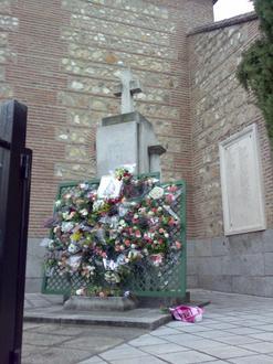
Nearby Cities
| City▲ | Administrative Region↕ | Country Or Region | City Population↕ | Postal Codes |
|---|---|---|---|---|
| Hortaleza | Community of Madrid | Spain | 161,661 | 28043 |
| Madrid | Community of Madrid | Spain | 3,255,944 | 28000, 28001, 28002, 28003, 28004, 28005, 28006, 28007, 28008, 28009, 28010, 28011, 28012, 28013, 28014, 28015, 28016, 28017, 28018, 28019, 28020, 28021, 28022, 28023, 28024, 28025, 28026, 28027, 28028, 28029, 28030, 28031, 28032, 28033, 28034, 28035, 28036, 28037, 28038, 28039, 28040, 28041, 28042, 28043, 28044, 28045, 28046, 28047, 28048, 28049, 28050, 28051, 28052, 28053, 28054, 28055, 28070, 28071, 28082, 28083, 28085, 28086, 28087, 28119, 28149, 28339, 28391, 28419, 28499, 28513, 28520, 28660, 28668, 28669, 28679, 28790, 28798, 28819, 28851, 28925 |
| Moncloa-Aravaca | Community of Madrid | Spain | 116,531 | 28011 |
| San Sebastián de los Reyes | Community of Madrid | Spain | 75,912 | 28700, 28701, 28702, 28703 |
| Tetuán (Madrid) | Community of Madrid | Spain | 155,000 | 28035 |