1 Postal Districts in Romiley
View a list of Postal Districts in Romiley| Timezone | United Kingdom Time |
| Area | 45.1 km² |
| Population | 49,870 (More Details) |
| Median Age | 45.3 |
| Postal District | SK6 |
| Postal Codes | 1,830 |
1 Postal Districts in Romiley
| Postal District▲ | City↕ | Population↕ | Area |
|---|---|---|---|
| SK6 | — | 51,076 | 45.1 km² |
Romiley Demographic Information
| Population | 49,870 |
| Population Density | 1,106 / km² |
| Median Age | 45.3 |
| Businesses in Romiley | 51 |
| Population (1975) | 58,364 |
| Population (2000) | 51,056 |
| Population change from 1975 to 2015 | -14.6% |
| Population change from 2000 to 2015 | -2.3% |
Romiley
is an area of the Metropolitan Borough of Stockport, Greater Manchester, England. It borders Marple, Bredbury and Woodley. In Roman times there is thought to have been a settlement along Sandy Lane. In the 2001 census Romiley ward, which included C..
Romiley Wikipedia Page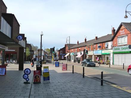
Nearby Cities
| City▲ | Administrative Region↕ | Country Or Region | City Population↕ | Postal Codes |
|---|---|---|---|---|
| Bredbury | England | United Kingdom | 15,126 | SK6 |
| Hyde | England | United Kingdom | 31,926 | M16, M34, M4, M43, SK13, SK14, SK16, SK5, SK6 |
| Manchester | England | United Kingdom | 395,515 | BL1, BL2, BL3, BL4, BL5, BL6, BL7, BL8, BL9, M1, M10, M11, M12, M13, M14, M15, M16, M17, M18, M19, M2, M20, M21, M22, M23, M24, M25, M26, M27, M28, M29, M3, M30, M31, M32, M33, M34, M35, M38, M4, M40, M41, M43, M44, M45, M46, M5, M50, M52, M6, M60, M61, M7, M8, M9, M90, M99, OL1, OL10, OL11, OL12, OL16, OL2, OL3, OL4, OL5, OL6, OL7, OL8, OL9, OL95, SK1, SK10, SK12, SK13, SK14, SK15, SK16, SK2, SK3, SK4, SK5, SK6, SK7, SK8, WA14, WA15, WA3, WN1, WN2, WN3, WN4, WN5, WN6, WN7 |
| Oldham | England | United Kingdom | 104,782 | M10, M24, M35, M40, OL1, OL11, OL2, OL3, OL4, OL6, OL8, OL9, OL95 |
| Stockport | England | United Kingdom | 139,052 | M19, M20, M22, M23, M90, SK1, SK10, SK12, SK14, SK2, SK22, SK3, SK4, SK5, SK6, SK7, SK8 |