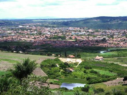
Postal Code 55640-000 - Gravatá, Pernambuco
Pernambuco | Brazil
| Primary City | Gravatá |
| Population | 61,249 |
| Timezone | Brasilia Standard Time |
| Coordinates | -8.20303034682076° / -35.56705771648874° |
| Related Postal Codes | 55614-000, 55640-000, 55641-000, 55642-000, 55643-000, 55644-000, 55645-000, 55646-000, 55647-000, 55648-000 |
Map of Postal Code 55640-000 - Gravatá, Pernambuco
Interactive Map
Gravatá Population Density
Population Density: 373 / km²
| Location | Population | Area | Density |
|---|---|---|---|
| Gravatá | 73,367 | 196.5 km² | 373 / km² |
| Pernambuco | 9.9 million | 98,148.3 km² | 100 / km² |
| Brazil | 206.1 million | 8,479,487.1 km² | 24.3 / km² |
Sources: JRC (European Commission's Joint Research Centre) work on the GHS built-up grid
Gravatá CO2 Emissions
Carbon Dioxide (CO2) Emissions Per Capita in Tonnes Per Year
| Location | CO2 Emissions | CO2 Emissions Per Capita | CO2 Emissions Intensity |
|---|---|---|---|
| Gravatá | 187,390 tn | 2.55 tn | 953.4 tons/km² |
| Pernambuco | 22,827,703 tn | 2.32 tn | 232.6 tons/km² |
| Brazil | 561,829,904 tn | 2.73 tn | 66.3 tons/km² |
Sources: [Link] Moran, D., Kanemoto K; Jiborn, M., Wood, R., Többen, J., and Seto, K.C. (2018) Carbon footprints of 13,000 cities. Environmental Research Letters DOI: 10.1088/1748-9326/aac72a
Gravatá CO2 Emissions
| 2013 CO2 emissions (tonnes/year) | 187,390 tn |
| 2013 CO2 emissions (tonnes/year) per capita | 2.55 tn |
| 2013 CO2 emissions intensity (tonnes/km²/year) | 953.4 tons/km² |
Primary City
Gravatá is a city in the state of Pernambuco, Brazil, located about 75 km (47 mi) from the state's capital Recife (the distance by road is 85 km or 53 mi). The population of Gravatá in 2009 was 75.229 inhabitants, according with IBGE.
Gravatá Wikipedia Page