Postal Code 06237 - Spergau, Saxony-Anhalt
| Primary City | Spergau |
| Area of Postal Code 06237 | 22.4 km² |
| Population | 9,678 |
| Male Population | 4,773 (49.3%) |
| Female Population | 4,905 (50.7%) |
| Population change from 1975 to 2020 | -38.8% |
| Population change from 2000 to 2020 | -18.0% |
| Median Age | 48.3 years |
| Male Median Age | 46.6 years |
| Female Median Age | 49.9 years |
| Area Codes | 34446, 3461, 3462 |
| Associated Cities | Leuna |
| Neighborhoods | Günthersdorf, Kötschlitz, Kötzschau, Kreypau, Spergau, Zöschen, Zweimen |
| Timezone | Central European Summer Time |
| Coordinates | 51.3078820485509° / 12.01430528191631° |
| Related Postal Codes | 06217, 06231, 06246, 06249, 06254, 06255, 06258, 06259, 06268, 06295 |
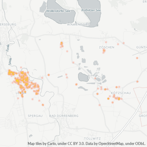
Map of Postal Code 06237 - Spergau, Saxony-Anhalt
Interactive Map
Postal Code 06237 - Spergau, Saxony-Anhalt Population
Years 1975 to 2030
| Data | 1975 | 1990 | 2000 | 2015 | 2020 | 2025* | 2030* |
|---|---|---|---|---|---|---|---|
| Population | 15,806 | 13,088 | 11,799 | 9,327 | 9,678 | 9,101 | 8,537 |
| Population Density | 705.6 / km² | 584.2 / km² | 526.7 / km² | 416.3 / km² | 432 / km² | 406.3 / km² | 381.1 / km² |
Postal Code 06237 - Spergau, Saxony-Anhalt Population change from 2000 to 2020
Decrease of 18% from year 2000 to 2020
| Location | Change since 1975 | Change since 1990 | Change since 2000 |
|---|---|---|---|
| Postal Code 06237 - Spergau, Saxony-Anhalt | -38.8% | -26.1% | -18% |
| Spergau | -8.1% | -4.1% | -13.8% |
| Saxony-Anhalt | -31.1% | -20.4% | -15.4% |
| Germany | — | — | — |
Postal Code 06237 - Spergau, Saxony-Anhalt Median Age
Median Age: 48.3 years
| Location | Median Age | Median Age (Female) | Median Age (Male) |
|---|---|---|---|
| Postal Code 06237 - Spergau, Saxony-Anhalt | 48.3 yrs | 49.9 yrs | 46.6 yrs |
| Spergau | 48.5 yrs | 50.2 yrs | 46.7 yrs |
| Saxony-Anhalt | 48.5 yrs | 50.4 yrs | 46.6 yrs |
| Germany | 44.8 yrs | 46 yrs | 43.6 yrs |
Postal Code 06237 Population Density
Population Density: 432 / km²
| Location | Population | Area | Density |
|---|---|---|---|
| Postal Code 06237 | 9,678 | 22.4 km² | 432 / km² |
| Spergau | 4,897 | 6.4 km² | 761 / km² |
| Saxony-Anhalt | 2.2 million | 20,550.4 km² | 106 / km² |
| Germany | 80.7 million | 358,179.8 km² | 225 / km² |
Postal Code 06237 - Spergau, Saxony-Anhalt Historical and Projected Population
Estimated Population from 0 to 2100
- JRC (European Commission's Joint Research Centre) work on the GHS built-up grid
- CIESIN (Center for International Earth Science Information Network)
- [Link] Klein Goldewijk, K., Beusen, A., Doelman, J., and Stehfest, E.: Anthropogenic land use estimates for the Holocene – HYDE 3.2, Earth Syst. Sci. Data, 9, 927–953, https://doi.org/10.5194/essd-9-927-2017, 2017.
Neighborhoods
Business Distribution by neighborhood in Postal Code 06237 - Spergau, Saxony-Anhalt
Area Codes
Percentage Area Codes used by businesses in Postal Code 06237 - Spergau, Saxony-Anhalt
Industries
Business Distribution by Industry in Postal Code 06237 - Spergau, Saxony-Anhalt
| Industry Description | Number of Establishments |
|---|---|
| Clothing stores | 72 |
| Construction of buildings | 33 |
| Corporate management | 94 |
| Electrical installation | 24 |
| Hairdressers | 23 |
| Health and medical | 28 |
| Other membership organizations | 24 |
| Real estate | 24 |
| Restaurants | 55 |
| Shopping | 90 |
| Travel agencies | 23 |
Business distribution by price for Postal Code 06237 - Spergau, Saxony-Anhalt
Human Development Index (HDI)
Statistic composite index of life expectancy, education, and per capita income.
Postal Code 06237 - Spergau, Saxony-Anhalt Gross Domestic Product (GDP)
GDP per capita, PPP (constant 2017 international $)
| Data | 1990 | 1995 | 2000 | 2005 | 2010 | 2015 | 2020 | 2022 |
|---|---|---|---|---|---|---|---|---|
| GDP per capita | $28,271 | $30,292 | $33,039 | $36,393 | $41,932 | $43,561 | $44,433 | $46,253 |
| Total GDP | $1.3B | $1.3B | $1.4B | $1.4B | $1.6B | $1.6B | $1.6B | $1.6B |
Postal Code 06237 CO2 Emissions
Carbon Dioxide (CO2) Emissions Per Capita in Tonnes Per Year
| Location | CO2 Emissions | CO2 Emissions Per Capita | CO2 Emissions Intensity |
|---|---|---|---|
| Postal Code 06237 | 92,297 tn | 9.54 tn | 4,120.1 tons/km² |
| Spergau | 46,549 tn | 9.51 tn | 7,231.2 tons/km² |
| Saxony-Anhalt | 20,344,225 tn | 9.33 tn | 990 tons/km² |
| Germany | 755,339,039 tn | 9.36 tn | 2,108.8 tons/km² |
| 2013 CO2 emissions (tonnes/year) | 92,297 tn |
| 2013 CO2 emissions (tonnes/year) per capita | 9.54 tn |
| 2013 CO2 emissions intensity (tonnes/km²/year) | 4,120.1 tons/km² |
Natural Hazards Risk
Relative risk out of 10
| Hazard | Risk Level |
|---|---|
| Flood | Medium (7) |
| Earthquake | Low (2) |
Recent Nearby Earthquakes
Magnitude 3.0 and greater
| Date▼ | Time↕ | Magnitude↕ | Distance↕ | Depth↕ | Location↕ | Link |
|---|---|---|---|---|---|---|
| 4/15/15 | 11:38 PM | 3.3 | 16.7 km | 20,600 m | 1km NE of Grobers, Germany | usgs.gov |
| 10/18/07 | 9:42 PM | 3.6 | 83.4 km | 10,000 m | Germany-Czech Republic border region | usgs.gov |
| 9/10/96 | 8:36 PM | 4.9 | 23.4 km | 10,000 m | Germany | usgs.gov |
| 2/25/96 | 6:23 AM | 3.1 | 58.9 km | 10,000 m | Germany | usgs.gov |
| 6/20/87 | 3:21 PM | 3.1 | 93.9 km | 8,900 m | Germany-Czech Republic border region | usgs.gov |
Primary City
Spergau is a village and a former municipality in the district Saalekreis, in Saxony-Anhalt, Germany. Since 31 December 2009, it is part of the town Leuna.
Spergau Wikipedia PageAbout Our Data
The data on this page is estimated using a number of publicly available tools and resources. It is provided without warranty, and could contain inaccuracies. Use at your own risk.