Postal Code 26529 - Wirdum, Lower Saxony
| Primary City | Wirdum |
| Area of Postal Code 26529 | 76.8 km² |
| Population | 13,151 |
| Male Population | 6,490 (49.3%) |
| Female Population | 6,661 (50.7%) |
| Population change from 1975 to 2015 | +11.6% |
| Population change from 2000 to 2015 | +1.0% |
| Median Age | 45 years |
| Male Median Age | 43.8 years |
| Female Median Age | 46.1 years |
| Area Codes | 4920, 4934 |
| Neighborhoods | Tjüche, Tjücher Äcker, Tjücher Grashaus, Upgant-Schott, Upganter Äcker, Wirdumer Altendeich |
| Timezone | Central European Summer Time |
| Coordinates | 53.5177705088764° / 7.25701338232681° |
| Related Postal Codes | 26441, 26446, 26506, 26524, 26532, 26548, 26553, 26556, 26571, 26579 |
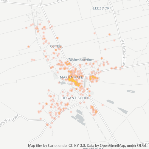
Map of Postal Code 26529 - Wirdum, Lower Saxony
Interactive Map
Postal Code 26529 - Wirdum, Lower Saxony Population
Years 1975 to 2020
| Data | 1975 | 1990 | 2000 | 2015 | 2020 |
|---|---|---|---|---|---|
| Population | 11,786 | 12,294 | 13,023 | 13,151 | 13,054 |
| Population Density | 153.4 / km² | 160 / km² | 169.5 / km² | 171.1 / km² | 169.9 / km² |
Postal Code 26529 - Wirdum, Lower Saxony Population change from 2000 to 2015
Increase of 1% from year 2000 to 2015
| Location | Change since 1975 | Change since 1990 | Change since 2000 |
|---|---|---|---|
| Postal Code 26529 - Wirdum, Lower Saxony | +11.6% | +7% | +1% |
| Wirdum | -13.6% | -16% | -17.3% |
| Lower Saxony | +4.3% | +2.8% | -1.3% |
| Germany | +2.6% | +2.2% | -1.5% |
Postal Code 26529 - Wirdum, Lower Saxony Median Age
Median Age: 45 years
| Location | Median Age | Median Age (Female) | Median Age (Male) |
|---|---|---|---|
| Postal Code 26529 - Wirdum, Lower Saxony | 45 yrs | 46.1 yrs | 43.8 yrs |
| Lower Saxony | 44.8 yrs | 45.8 yrs | 43.7 yrs |
| Germany | 44.8 yrs | 46 yrs | 43.6 yrs |
Postal Code 26529 Population Density
Population Density: 171 / km²
| Location | Population | Area | Density |
|---|---|---|---|
| Postal Code 26529 | 13,151 | 76.8 km² | 171 / km² |
| Wirdum | 349 | 0.46 km² | 759 / km² |
| Lower Saxony | 8 million | 47,789.6 km² | 167 / km² |
| Germany | 80.7 million | 358,179.8 km² | 225 / km² |
Postal Code 26529 - Wirdum, Lower Saxony Historical and Projected Population
Estimated Population from 0 to 2100
- JRC (European Commission's Joint Research Centre) work on the GHS built-up grid
- CIESIN (Center for International Earth Science Information Network)
- [Link] Klein Goldewijk, K., Beusen, A., Doelman, J., and Stehfest, E.: Anthropogenic land use estimates for the Holocene – HYDE 3.2, Earth Syst. Sci. Data, 9, 927–953, https://doi.org/10.5194/essd-9-927-2017, 2017.
Neighborhoods
Business Distribution by neighborhood in Postal Code 26529 - Wirdum, Lower Saxony
Area Codes
Percentage Area Codes used by businesses in Postal Code 26529 - Wirdum, Lower Saxony
Industries
Business Distribution by Industry in Postal Code 26529 - Wirdum, Lower Saxony
| Industry Description | Number of Establishments |
|---|---|
| All food and beverage | 25 |
| Bakeries | 19 |
| Buses and trains | 26 |
| Construction of buildings | 39 |
| Corporate management | 26 |
| Education | 18 |
| Financial services | 27 |
| Florists | 16 |
| General practitioners | 20 |
| Health and medical | 16 |
| Other accommodation | 65 |
| Other membership organizations | 16 |
| Restaurants | 29 |
| Shopping | 42 |
| Tractors and farm equipment | 21 |
Human Development Index (HDI)
Statistic composite index of life expectancy, education, and per capita income.
Postal Code 26529 CO2 Emissions
Carbon Dioxide (CO2) Emissions Per Capita in Tonnes Per Year
| Location | CO2 Emissions | CO2 Emissions Per Capita | CO2 Emissions Intensity |
|---|---|---|---|
| Postal Code 26529 | 126,412 tn | 9.61 tn | 1,645.1 tons/km² |
| Wirdum | 3,358 tn | 9.62 tn | 7,299.2 tons/km² |
| Lower Saxony | 79,913,745 tn | 10.03 tn | 1,672.2 tons/km² |
| Germany | 755,339,039 tn | 9.36 tn | 2,108.8 tons/km² |
| 2013 CO2 emissions (tonnes/year) | 126,412 tn |
| 2013 CO2 emissions (tonnes/year) per capita | 9.61 tn |
| 2013 CO2 emissions intensity (tonnes/km²/year) | 1,645.1 tons/km² |
Recent Nearby Earthquakes
Magnitude 3.0 and greater
| Date▼ | Time↕ | Magnitude↕ | Distance↕ | Depth↕ | Location↕ | Link |
|---|---|---|---|---|---|---|
| 5/21/19 | 8:48 PM | 3.2 | 46.7 km | 10,000 m | 8km NNE of Winsum, Netherlands | usgs.gov |
| 2/7/13 | 3:19 PM | 3.4 | 43.8 km | 10,000 m | 11km NNE of Winsum, Netherlands | usgs.gov |
| 8/16/12 | 1:30 PM | 3.4 | 38.9 km | 3,000 m | The Netherlands | usgs.gov |
| 10/29/08 | 10:54 PM | 3.3 | 46.2 km | 3,000 m | The Netherlands | usgs.gov |
| 8/7/06 | 10:03 PM | 3.8 | 50.9 km | 10,000 m | The Netherlands | usgs.gov |
| 11/9/03 | 4:22 PM | 3.1 | 64.4 km | 10,000 m | The Netherlands | usgs.gov |
Cities
Percentage of businesses by city in Postal Code 26529 - Wirdum, Lower Saxony
About Our Data
The data on this page is estimated using a number of publicly available tools and resources. It is provided without warranty, and could contain inaccuracies. Use at your own risk.