Postal Code 45657 - Recklinghausen, North Rhine-Westphalia
| Primary City | Recklinghausen |
| Area of Postal Code 45657 | 6.1 km² |
| Population | 17,867 |
| Male Population | 8,625 (48.3%) |
| Female Population | 9,242 (51.7%) |
| Population change from 1975 to 2020 | +5.5% |
| Population change from 2000 to 2020 | +3.3% |
| Median Age | 46 years |
| Male Median Age | 44.6 years |
| Female Median Age | 47.3 years |
| Area Codes | 2361 |
| Neighborhoods | Elberfeld, Mitte |
| Timezone | Central European Summer Time |
| Coordinates | 51.619589617333546° / 7.191465717566537° |
| Related Postal Codes | 45473, 45475, 45476, 45478, 45479, 45659, 45661, 45663, 45665, 45699 |
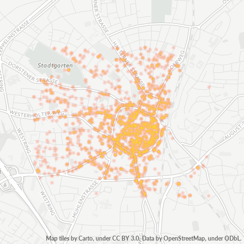
Map of Postal Code 45657 - Recklinghausen, North Rhine-Westphalia
Interactive Map
Postal Code 45657 - Recklinghausen, North Rhine-Westphalia Population
Years 1975 to 2030
| Data | 1975 | 1990 | 2000 | 2015 | 2020 | 2025* | 2030* |
|---|---|---|---|---|---|---|---|
| Population | 16,936 | 16,991 | 17,295 | 15,848 | 17,867 | 17,896 | 17,893 |
| Population Density | 2,781.7 / km² | 2,790.7 / km² | 2,840.6 / km² | 2,603 / km² | 2,934.6 / km² | 2,939.3 / km² | 2,938.9 / km² |
Postal Code 45657 - Recklinghausen, North Rhine-Westphalia Population change from 2000 to 2020
Increase of 3.3% from year 2000 to 2020
| Location | Change since 1975 | Change since 1990 | Change since 2000 |
|---|---|---|---|
| Postal Code 45657 - Recklinghausen, North Rhine-Westphalia | +5.5% | +5.2% | +3.3% |
| Recklinghausen | -7.3% | -2% | -1.8% |
| North Rhine-Westphalia | +6.8% | +6% | +2.2% |
| Germany | — | — | — |
Postal Code 45657 - Recklinghausen, North Rhine-Westphalia Median Age
Median Age: 46 years
| Location | Median Age | Median Age (Female) | Median Age (Male) |
|---|---|---|---|
| Postal Code 45657 - Recklinghausen, North Rhine-Westphalia | 46 yrs | 47.3 yrs | 44.6 yrs |
| Recklinghausen | 46 yrs | 47.3 yrs | 44.6 yrs |
| North Rhine-Westphalia | 44.5 yrs | 45.6 yrs | 43.3 yrs |
| Germany | 44.8 yrs | 46 yrs | 43.6 yrs |
Postal Code 45657 Population Density
Population Density: 2,935 / km²
| Location | Population | Area | Density |
|---|---|---|---|
| Postal Code 45657 | 17,867 | 6.1 km² | 2,935 / km² |
| Recklinghausen | 110,465 | 42.2 km² | 2,619 / km² |
| North Rhine-Westphalia | 18.3 million | 34,118.6 km² | 537 / km² |
| Germany | 80.7 million | 358,179.8 km² | 225 / km² |
Postal Code 45657 - Recklinghausen, North Rhine-Westphalia Historical and Projected Population
Estimated Population from 1600 to 2100
- JRC (European Commission's Joint Research Centre) work on the GHS built-up grid
- CIESIN (Center for International Earth Science Information Network)
- [Link] Klein Goldewijk, K., Beusen, A., Doelman, J., and Stehfest, E.: Anthropogenic land use estimates for the Holocene – HYDE 3.2, Earth Syst. Sci. Data, 9, 927–953, https://doi.org/10.5194/essd-9-927-2017, 2017.
Industries
Business Distribution by Industry in Postal Code 45657 - Recklinghausen, North Rhine-Westphalia
| Industry Description | Number of Establishments | Average Age of Business |
|---|---|---|
| Accountants | 74 | — |
| All membership organizations | 71 | — |
| Beauty salons | 76 | — |
| Clothing stores | 134 | — |
| Corporate management | 178 | 24.8 years |
| Dentists | 100 | — |
| Financial services | 104 | — |
| Hairdressers | 72 | — |
| Health and medical | 209 | — |
| Lawyers legal | 191 | — |
| Psychiatrists and psychotherapists | 73 | — |
| Real estate | 192 | — |
| Restaurants | 221 | 21.9 years |
| Shopping | 208 | — |
Business distribution by price for Postal Code 45657 - Recklinghausen, North Rhine-Westphalia
Human Development Index (HDI)
Statistic composite index of life expectancy, education, and per capita income.
Postal Code 45657 CO2 Emissions
Carbon Dioxide (CO2) Emissions Per Capita in Tonnes Per Year
| Location | CO2 Emissions | CO2 Emissions Per Capita | CO2 Emissions Intensity |
|---|---|---|---|
| Postal Code 45657 | 174,472 tn | 9.77 tn | 28,656.3 tons/km² |
| Recklinghausen | 1,077,157 tn | 9.75 tn | 25,538.5 tons/km² |
| North Rhine-Westphalia | 183,519,420 tn | 10.01 tn | 5,378.9 tons/km² |
| Germany | 755,339,039 tn | 9.36 tn | 2,108.8 tons/km² |
| 2013 CO2 emissions (tonnes/year) | 174,472 tn |
| 2013 CO2 emissions (tonnes/year) per capita | 9.77 tn |
| 2013 CO2 emissions intensity (tonnes/km²/year) | 28,656.3 tons/km² |
Natural Hazards Risk
Relative risk out of 10
| Hazard | Risk Level |
|---|---|
| Flood | Medium (7) |
Recent Nearby Earthquakes
Magnitude 3.0 and greater
| Date▼ | Time↕ | Magnitude↕ | Distance↕ | Depth↕ | Location↕ | Link |
|---|---|---|---|---|---|---|
| 9/8/11 | 12:02 PM | 4.2 | 81 km | 6,000 m | Germany | usgs.gov |
| 7/23/09 | 7:58 PM | 4.1 | 47.8 km | 5,000 m | Germany | usgs.gov |
| 12/25/08 | 5:53 AM | 3.2 | 37.4 km | 1,000 m | Germany | usgs.gov |
| 12/9/08 | 7:28 PM | 3.3 | 43.7 km | 10,000 m | Germany | usgs.gov |
| 11/21/08 | 11:41 PM | 3.3 | 23.9 km | 1,000 m | Germany | usgs.gov |
| 11/12/08 | 12:56 PM | 3.4 | 43.5 km | 1,000 m | Germany | usgs.gov |
| 9/18/08 | 7:33 AM | 3.2 | 43.1 km | 1,000 m | Germany | usgs.gov |
| 7/18/08 | 11:12 AM | 3.4 | 85.4 km | 5,000 m | Germany | usgs.gov |
| 5/13/08 | 2:55 AM | 3.3 | 47.3 km | 1,000 m | Germany | usgs.gov |
| 5/1/08 | 11:54 PM | 3.1 | 43.1 km | 1,000 m | Germany | usgs.gov |
Primary City
Recklinghausen (German pronunciation: [ʁɛklɪŋˈhaʊzən]) is the northernmost city in the Ruhr-Area and the capital of the Recklinghausen district. It borders the rural Münsterland and is characterized by large fields and farms in the north and industry..
Recklinghausen Wikipedia Page
About Our Data
The data on this page is estimated using a number of publicly available tools and resources. It is provided without warranty, and could contain inaccuracies. Use at your own risk.