Postal Code 49565 - Bramsche, Lower Saxony
| Primary City | Bramsche |
| Area of Postal Code 49565 | 178.6 km² |
| Population | 30,269 |
| Male Population | 14,944 (49.4%) |
| Female Population | 15,325 (50.6%) |
| Population change from 1975 to 2015 | +8.3% |
| Population change from 2000 to 2015 | -0.3% |
| Median Age | 43.7 years |
| Male Median Age | 42.7 years |
| Female Median Age | 44.7 years |
| Area Codes | 5407, 5461, 5464, 5465, More |
| Neighborhoods | Achmer, Engter, Epe, Hesepe, Kalkriese, Lappenstuhl, Pente, Schleptrup, Ueffeln |
| Timezone | Central European Summer Time |
| Coordinates | 52.41861402800787° / 7.996557271956198° |
| Related Postal Codes | 49504, 49509, 49525, 49536, 49545, 49549, 49586, 49593, 49594, 49596 |
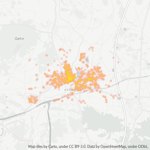
Map of Postal Code 49565 - Bramsche, Lower Saxony
Interactive Map
Postal Code 49565 - Bramsche, Lower Saxony Population
Years 1975 to 2020
| Data | 1975 | 1990 | 2000 | 2015 | 2020 |
|---|---|---|---|---|---|
| Population | 27,953 | 28,940 | 30,368 | 30,269 | 29,685 |
| Population Density | 156.5 / km² | 162.1 / km² | 170.1 / km² | 169.5 / km² | 166.2 / km² |
Postal Code 49565 - Bramsche, Lower Saxony Population change from 2000 to 2015
Decrease of 0.3% from year 2000 to 2015
| Location | Change since 1975 | Change since 1990 | Change since 2000 |
|---|---|---|---|
| Postal Code 49565 - Bramsche, Lower Saxony | +8.3% | +4.6% | -0.3% |
| Bramsche | -26.7% | -18.2% | -12.9% |
| Lower Saxony | +4.3% | +2.8% | -1.3% |
| Germany | +2.6% | +2.2% | -1.5% |
Postal Code 49565 - Bramsche, Lower Saxony Median Age
Median Age: 43.7 years
| Location | Median Age | Median Age (Female) | Median Age (Male) |
|---|---|---|---|
| Postal Code 49565 - Bramsche, Lower Saxony | 43.7 yrs | 44.7 yrs | 42.7 yrs |
| Bramsche | 43.8 yrs | 44.8 yrs | 42.7 yrs |
| Lower Saxony | 44.8 yrs | 45.8 yrs | 43.7 yrs |
| Germany | 44.8 yrs | 46 yrs | 43.6 yrs |
Postal Code 49565 Population Density
Population Density: 170 / km²
| Location | Population | Area | Density |
|---|---|---|---|
| Postal Code 49565 | 30,269 | 178.6 km² | 170 / km² |
| Bramsche | 11,505 | 5.4 km² | 2,147 / km² |
| Lower Saxony | 8 million | 47,789.6 km² | 167 / km² |
| Germany | 80.7 million | 358,179.8 km² | 225 / km² |
Postal Code 49565 - Bramsche, Lower Saxony Historical and Projected Population
Estimated Population from 1200 to 2100
- JRC (European Commission's Joint Research Centre) work on the GHS built-up grid
- CIESIN (Center for International Earth Science Information Network)
- [Link] Klein Goldewijk, K., Beusen, A., Doelman, J., and Stehfest, E.: Anthropogenic land use estimates for the Holocene – HYDE 3.2, Earth Syst. Sci. Data, 9, 927–953, https://doi.org/10.5194/essd-9-927-2017, 2017.
Neighborhoods
Business Distribution by neighborhood in Postal Code 49565 - Bramsche, Lower Saxony
Area Codes
Percentage Area Codes used by businesses in Postal Code 49565 - Bramsche, Lower Saxony
Industries
Business Distribution by Industry in Postal Code 49565 - Bramsche, Lower Saxony
| Industry Description | Number of Establishments |
|---|---|
| All food and beverage | 68 |
| Buses and trains | 70 |
| Car repair | 58 |
| Construction of buildings | 79 |
| Corporate management | 93 |
| Financial services | 50 |
| Hairdressers | 49 |
| Health and medical | 112 |
| Playground | 51 |
| Real estate | 74 |
| Restaurants | 102 |
| Shopping | 123 |
| Tractors and farm equipment | 68 |
Human Development Index (HDI)
Statistic composite index of life expectancy, education, and per capita income.
Postal Code 49565 CO2 Emissions
Carbon Dioxide (CO2) Emissions Per Capita in Tonnes Per Year
| Location | CO2 Emissions | CO2 Emissions Per Capita | CO2 Emissions Intensity |
|---|---|---|---|
| Postal Code 49565 | 303,313 tn | 10.02 tn | 1,698.6 tons/km² |
| Bramsche | 114,818 tn | 9.98 tn | 21,421.3 tons/km² |
| Lower Saxony | 79,913,745 tn | 10.03 tn | 1,672.2 tons/km² |
| Germany | 755,339,039 tn | 9.36 tn | 2,108.8 tons/km² |
| 2013 CO2 emissions (tonnes/year) | 303,313 tn |
| 2013 CO2 emissions (tonnes/year) per capita | 10.02 tn |
| 2013 CO2 emissions intensity (tonnes/km²/year) | 1,698.6 tons/km² |
Natural Hazards Risk
Relative risk out of 10
| Hazard | Risk Level |
|---|---|
| Flood | Medium (4) |
Recent Nearby Earthquakes
Magnitude 3.0 and greater
| Date▼ | Time↕ | Magnitude↕ | Distance↕ | Depth↕ | Location↕ | Link |
|---|---|---|---|---|---|---|
| 7/18/08 | 11:12 AM | 3.4 | 25 km | 5,000 m | Germany | usgs.gov |
| 3/20/07 | 12:54 PM | 3.7 | 27.3 km | 10,000 m | Germany | usgs.gov |
| 7/15/05 | 8:02 AM | 4 | 70.6 km | 10,000 m | Germany | usgs.gov |
| 1/6/03 | 1:49 PM | 4.3 | 28.7 km | 10,000 m | Germany | usgs.gov |
| 5/23/01 | 6:34 AM | 3.2 | 88.9 km | 10,000 m | Germany | usgs.gov |
| 2/13/01 | 9:05 AM | 3.1 | 99.7 km | 10,000 m | Germany | usgs.gov |
| 11/18/00 | 12:27 PM | 3.2 | 93.3 km | 1,000 m | Germany | usgs.gov |
| 9/23/99 | 8:53 AM | 3.1 | 99 km | 10,000 m | Germany | usgs.gov |
| 8/17/98 | 10:09 PM | 3.2 | 85.5 km | 10,000 m | Germany | usgs.gov |
| 7/22/98 | 12:51 PM | 3.1 | 90.4 km | 10,000 m | Germany | usgs.gov |
Primary City
Bramsche is a town in the district of Osnabrück, Lower Saxony, Germany. It is about 20 kilometres (12 miles) north of Osnabrück, at 52°24′N 7°59′E. Population is 30858 (2002). 1971/72 12 previously independent municipalities were included into the t..
Bramsche Wikipedia PageAbout Our Data
The data on this page is estimated using a number of publicly available tools and resources. It is provided without warranty, and could contain inaccuracies. Use at your own risk.