Postal Code 58849 - Herscheid, North Rhine-Westphalia
| Primary City | Herscheid |
| Area of Postal Code 58849 | 61.1 km² |
| Population | 7,390 |
| Male Population | 3,629 (49.1%) |
| Female Population | 3,761 (50.9%) |
| Population change from 1975 to 2015 | -15.2% |
| Population change from 2000 to 2015 | -9.2% |
| Median Age | 45 years |
| Male Median Age | 43.8 years |
| Female Median Age | 46.2 years |
| Area Codes | 2351, 2357, 2392 |
| Neighborhoods | Berghagen, Danklin, Elsen, Friedlin, Hüinghausen, Niederholte, Stottmert, Weiße Ahe |
| Timezone | Central European Summer Time |
| Coordinates | 51.183808654689706° / 7.7520583230609725° |
| Related Postal Codes | 58708, 58710, 58730, 58739, 58762, 58769, 58791, 58802, 58809, 58840 |
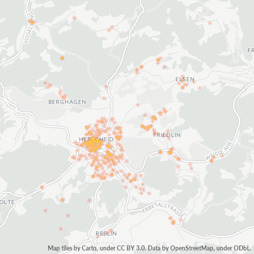
Map of Postal Code 58849 - Herscheid, North Rhine-Westphalia
Interactive Map
Postal Code 58849 - Herscheid, North Rhine-Westphalia Population
Years 1975 to 2020
| Data | 1975 | 1990 | 2000 | 2015 | 2020 |
|---|---|---|---|---|---|
| Population | 8,710 | 8,205 | 8,135 | 7,390 | 7,255 |
| Population Density | 142.5 / km² | 134.3 / km² | 133.1 / km² | 120.9 / km² | 118.7 / km² |
Postal Code 58849 - Herscheid, North Rhine-Westphalia Population change from 2000 to 2015
Decrease of 9.2% from year 2000 to 2015
| Location | Change since 1975 | Change since 1990 | Change since 2000 |
|---|---|---|---|
| Postal Code 58849 - Herscheid, North Rhine-Westphalia | -15.2% | -9.9% | -9.2% |
| Herscheid | -39.9% | -18.3% | -14.6% |
| North Rhine-Westphalia | +2.5% | +1.7% | -1.9% |
| Germany | +2.6% | +2.2% | -1.5% |
Postal Code 58849 - Herscheid, North Rhine-Westphalia Median Age
Median Age: 45 years
| Location | Median Age | Median Age (Female) | Median Age (Male) |
|---|---|---|---|
| Postal Code 58849 - Herscheid, North Rhine-Westphalia | 45 yrs | 46.2 yrs | 43.8 yrs |
| Herscheid | 45 yrs | 46.2 yrs | 43.8 yrs |
| North Rhine-Westphalia | 44.5 yrs | 45.6 yrs | 43.3 yrs |
| Germany | 44.8 yrs | 46 yrs | 43.6 yrs |
Postal Code 58849 Population Density
Population Density: 121 / km²
| Location | Population | Area | Density |
|---|---|---|---|
| Postal Code 58849 | 7,390 | 61.1 km² | 121 / km² |
| Herscheid | 3,043 | 1.69 km² | 1,801 / km² |
| North Rhine-Westphalia | 18.3 million | 34,118.6 km² | 537 / km² |
| Germany | 80.7 million | 358,179.8 km² | 225 / km² |
Postal Code 58849 - Herscheid, North Rhine-Westphalia Historical and Projected Population
Estimated Population from 0 to 2100
- JRC (European Commission's Joint Research Centre) work on the GHS built-up grid
- CIESIN (Center for International Earth Science Information Network)
- [Link] Klein Goldewijk, K., Beusen, A., Doelman, J., and Stehfest, E.: Anthropogenic land use estimates for the Holocene – HYDE 3.2, Earth Syst. Sci. Data, 9, 927–953, https://doi.org/10.5194/essd-9-927-2017, 2017.
Neighborhoods
Business Distribution by neighborhood in Postal Code 58849 - Herscheid, North Rhine-Westphalia
Industries
Business Distribution by Industry in Postal Code 58849 - Herscheid, North Rhine-Westphalia
| Industry Description | Number of Establishments |
|---|---|
| All membership organizations | 12 |
| Construction of buildings | 29 |
| Corporate management | 28 |
| Electrical installation | 17 |
| Firefighting and rescue | 13 |
| Landscaping | 16 |
| Other accommodation | 15 |
| Real estate | 12 |
| Restaurants | 24 |
| Shopping | 29 |
| Wholesale of construction supplies | 24 |
| Wholesale of machinery | 15 |
| Wholesalers | 16 |
Human Development Index (HDI)
Statistic composite index of life expectancy, education, and per capita income.
Postal Code 58849 CO2 Emissions
Carbon Dioxide (CO2) Emissions Per Capita in Tonnes Per Year
| Location | CO2 Emissions | CO2 Emissions Per Capita | CO2 Emissions Intensity |
|---|---|---|---|
| Postal Code 58849 | 76,066 tn | 10.29 tn | 1,244.7 tons/km² |
| Herscheid | 31,322 tn | 10.29 tn | 18,533.7 tons/km² |
| North Rhine-Westphalia | 183,519,420 tn | 10.01 tn | 5,378.9 tons/km² |
| Germany | 755,339,039 tn | 9.36 tn | 2,108.8 tons/km² |
| 2013 CO2 emissions (tonnes/year) | 76,066 tn |
| 2013 CO2 emissions (tonnes/year) per capita | 10.29 tn |
| 2013 CO2 emissions intensity (tonnes/km²/year) | 1,244.7 tons/km² |
Natural Hazards Risk
Relative risk out of 10
| Hazard | Risk Level |
|---|---|
| Flood | Medium (7) |
| Earthquake | Low (2) |
Recent Nearby Earthquakes
Magnitude 3.0 and greater
| Date▼ | Time↕ | Magnitude↕ | Distance↕ | Depth↕ | Location↕ | Link |
|---|---|---|---|---|---|---|
| 2/14/11 | 4:43 AM | 3.9 | 94.1 km | 12,000 m | Germany | usgs.gov |
| 4/11/10 | 4:16 AM | 3.4 | 96.8 km | 5,000 m | Germany | usgs.gov |
| 7/23/09 | 7:58 PM | 4.1 | 93.8 km | 5,000 m | Germany | usgs.gov |
| 12/25/08 | 5:53 AM | 3.2 | 84 km | 1,000 m | Germany | usgs.gov |
| 12/9/08 | 7:28 PM | 3.3 | 97.9 km | 10,000 m | Germany | usgs.gov |
| 11/21/08 | 11:41 PM | 3.3 | 75.1 km | 1,000 m | Germany | usgs.gov |
| 11/12/08 | 12:56 PM | 3.4 | 84.8 km | 1,000 m | Germany | usgs.gov |
| 9/18/08 | 7:33 AM | 3.2 | 95.2 km | 1,000 m | Germany | usgs.gov |
| 5/13/08 | 2:55 AM | 3.3 | 93.9 km | 1,000 m | Germany | usgs.gov |
| 5/1/08 | 11:54 PM | 3.1 | 90.5 km | 1,000 m | Germany | usgs.gov |
Primary City
Herscheid is a municipality in the southern Märkischer Kreis, in North Rhine-Westphalia, Germany.
Herscheid Wikipedia Page
About Our Data
The data on this page is estimated using a number of publicly available tools and resources. It is provided without warranty, and could contain inaccuracies. Use at your own risk.