Postal Code 66994 - Dahn, Rhineland-Palatinate
| Primary City | Dahn |
| Area of Postal Code 66994 | 40.8 km² |
| Population | 5,354 |
| Male Population | 2,587 (48.3%) |
| Female Population | 2,767 (51.7%) |
| Population change from 1975 to 2015 | +324.2% |
| Population change from 2000 to 2015 | +63.3% |
| Median Age | 47.5 years |
| Male Median Age | 46.6 years |
| Female Median Age | 48.4 years |
| Area Codes | 6391 |
| Neighborhoods | Büttelwoog, Gewerbepark Neudahn 1, Reichenbach |
| Timezone | Central European Summer Time |
| Coordinates | 49.145682164744564° / 7.762334754963573° |
| Related Postal Codes | 66953, 66954, 66955, 66957, 66969, 66976, 66978, 66981, 66996, 66999 |
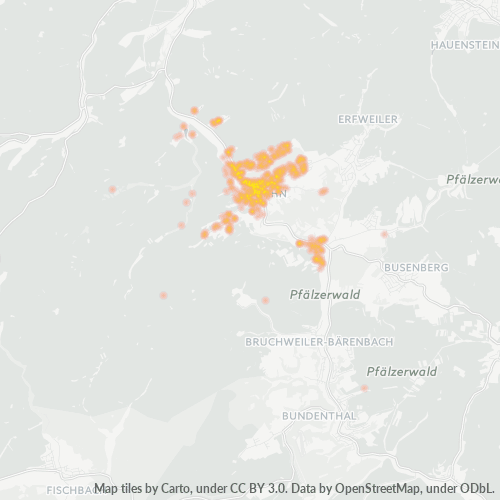
Map of Postal Code 66994 - Dahn, Rhineland-Palatinate
Interactive Map
Postal Code 66994 - Dahn, Rhineland-Palatinate Population
Years 1975 to 2020
| Data | 1975 | 1990 | 2000 | 2015 | 2020 |
|---|---|---|---|---|---|
| Population | 1,262 | 2,210 | 3,278 | 5,354 | 5,216 |
| Population Density | 30.9 / km² | 54.1 / km² | 80.3 / km² | 131.1 / km² | 127.7 / km² |
Postal Code 66994 - Dahn, Rhineland-Palatinate Population change from 2000 to 2015
Increase of 63.3% from year 2000 to 2015
| Location | Change since 1975 | Change since 1990 | Change since 2000 |
|---|---|---|---|
| Postal Code 66994 - Dahn, Rhineland-Palatinate | +324.2% | +142.3% | +63.3% |
| Dahn | +227.1% | +114.8% | +58.4% |
| Rhineland-Palatinate | +13% | +8.5% | +2.2% |
| Germany | +2.6% | +2.2% | -1.5% |
Postal Code 66994 - Dahn, Rhineland-Palatinate Median Age
Median Age: 47.5 years
| Location | Median Age | Median Age (Female) | Median Age (Male) |
|---|---|---|---|
| Postal Code 66994 - Dahn, Rhineland-Palatinate | 47.5 yrs | 48.4 yrs | 46.6 yrs |
| Dahn | 47.5 yrs | 48.4 yrs | 46.6 yrs |
| Rhineland-Palatinate | 45.2 yrs | 46.2 yrs | 44.1 yrs |
| Germany | 44.8 yrs | 46 yrs | 43.6 yrs |
Postal Code 66994 Population Density
Population Density: 131 / km²
| Location | Population | Area | Density |
|---|---|---|---|
| Postal Code 66994 | 5,354 | 40.8 km² | 131 / km² |
| Dahn | 2,741 | 2 km² | 1,371 / km² |
| Rhineland-Palatinate | 4.2 million | 19,855.3 km² | 210 / km² |
| Germany | 80.7 million | 358,179.8 km² | 225 / km² |
Postal Code 66994 - Dahn, Rhineland-Palatinate Historical and Projected Population
Estimated Population from 1200 to 2100
- JRC (European Commission's Joint Research Centre) work on the GHS built-up grid
- CIESIN (Center for International Earth Science Information Network)
- [Link] Klein Goldewijk, K., Beusen, A., Doelman, J., and Stehfest, E.: Anthropogenic land use estimates for the Holocene – HYDE 3.2, Earth Syst. Sci. Data, 9, 927–953, https://doi.org/10.5194/essd-9-927-2017, 2017.
Neighborhoods
Business Distribution by neighborhood in Postal Code 66994 - Dahn, Rhineland-Palatinate
Industries
Business Distribution by Industry in Postal Code 66994 - Dahn, Rhineland-Palatinate
| Industry Description | Number of Establishments |
|---|---|
| Accountants | 12 |
| Construction of buildings | 24 |
| Corporate management | 22 |
| Financial services | 12 |
| Hairdressers | 12 |
| Health and medical | 31 |
| Other accommodation | 43 |
| Public administration | 18 |
| Real estate | 12 |
| Restaurants | 42 |
| Shoe stores | 13 |
| Shopping | 32 |
| Travel agencies | 28 |
Business distribution by price for Postal Code 66994 - Dahn, Rhineland-Palatinate
Human Development Index (HDI)
Statistic composite index of life expectancy, education, and per capita income.
Postal Code 66994 CO2 Emissions
Carbon Dioxide (CO2) Emissions Per Capita in Tonnes Per Year
| Location | CO2 Emissions | CO2 Emissions Per Capita | CO2 Emissions Intensity |
|---|---|---|---|
| Postal Code 66994 | 24,087 tn | 4.5 tn | 589.7 tons/km² |
| Dahn | 12,331 tn | 4.5 tn | 6,165.7 tons/km² |
| Rhineland-Palatinate | 19,103,628 tn | 4.59 tn | 962.1 tons/km² |
| Germany | 755,339,039 tn | 9.36 tn | 2,108.8 tons/km² |
| 2013 CO2 emissions (tonnes/year) | 24,087 tn |
| 2013 CO2 emissions (tonnes/year) per capita | 4.5 tn |
| 2013 CO2 emissions intensity (tonnes/km²/year) | 589.7 tons/km² |
Natural Hazards Risk
Relative risk out of 10
| Hazard | Risk Level |
|---|---|
| Flood | High (8) |
| Earthquake | Low (2) |
Recent Nearby Earthquakes
Magnitude 3.0 and greater
| Date▼ | Time↕ | Magnitude↕ | Distance↕ | Depth↕ | Location↕ | Link |
|---|---|---|---|---|---|---|
| 5/17/14 | 9:46 AM | 3.6 | 95.7 km | 10,000 m | 2km SE of Pfungstadt, Germany | usgs.gov |
| 12/22/10 | 5:35 PM | 3.4 | 100 km | 9,000 m | Germany | usgs.gov |
| 2/23/08 | 7:30 AM | 4.5 | 71.1 km | 2,000 m | Germany | usgs.gov |
| 2/18/08 | 5:28 AM | 3.2 | 70.9 km | 1,000 m | Germany | usgs.gov |
| 2/16/08 | 1:48 AM | 3.2 | 44.3 km | 10,000 m | Germany | usgs.gov |
| 2/13/08 | 5:56 AM | 3.3 | 76.5 km | 1,000 m | Germany | usgs.gov |
| 2/9/08 | 12:47 PM | 3.5 | 73.7 km | 1,000 m | Germany | usgs.gov |
| 2/3/08 | 4:44 PM | 3.4 | 71.6 km | 1,000 m | Germany | usgs.gov |
| 1/25/08 | 9:44 PM | 3.9 | 72.3 km | 1,000 m | Germany | usgs.gov |
| 1/25/08 | 8:19 PM | 3.8 | 75.4 km | 1,000 m | Germany | usgs.gov |
Primary City
Dahn is a municipality in the Südwestpfalz district, in Rhineland-Palatinate, Germany. It is situated in the Palatinate Forest, approximately 15 km southeast of Pirmasens, and 25 km west of Landau. It is part of the Verbandsgemeinde ("collective muni..
Dahn Wikipedia Page
About Our Data
The data on this page is estimated using a number of publicly available tools and resources. It is provided without warranty, and could contain inaccuracies. Use at your own risk.