Postal Code 72818 - Trochtelfingen, Baden-Württemberg
| Primary City | Trochtelfingen |
| Area of Postal Code 72818 | 75.9 km² |
| Population | 6,398 |
| Male Population | 3,183 (49.8%) |
| Female Population | 3,215 (50.2%) |
| Population change from 1975 to 2020 | +4.5% |
| Population change from 2000 to 2020 | -1.9% |
| Median Age | 43.9 years |
| Male Median Age | 42.7 years |
| Female Median Age | 45 years |
| Area Codes | 7124, 7388 |
| Neighborhoods | Hausen, Mägerkingen, Steinhilben, Wilsingen |
| Timezone | Central European Summer Time |
| Coordinates | 48.307535011171126° / 9.259625530804334° |
| Related Postal Codes | 72762, 72764, 72766, 72800, 72805, 72810, 72813, 72820, 72827, 72829 |
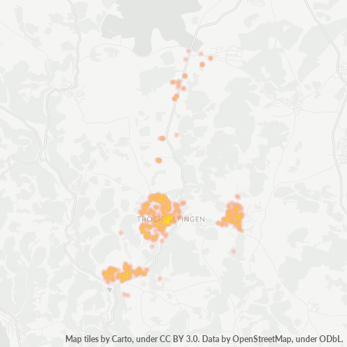
Map of Postal Code 72818 - Trochtelfingen, Baden-Württemberg
Interactive Map
Postal Code 72818 - Trochtelfingen, Baden-Württemberg Population
Years 1975 to 2030
| Data | 1975 | 1990 | 2000 | 2015 | 2020 | 2025* | 2030* |
|---|---|---|---|---|---|---|---|
| Population | 6,121 | 6,303 | 6,519 | 6,395 | 6,398 | 6,367 | 6,317 |
| Population Density | 80.6 / km² | 83 / km² | 85.9 / km² | 84.2 / km² | 84.3 / km² | 83.9 / km² | 83.2 / km² |
Postal Code 72818 - Trochtelfingen, Baden-Württemberg Population change from 2000 to 2020
Decrease of 1.9% from year 2000 to 2020
| Location | Change since 1975 | Change since 1990 | Change since 2000 |
|---|---|---|---|
| Postal Code 72818 - Trochtelfingen, Baden-Württemberg | +4.5% | +1.5% | -1.9% |
| Trochtelfingen | -25.9% | -13.1% | -11.6% |
| Baden-Württemberg | +14.1% | +10% | +4.1% |
| Germany | — | — | — |
Postal Code 72818 - Trochtelfingen, Baden-Württemberg Median Age
Median Age: 43.9 years
| Location | Median Age | Median Age (Female) | Median Age (Male) |
|---|---|---|---|
| Postal Code 72818 - Trochtelfingen, Baden-Württemberg | 43.9 yrs | 45 yrs | 42.7 yrs |
| Trochtelfingen | 43.9 yrs | 45 yrs | 42.7 yrs |
| Baden-Württemberg | 43.5 yrs | 44.6 yrs | 42.4 yrs |
| Germany | 44.8 yrs | 46 yrs | 43.6 yrs |
Postal Code 72818 Population Density
Population Density: 84.3 / km²
| Location | Population | Area | Density |
|---|---|---|---|
| Postal Code 72818 | 6,398 | 75.9 km² | 84.3 / km² |
| Trochtelfingen | 2,198 | 1.72 km² | 1,278 / km² |
| Baden-Württemberg | 11 million | 35,793.9 km² | 307 / km² |
| Germany | 80.7 million | 358,179.8 km² | 225 / km² |
Postal Code 72818 - Trochtelfingen, Baden-Württemberg Historical and Projected Population
Estimated Population from 0 to 2100
- JRC (European Commission's Joint Research Centre) work on the GHS built-up grid
- CIESIN (Center for International Earth Science Information Network)
- [Link] Klein Goldewijk, K., Beusen, A., Doelman, J., and Stehfest, E.: Anthropogenic land use estimates for the Holocene – HYDE 3.2, Earth Syst. Sci. Data, 9, 927–953, https://doi.org/10.5194/essd-9-927-2017, 2017.
Neighborhoods
Business Distribution by neighborhood in Postal Code 72818 - Trochtelfingen, Baden-Württemberg
Area Codes
Percentage Area Codes used by businesses in Postal Code 72818 - Trochtelfingen, Baden-Württemberg
Industries
Business Distribution by Industry in Postal Code 72818 - Trochtelfingen, Baden-Württemberg
Business distribution by price for Postal Code 72818 - Trochtelfingen, Baden-Württemberg
Human Development Index (HDI)
Statistic composite index of life expectancy, education, and per capita income.
Postal Code 72818 - Trochtelfingen, Baden-Württemberg Gross Domestic Product (GDP)
GDP per capita, PPP (constant 2017 international $)
| Data | 1990 | 1995 | 2000 | 2005 | 2010 | 2015 | 2020 | 2022 |
|---|---|---|---|---|---|---|---|---|
| GDP per capita | $39,331 | $42,142 | $45,965 | $44,985 | $47,890 | $53,690 | $51,921 | $54,048 |
| Total GDP | $598.5M | $664.8M | $740.8M | $724.3M | $773.9M | $877.5M | $851.6M | $887.8M |
Postal Code 72818 CO2 Emissions
Carbon Dioxide (CO2) Emissions Per Capita in Tonnes Per Year
| Location | CO2 Emissions | CO2 Emissions Per Capita | CO2 Emissions Intensity |
|---|---|---|---|
| Postal Code 72818 | 61,062 tn | 9.54 tn | 804.2 tons/km² |
| Trochtelfingen | 21,062 tn | 9.58 tn | 12,245.6 tons/km² |
| Baden-Württemberg | 103,935,162 tn | 9.47 tn | 2,903.7 tons/km² |
| Germany | 755,339,039 tn | 9.36 tn | 2,108.8 tons/km² |
| 2013 CO2 emissions (tonnes/year) | 61,062 tn |
| 2013 CO2 emissions (tonnes/year) per capita | 9.54 tn |
| 2013 CO2 emissions intensity (tonnes/km²/year) | 804.2 tons/km² |
Natural Hazards Risk
Relative risk out of 10
| Hazard | Risk Level |
|---|---|
| Flood | High (10) |
| Earthquake | Medium (4.1) |
Recent Nearby Earthquakes
Magnitude 3.0 and greater
| Date▼ | Time↕ | Magnitude↕ | Distance↕ | Depth↕ | Location↕ | Link |
|---|---|---|---|---|---|---|
| 7/19/13 | 8:30 PM | 3.6 | 98.7 km | 4,200 m | 3km ESE of Andwil, Switzerland | usgs.gov |
| 12/25/08 | 11:21 AM | 3.1 | 33.4 km | 10,000 m | Germany | usgs.gov |
| 12/15/08 | 4:34 PM | 3.1 | 95.6 km | 7,000 m | Switzerland | usgs.gov |
| 8/16/07 | 2:36 AM | 3.4 | 23.9 km | 6,000 m | Germany | usgs.gov |
| 9/13/05 | 11:54 AM | 3.1 | 21.8 km | 9,000 m | Germany | usgs.gov |
| 5/13/05 | 12:44 PM | 3.5 | 94.1 km | 11,000 m | Germany | usgs.gov |
| 12/5/04 | 11:45 AM | 3.1 | 95.3 km | 14,000 m | Germany | usgs.gov |
| 12/4/04 | 8:10 PM | 3.1 | 87 km | 10,000 m | Germany | usgs.gov |
| 12/4/04 | 6:51 PM | 3.2 | 94.9 km | 10,000 m | Germany | usgs.gov |
| 12/4/04 | 5:52 PM | 4.8 | 90.5 km | 10,000 m | Germany | usgs.gov |
Primary City
Trochtelfingen is a town in the district of Reutlingen, Baden-Württemberg, Germany. It is situated 20 km south of Reutlingen.
Trochtelfingen Wikipedia PageAbout Our Data
The data on this page is estimated using a number of publicly available tools and resources. It is provided without warranty, and could contain inaccuracies. Use at your own risk.