Postal Code 82166 - Gräfelfing, Bavaria
| Primary City | Gräfelfing |
| Area of Postal Code 82166 | 9.7 km² |
| Population | 16,542 |
| Male Population | 7,893 (47.7%) |
| Female Population | 8,649 (52.3%) |
| Population change from 1975 to 2020 | +70.9% |
| Population change from 2000 to 2020 | +21.9% |
| Median Age | 42.9 years |
| Male Median Age | 41.9 years |
| Female Median Age | 43.8 years |
| Area Codes | 89 |
| Associated Cities | Pasing |
| Neighborhoods | Lochham |
| Timezone | Central European Summer Time |
| Coordinates | 48.124306227917906° / 11.436254604258773° |
| Related Postal Codes | 82057, 82061, 82064, 82110, 82131, 82140, 82152, 82178, 82194, 82216 |
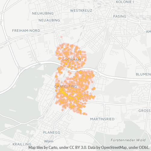
Map of Postal Code 82166 - Gräfelfing, Bavaria
Interactive Map
Postal Code 82166 - Gräfelfing, Bavaria Population
Years 1975 to 2030
| Data | 1975 | 1990 | 2000 | 2015 | 2020 | 2025* | 2030* |
|---|---|---|---|---|---|---|---|
| Population | 9,678 | 11,785 | 13,570 | 15,460 | 16,542 | 16,849 | 17,064 |
| Population Density | 1,000.2 / km² | 1,218 / km² | 1,402.5 / km² | 1,597.8 / km² | 1,709.6 / km² | 1,741.3 / km² | 1,763.6 / km² |
Postal Code 82166 - Gräfelfing, Bavaria Population change from 2000 to 2020
Increase of 21.9% from year 2000 to 2020
| Location | Change since 1975 | Change since 1990 | Change since 2000 |
|---|---|---|---|
| Postal Code 82166 - Gräfelfing, Bavaria | +70.9% | +40.4% | +21.9% |
| Gräfelfing | +63.9% | +34% | +16.2% |
| Bavaria | +23.9% | +16.7% | +8.4% |
| Germany | — | — | — |
Postal Code 82166 - Gräfelfing, Bavaria Median Age
Median Age: 42.9 years
| Location | Median Age | Median Age (Female) | Median Age (Male) |
|---|---|---|---|
| Postal Code 82166 - Gräfelfing, Bavaria | 42.9 yrs | 43.8 yrs | 41.9 yrs |
| Gräfelfing | 43.6 yrs | 44.5 yrs | 42.7 yrs |
| Bavaria | 43.9 yrs | 44.9 yrs | 42.8 yrs |
| Germany | 44.8 yrs | 46 yrs | 43.6 yrs |
Postal Code 82166 Population Density
Population Density: 1,710 / km²
| Location | Population | Area | Density |
|---|---|---|---|
| Postal Code 82166 | 16,542 | 9.7 km² | 1,710 / km² |
| Gräfelfing | 16,352 | 7.3 km² | 2,242 / km² |
| Bavaria | 13.2 million | 70,548.3 km² | 187 / km² |
| Germany | 80.7 million | 358,179.8 km² | 225 / km² |
Postal Code 82166 - Gräfelfing, Bavaria Historical and Projected Population
Estimated Population from 1750 to 2100
- JRC (European Commission's Joint Research Centre) work on the GHS built-up grid
- CIESIN (Center for International Earth Science Information Network)
- [Link] Klein Goldewijk, K., Beusen, A., Doelman, J., and Stehfest, E.: Anthropogenic land use estimates for the Holocene – HYDE 3.2, Earth Syst. Sci. Data, 9, 927–953, https://doi.org/10.5194/essd-9-927-2017, 2017.
Industries
Business Distribution by Industry in Postal Code 82166 - Gräfelfing, Bavaria
| Industry Description | Number of Establishments | Average Age of Business |
|---|---|---|
| Architects | 67 | — |
| Construction of buildings | 28 | — |
| Electronics stores | 2 | 29.6 years |
| Restaurants | 25 | — |
| Shopping | 16 | 24.9 years |
| Businesses | 7,846 |
| Estimated total revenue | ~€327.9M |
| Median revenue per business | ~€91.6K |
| Estimated jobs | 5,568 |
| Estimated payroll | ~€194.4M |
| Industries | Businesses | Total revenue | Median | Jobs |
|---|---|---|---|---|
| Wholesale and retail trade; repair of motor vehicles and motorcycles | 636 | ~€71.5M | ~€85.3K | 950 |
| Construction | 197 | ~€40.7M | ~€200.6K | 450 |
| Professional, scientific and technical activities | 751 | ~€38.5M | ~€79.4K | 675 |
| Human health and social work activities | 392 | ~€34.3M | ~€52.2K | 736 |
| Manufacturing | 109 | ~€14.6M | ~€186.2K | 185 |
| Financial and insurance activities | 125 | ~€10.3M | ~€133.8K | 159 |
| Administrative and support service activities | 95 | ~€10.1M | ~€99.1K | 190 |
| Real estate activities | 260 | ~€9.8M | ~€95.2K | 112 |
Largest businesses by estimated revenue
- BFW Werner Völk GmbH — Gräfelfing · ~€5.2M
- WolfartKlinik — Gräfelfing · ~€4.2M
- Bakery u. Konditorei Sickinger GmbH — Gräfelfing · ~€2.5M
- TOPTICA Photonics AG — Gräfelfing · ~€2.3M
- Wittmann waste management GmbH — Gräfelfing · ~€2.3M
Postal Code 82166 - Gräfelfing, Bavaria — Revenue trend
Median business revenue by year
| Year | 2019 | 2020 | 2021 | 2022 | 2023 | 2024 |
|---|---|---|---|---|---|---|
| Median revenue per business | ~€62.4K | ~€59.5K | ~€66.5K | ~€77.1K | ~€87.4K | ~€89.0K |
Business distribution by price for Postal Code 82166 - Gräfelfing, Bavaria
Human Development Index (HDI)
Statistic composite index of life expectancy, education, and per capita income.
Postal Code 82166 CO2 Emissions
Carbon Dioxide (CO2) Emissions Per Capita in Tonnes Per Year
| Location | CO2 Emissions | CO2 Emissions Per Capita | CO2 Emissions Intensity |
|---|---|---|---|
| Postal Code 82166 | 185,565 tn | 11.22 tn | 19,178.2 tons/km² |
| Gräfelfing | 184,571 tn | 11.29 tn | 25,302.3 tons/km² |
| Bavaria | 129,701,500 tn | 9.81 tn | 1,838.5 tons/km² |
| Germany | 755,339,039 tn | 9.36 tn | 2,108.8 tons/km² |
| 2013 CO2 emissions (tonnes/year) | 185,565 tn |
| 2013 CO2 emissions (tonnes/year) per capita | 11.22 tn |
| 2013 CO2 emissions intensity (tonnes/km²/year) | 19,178.2 tons/km² |
Natural Hazards Risk
Relative risk out of 10
| Hazard | Risk Level |
|---|---|
| Flood | High (8) |
| Earthquake | Low (2) |
Recent Nearby Earthquakes
Magnitude 3.0 and greater
| Date▼ | Time↕ | Magnitude↕ | Distance↕ | Depth↕ | Location↕ | Link |
|---|---|---|---|---|---|---|
| 8/9/13 | 3:44 AM | 3.7 | 98.1 km | 6,400 m | 1km ENE of Sistrans, Austria | usgs.gov |
| 10/18/10 | 5:38 PM | 4 | 84.1 km | 6,600 m | Austria | usgs.gov |
| 9/10/08 | 6:57 AM | 3.1 | 86.9 km | 10,000 m | Austria | usgs.gov |
| 5/23/06 | 5:57 AM | 3.4 | 88.8 km | 10,000 m | Austria | usgs.gov |
| 9/6/05 | 12:08 AM | 3.6 | 85.3 km | 3,300 m | Austria | usgs.gov |
| 7/22/04 | 5:12 AM | 3.8 | 55.1 km | 10,000 m | Austria | usgs.gov |
| 5/22/04 | 5:18 AM | 3.5 | 91.3 km | 5,400 m | Austria | usgs.gov |
| 5/22/04 | 4:37 AM | 3.1 | 93.1 km | 5,000 m | Austria | usgs.gov |
| 5/22/04 | 4:35 AM | 3.2 | 93.3 km | 4,900 m | Austria | usgs.gov |
| 10/28/03 | 11:15 PM | 4 | 74.3 km | 5,000 m | Austria | usgs.gov |
Primary City
Gräfelfing is a municipality in the district of Munich, in Bavaria, Germany. It is located 1 km west of Munich (centre). The name "Gräfelfing" first appears as "Grevolvinga", which as per one hypothesis could possibly name a tribe leader named "grey ..
Gräfelfing Wikipedia Page
About Our Data
The data on this page is estimated using a number of publicly available tools and resources. It is provided without warranty, and could contain inaccuracies. Use at your own risk.