Postal Code 83404 - Ainring, Bavaria
| Primary City | Ainring |
| Area of Postal Code 83404 | 31.1 km² |
| Population | 9,056 |
| Male Population | 4,408 (48.7%) |
| Female Population | 4,648 (51.3%) |
| Population change from 1975 to 2020 | +19.9% |
| Population change from 2000 to 2020 | +5.1% |
| Median Age | 45.4 years |
| Male Median Age | 43.5 years |
| Female Median Age | 47.2 years |
| Area Codes | 8654, 8656 |
| Neighborhoods | Feldkirchen, Hammerau, Mitterfelden, Perach |
| Timezone | Central European Summer Time |
| Coordinates | 47.82265335134115° / 12.92497459248846° |
| Related Postal Codes | 83410, 83413, 83416, 83417, 83435, 83451, 83454, 83457, 83458, 83471 |
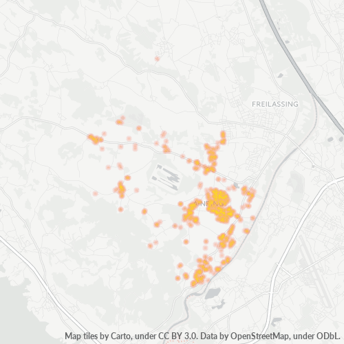
Map of Postal Code 83404 - Ainring, Bavaria
Interactive Map
Postal Code 83404 - Ainring, Bavaria Population
Years 1975 to 2030
| Data | 1975 | 1990 | 2000 | 2015 | 2020 | 2025* | 2030* |
|---|---|---|---|---|---|---|---|
| Population | 7,554 | 8,004 | 8,615 | 8,582 | 9,056 | 9,134 | 9,148 |
| Population Density | 242.6 / km² | 257 / km² | 276.7 / km² | 275.6 / km² | 290.8 / km² | 293.3 / km² | 293.8 / km² |
Postal Code 83404 - Ainring, Bavaria Population change from 2000 to 2020
Increase of 5.1% from year 2000 to 2020
| Location | Change since 1975 | Change since 1990 | Change since 2000 |
|---|---|---|---|
| Postal Code 83404 - Ainring, Bavaria | +19.9% | +13.1% | +5.1% |
| Ainring | -31.3% | -33.2% | -35% |
| Bavaria | +23.9% | +16.7% | +8.4% |
| Germany | — | — | — |
Postal Code 83404 - Ainring, Bavaria Median Age
Median Age: 45.4 years
| Location | Median Age | Median Age (Female) | Median Age (Male) |
|---|---|---|---|
| Postal Code 83404 - Ainring, Bavaria | 45.4 yrs | 47.2 yrs | 43.5 yrs |
| Ainring | 45.4 yrs | 47.2 yrs | 43.5 yrs |
| Bavaria | 43.9 yrs | 44.9 yrs | 42.8 yrs |
| Germany | 44.8 yrs | 46 yrs | 43.6 yrs |
Postal Code 83404 Population Density
Population Density: 291 / km²
| Location | Population | Area | Density |
|---|---|---|---|
| Postal Code 83404 | 9,056 | 31.1 km² | 291 / km² |
| Ainring | 2,352 | 1.72 km² | 1,367 / km² |
| Bavaria | 13.2 million | 70,548.3 km² | 187 / km² |
| Germany | 80.7 million | 358,179.8 km² | 225 / km² |
Postal Code 83404 - Ainring, Bavaria Historical and Projected Population
Estimated Population from 1100 to 2100
- JRC (European Commission's Joint Research Centre) work on the GHS built-up grid
- CIESIN (Center for International Earth Science Information Network)
- [Link] Klein Goldewijk, K., Beusen, A., Doelman, J., and Stehfest, E.: Anthropogenic land use estimates for the Holocene – HYDE 3.2, Earth Syst. Sci. Data, 9, 927–953, https://doi.org/10.5194/essd-9-927-2017, 2017.
Neighborhoods
Business Distribution by neighborhood in Postal Code 83404 - Ainring, Bavaria
Industries
Business Distribution by Industry in Postal Code 83404 - Ainring, Bavaria
| Industry Description | Number of Establishments |
|---|---|
| Car repair | 17 |
| Construction of buildings | 28 |
| Corporate management | 43 |
| Electrical installation | 19 |
| Electronics stores | 22 |
| Other accommodation | 31 |
| Other construction | 18 |
| Other membership organizations | 32 |
| Real estate | 38 |
| Restaurants | 34 |
| Shopping | 39 |
| Shopping other | 18 |
| Wholesale of construction supplies | 23 |
Human Development Index (HDI)
Statistic composite index of life expectancy, education, and per capita income.
Postal Code 83404 - Ainring, Bavaria Gross Domestic Product (GDP)
GDP per capita, PPP (constant 2017 international $)
| Data | 1990 | 1995 | 2000 | 2005 | 2010 | 2015 | 2020 | 2022 |
|---|---|---|---|---|---|---|---|---|
| GDP per capita | $30,640 | $32,830 | $35,808 | $35,472 | $38,656 | $42,909 | $44,130 | $45,938 |
| Total GDP | $132.7M | $147.8M | $166M | $166.8M | $185.6M | $210.8M | $217.8M | $227.2M |
Postal Code 83404 CO2 Emissions
Carbon Dioxide (CO2) Emissions Per Capita in Tonnes Per Year
| Location | CO2 Emissions | CO2 Emissions Per Capita | CO2 Emissions Intensity |
|---|---|---|---|
| Postal Code 83404 | 84,929 tn | 9.38 tn | 2,727.5 tons/km² |
| Ainring | 21,761 tn | 9.25 tn | 12,652 tons/km² |
| Bavaria | 129,701,500 tn | 9.81 tn | 1,838.5 tons/km² |
| Germany | 755,339,039 tn | 9.36 tn | 2,108.8 tons/km² |
| 2013 CO2 emissions (tonnes/year) | 84,929 tn |
| 2013 CO2 emissions (tonnes/year) per capita | 9.38 tn |
| 2013 CO2 emissions intensity (tonnes/km²/year) | 2,727.5 tons/km² |
Natural Hazards Risk
Relative risk out of 10
| Hazard | Risk Level |
|---|---|
| Flood | Medium (4) |
| Earthquake | Medium (3.3) |
Recent Nearby Earthquakes
Magnitude 3.0 and greater
| Date▼ | Time↕ | Magnitude↕ | Distance↕ | Depth↕ | Location↕ | Link |
|---|---|---|---|---|---|---|
| 8/12/08 | 10:25 AM | 3.8 | 40.3 km | 10,000 m | Austria | usgs.gov |
| 7/18/08 | 3:54 PM | 4.1 | 76.1 km | 10,000 m | Austria | usgs.gov |
| 6/22/08 | 8:05 AM | 3.2 | 94.8 km | 1,300 m | Austria | usgs.gov |
| 5/21/08 | 6:39 AM | 3.5 | 57.3 km | 1,400 m | Austria | usgs.gov |
| 4/17/08 | 9:00 AM | 3.8 | 12.7 km | 10,000 m | Austria | usgs.gov |
| 9/20/07 | 1:04 PM | 3.5 | 6 km | 10,000 m | Austria | usgs.gov |
| 2/22/07 | 10:14 PM | 3.2 | 98.3 km | 5,000 m | Austria | usgs.gov |
| 10/6/05 | 12:23 AM | 3.8 | 44.2 km | 10,000 m | Austria | usgs.gov |
| 6/29/04 | 3:25 PM | 3.6 | 47.4 km | 10,000 m | Austria | usgs.gov |
| 6/18/04 | 1:10 AM | 3.9 | 48.8 km | 10,000 m | Austria | usgs.gov |
Primary City
Ainring is a municipality in the district of Berchtesgadener Land, Upper Bavaria, Germany, near the border to Austria. World War II it was the site of a displaced persons camp.
Ainring Wikipedia Page
About Our Data
The data on this page is estimated using a number of publicly available tools and resources. It is provided without warranty, and could contain inaccuracies. Use at your own risk.