Postal Code 86949 - Windach, Bavaria
| Primary City | Windach |
| Area of Postal Code 86949 | 26.7 km² |
| Population | 4,076 |
| Male Population | 2,035 (49.9%) |
| Female Population | 2,041 (50.1%) |
| Population change from 1975 to 2020 | +43.6% |
| Population change from 2000 to 2020 | +15.1% |
| Median Age | 43.4 years |
| Male Median Age | 42.5 years |
| Female Median Age | 44.3 years |
| Area Codes | 8193, 8806 |
| Neighborhoods | Hechenwang, Schöffelding |
| Timezone | Central European Summer Time |
| Coordinates | 48.061223572842536° / 11.02562369477219° |
| Related Postal Codes | 86934, 86935, 86937, 86938, 86940, 86941, 86943, 86944, 86946, 86947 |
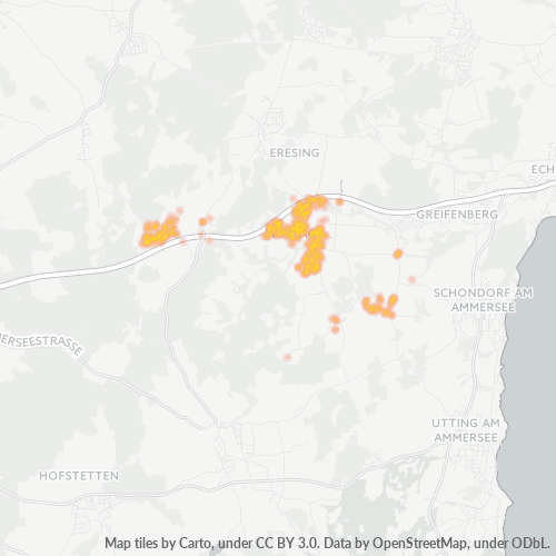
Map of Postal Code 86949 - Windach, Bavaria
Interactive Map
Postal Code 86949 - Windach, Bavaria Population
Years 1975 to 2030
| Data | 1975 | 1990 | 2000 | 2015 | 2020 | 2025* | 2030* |
|---|---|---|---|---|---|---|---|
| Population | 2,839 | 3,150 | 3,541 | 3,930 | 4,076 | 4,117 | 4,136 |
| Population Density | 106.5 / km² | 118.1 / km² | 132.8 / km² | 147.4 / km² | 152.9 / km² | 154.4 / km² | 155.1 / km² |
Postal Code 86949 - Windach, Bavaria Population change from 2000 to 2020
Increase of 15.1% from year 2000 to 2020
| Location | Change since 1975 | Change since 1990 | Change since 2000 |
|---|---|---|---|
| Postal Code 86949 - Windach, Bavaria | +43.6% | +29.4% | +15.1% |
| Windach | -37.2% | -43% | -43.7% |
| Bavaria | +23.9% | +16.7% | +8.4% |
| Germany | — | — | — |
Postal Code 86949 - Windach, Bavaria Median Age
Median Age: 43.4 years
| Location | Median Age | Median Age (Female) | Median Age (Male) |
|---|---|---|---|
| Postal Code 86949 - Windach, Bavaria | 43.4 yrs | 44.3 yrs | 42.5 yrs |
| Windach | 43.4 yrs | 44.3 yrs | 42.5 yrs |
| Bavaria | 43.9 yrs | 44.9 yrs | 42.8 yrs |
| Germany | 44.8 yrs | 46 yrs | 43.6 yrs |
Postal Code 86949 Population Density
Population Density: 153 / km²
| Location | Population | Area | Density |
|---|---|---|---|
| Postal Code 86949 | 4,076 | 26.7 km² | 153 / km² |
| Windach | 790 | 0.89 km² | 888 / km² |
| Bavaria | 13.2 million | 70,548.3 km² | 187 / km² |
| Germany | 80.7 million | 358,179.8 km² | 225 / km² |
Postal Code 86949 - Windach, Bavaria Historical and Projected Population
Estimated Population from 0 to 2100
- JRC (European Commission's Joint Research Centre) work on the GHS built-up grid
- CIESIN (Center for International Earth Science Information Network)
- [Link] Klein Goldewijk, K., Beusen, A., Doelman, J., and Stehfest, E.: Anthropogenic land use estimates for the Holocene – HYDE 3.2, Earth Syst. Sci. Data, 9, 927–953, https://doi.org/10.5194/essd-9-927-2017, 2017.
Neighborhoods
Business Distribution by neighborhood in Postal Code 86949 - Windach, Bavaria
Area Codes
Percentage Area Codes used by businesses in Postal Code 86949 - Windach, Bavaria
Industries
Business Distribution by Industry in Postal Code 86949 - Windach, Bavaria
| Industry Description | Number of Establishments |
|---|---|
| Accountants | 13 |
| All food and beverage | 10 |
| Alternative medicine | 17 |
| Construction of buildings | 25 |
| Corporate management | 30 |
| Electrical installation | 11 |
| Electronics stores | 14 |
| Other membership organizations | 9 |
| Real estate | 20 |
| Restaurants | 12 |
| Shopping | 17 |
| Specialized design | 12 |
Human Development Index (HDI)
Statistic composite index of life expectancy, education, and per capita income.
Postal Code 86949 - Windach, Bavaria Gross Domestic Product (GDP)
GDP per capita, PPP (constant 2017 international $)
| Data | 1990 | 1995 | 2000 | 2005 | 2010 | 2015 | 2020 | 2022 |
|---|---|---|---|---|---|---|---|---|
| GDP per capita | $31,130 | $33,355 | $36,381 | $36,403 | $39,612 | $43,699 | $46,091 | $47,979 |
| Total GDP | $134.6M | $153.2M | $175.7M | $182.4M | $207.4M | $238.5M | $255.6M | $265.8M |
Postal Code 86949 CO2 Emissions
Carbon Dioxide (CO2) Emissions Per Capita in Tonnes Per Year
| Location | CO2 Emissions | CO2 Emissions Per Capita | CO2 Emissions Intensity |
|---|---|---|---|
| Postal Code 86949 | 42,327 tn | 10.38 tn | 1,587.5 tons/km² |
| Windach | 8,216 tn | 10.4 tn | 9,231.9 tons/km² |
| Bavaria | 129,701,500 tn | 9.81 tn | 1,838.5 tons/km² |
| Germany | 755,339,039 tn | 9.36 tn | 2,108.8 tons/km² |
| 2013 CO2 emissions (tonnes/year) | 42,327 tn |
| 2013 CO2 emissions (tonnes/year) per capita | 10.38 tn |
| 2013 CO2 emissions intensity (tonnes/km²/year) | 1,587.5 tons/km² |
Natural Hazards Risk
Relative risk out of 10
| Hazard | Risk Level |
|---|---|
| Flood | High (9) |
| Earthquake | Low (2) |
Recent Nearby Earthquakes
Magnitude 3.0 and greater
| Date▼ | Time↕ | Magnitude↕ | Distance↕ | Depth↕ | Location↕ | Link |
|---|---|---|---|---|---|---|
| 8/9/13 | 3:44 AM | 3.7 | 97.1 km | 6,400 m | 1km ENE of Sistrans, Austria | usgs.gov |
| 10/18/10 | 5:38 PM | 4 | 88.7 km | 6,600 m | Austria | usgs.gov |
| 9/10/08 | 6:57 AM | 3.1 | 73.5 km | 10,000 m | Austria | usgs.gov |
| 10/15/07 | 9:25 AM | 3.2 | 88.3 km | 14,300 m | Austria | usgs.gov |
| 5/23/06 | 5:57 AM | 3.4 | 89.9 km | 10,000 m | Austria | usgs.gov |
| 2/26/06 | 7:30 AM | 3.6 | 93.5 km | 10,000 m | Austria | usgs.gov |
| 9/6/05 | 12:08 AM | 3.6 | 91.1 km | 3,300 m | Austria | usgs.gov |
| 7/4/05 | 4:02 PM | 3.3 | 96.1 km | 10,000 m | Austria | usgs.gov |
| 7/22/04 | 5:12 AM | 3.8 | 63.1 km | 10,000 m | Austria | usgs.gov |
| 5/22/04 | 4:37 AM | 3.1 | 100 km | 5,000 m | Austria | usgs.gov |
About Our Data
The data on this page is estimated using a number of publicly available tools and resources. It is provided without warranty, and could contain inaccuracies. Use at your own risk.