Postal Code 91564 - Neuendettelsau, Bavaria
| Primary City | Neuendettelsau |
| Area of Postal Code 91564 | 35.2 km² |
| Population | 7,790 |
| Male Population | 3,629 (46.6%) |
| Female Population | 4,161 (53.4%) |
| Population change from 1975 to 2020 | +4.2% |
| Population change from 2000 to 2020 | +0.3% |
| Median Age | 43.9 years |
| Male Median Age | 42.9 years |
| Female Median Age | 44.8 years |
| Area Codes | 9871, 9872, 9874 |
| Neighborhoods | Aich, Bechhofen, Haag, Mausendorf, Reuth, Watzendorf, Wernsbach, Wollersdorf |
| Timezone | Central European Summer Time |
| Coordinates | 49.28910802939766° / 10.807519430503799° |
| Related Postal Codes | 91522, 91541, 91550, 91555, 91560, 91567, 91583, 91586, 91587, 91589 |
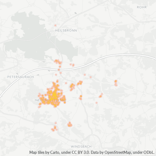
Map of Postal Code 91564 - Neuendettelsau, Bavaria
Interactive Map
Postal Code 91564 - Neuendettelsau, Bavaria Population
Years 1975 to 2030
| Data | 1975 | 1990 | 2000 | 2015 | 2020 | 2025* | 2030* |
|---|---|---|---|---|---|---|---|
| Population | 7,477 | 7,509 | 7,768 | 7,589 | 7,790 | 7,841 | 7,848 |
| Population Density | 212.6 / km² | 213.5 / km² | 220.9 / km² | 215.8 / km² | 221.5 / km² | 223 / km² | 223.2 / km² |
Postal Code 91564 - Neuendettelsau, Bavaria Population change from 2000 to 2020
Increase of 0.3% from year 2000 to 2020
| Location | Change since 1975 | Change since 1990 | Change since 2000 |
|---|---|---|---|
| Postal Code 91564 - Neuendettelsau, Bavaria | +4.2% | +3.7% | +0.3% |
| Neuendettelsau | -6% | -2.7% | -0.4% |
| Bavaria | +23.9% | +16.7% | +8.4% |
| Germany | — | — | — |
Postal Code 91564 - Neuendettelsau, Bavaria Median Age
Median Age: 43.9 years
| Location | Median Age | Median Age (Female) | Median Age (Male) |
|---|---|---|---|
| Postal Code 91564 - Neuendettelsau, Bavaria | 43.9 yrs | 44.8 yrs | 42.9 yrs |
| Neuendettelsau | 43.9 yrs | 44.8 yrs | 42.9 yrs |
| Bavaria | 43.9 yrs | 44.9 yrs | 42.8 yrs |
| Germany | 44.8 yrs | 46 yrs | 43.6 yrs |
Postal Code 91564 Population Density
Population Density: 222 / km²
| Location | Population | Area | Density |
|---|---|---|---|
| Postal Code 91564 | 7,790 | 35.2 km² | 222 / km² |
| Neuendettelsau | 4,804 | 2.5 km² | 1,922 / km² |
| Bavaria | 13.2 million | 70,548.3 km² | 187 / km² |
| Germany | 80.7 million | 358,179.8 km² | 225 / km² |
Postal Code 91564 - Neuendettelsau, Bavaria Historical and Projected Population
Estimated Population from 0 to 2100
- JRC (European Commission's Joint Research Centre) work on the GHS built-up grid
- CIESIN (Center for International Earth Science Information Network)
- [Link] Klein Goldewijk, K., Beusen, A., Doelman, J., and Stehfest, E.: Anthropogenic land use estimates for the Holocene – HYDE 3.2, Earth Syst. Sci. Data, 9, 927–953, https://doi.org/10.5194/essd-9-927-2017, 2017.
Neighborhoods
Business Distribution by neighborhood in Postal Code 91564 - Neuendettelsau, Bavaria
Industries
Business Distribution by Industry in Postal Code 91564 - Neuendettelsau, Bavaria
| Industry Description | Number of Establishments |
|---|---|
| All food and beverage | 12 |
| All membership organizations | 17 |
| Alternative medicine | 12 |
| Car repair | 16 |
| Churches | 13 |
| Construction of buildings | 21 |
| Corporate management | 19 |
| Education | 20 |
| General practitioners | 13 |
| Grocery stores and supermarkets | 12 |
| Health and medical | 40 |
| Other membership organizations | 21 |
| Real estate | 15 |
| Restaurants | 27 |
| Shopping | 27 |
Human Development Index (HDI)
Statistic composite index of life expectancy, education, and per capita income.
Postal Code 91564 - Neuendettelsau, Bavaria Gross Domestic Product (GDP)
GDP per capita, PPP (constant 2017 international $)
| Data | 1990 | 1995 | 2000 | 2005 | 2010 | 2015 | 2020 | 2022 |
|---|---|---|---|---|---|---|---|---|
| GDP per capita | $27,372 | $29,328 | $31,989 | $32,952 | $37,825 | $40,283 | $41,247 | $42,937 |
| Total GDP | $347.9M | $389.9M | $437.2M | $448.8M | $514.7M | $554.2M | $574.3M | $599.3M |
Postal Code 91564 CO2 Emissions
Carbon Dioxide (CO2) Emissions Per Capita in Tonnes Per Year
| Location | CO2 Emissions | CO2 Emissions Per Capita | CO2 Emissions Intensity |
|---|---|---|---|
| Postal Code 91564 | 74,048 tn | 9.51 tn | 2,105.8 tons/km² |
| Neuendettelsau | 45,664 tn | 9.51 tn | 18,265.8 tons/km² |
| Bavaria | 129,701,500 tn | 9.81 tn | 1,838.5 tons/km² |
| Germany | 755,339,039 tn | 9.36 tn | 2,108.8 tons/km² |
| 2013 CO2 emissions (tonnes/year) | 74,048 tn |
| 2013 CO2 emissions (tonnes/year) per capita | 9.51 tn |
| 2013 CO2 emissions intensity (tonnes/km²/year) | 2,105.8 tons/km² |
Natural Hazards Risk
Relative risk out of 10
| Hazard | Risk Level |
|---|---|
| Flood | High (10) |
| Earthquake | Low (2) |
Recent Nearby Earthquakes
Magnitude 3.0 and greater
| Date▼ | Time↕ | Magnitude↕ | Distance↕ | Depth↕ | Location↕ | Link |
|---|---|---|---|---|---|---|
| 5/17/82 | 10:30 AM | 4.3 | 97.1 km | 33,000 m | Germany | usgs.gov |
| 8/2/81 | 7:15 AM | 3.1 | 90.8 km | 10,000 m | Germany | usgs.gov |
Primary City
Neuendettelsau is a local authority in Middle Franconia, Germany. Neuendettelsau is situated 20 miles southwest of Nuremberg and 12 miles east of Ansbach. Population: 7.535 (31. December 2013). The city has three schools. Since 1947 it has a Lutheran..
Neuendettelsau Wikipedia Page
About Our Data
The data on this page is estimated using a number of publicly available tools and resources. It is provided without warranty, and could contain inaccuracies. Use at your own risk.