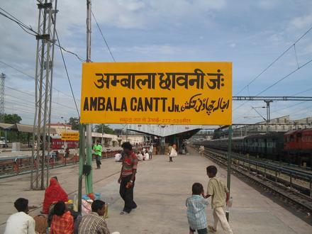
Pin Code 133003 - Ambala, Haryana
Haryana | India
| Primary City | Ambala |
| Population | 146,787 |
| Area Codes | 171 |
| Timezone | India Standard Time |
| Coordinates | 30.363281329728643° / 76.79813520404439° |
| Related Pin Codes | 133001, 133004, 133005, 133006, 133008, 133010, 133021, 133101, 133102, 133103 |
Map of Pin Code 133003 - Ambala, Haryana
Interactive Map
Ambala Population Density
Population Density: 5,725 / km²
| Location | Population | Area | Density |
|---|---|---|---|
| Ambala | 396,817 | 69.3 km² | 5,725 / km² |
| Haryana | 29.2 million | 44,119.4 km² | 661 / km² |
| India | 1,307 million | 3,083,563.4 km² | 424 / km² |
Sources: JRC (European Commission's Joint Research Centre) work on the GHS built-up grid
Neighborhoods
Business Distribution by neighborhood in Pin Code 133003 - Ambala, Haryana
Industries
Business Distribution by Industry in Pin Code 133003 - Ambala, Haryana
| Industry Description | Number of Establishments |
|---|---|
| Apartments | 26 |
| Grocery stores and supermarkets | 10 |
| Shopping | 14 |
| Shopping other | 8 |
| Travel and transportation | 34 |
Ambala CO2 Emissions
Carbon Dioxide (CO2) Emissions Per Capita in Tonnes Per Year
| Location | CO2 Emissions | CO2 Emissions Per Capita | CO2 Emissions Intensity |
|---|---|---|---|
| Ambala | 1,067,341 tn | 2.69 tn | 15,398.6 tons/km² |
| Haryana | 61,507,806 tn | 2.11 tn | 1,394.1 tons/km² |
| India | 1,928,568,344 tn | 1.48 tn | 625.4 tons/km² |
Sources: [Link] Moran, D., Kanemoto K; Jiborn, M., Wood, R., Többen, J., and Seto, K.C. (2018) Carbon footprints of 13,000 cities. Environmental Research Letters DOI: 10.1088/1748-9326/aac72a
Ambala CO2 Emissions
| 2013 CO2 emissions (tonnes/year) | 1,067,341 tn |
| 2013 CO2 emissions (tonnes/year) per capita | 2.69 tn |
| 2013 CO2 emissions intensity (tonnes/km²/year) | 15,398.6 tons/km² |
Recent Nearby Earthquakes
Magnitude 3.0 and greater
| Date▼ | Time↕ | Magnitude↕ | Distance↕ | Depth↕ | Location↕ | Link |
|---|---|---|---|---|---|---|
| 2/20/14 | 10:46 PM | 4.6 | 71.7 km | 16,020 m | 19km ESE of Dirba, India | usgs.gov |
| 11/26/04 | 3:53 PM | 3.7 | 51.9 km | 42,100 m | Haryana - Uttaranchal region, India | usgs.gov |
| 8/13/97 | 4:10 PM | 4.2 | 94.5 km | 33,000 m | Punjab-Himachal Pradesh border region, India | usgs.gov |
| 11/11/96 | 8:20 PM | 4.5 | 61 km | 53,700 m | Uttar Pradesh, India | usgs.gov |
| 7/15/82 | 9:15 PM | 4.2 | 44.9 km | 103,300 m | Haryana - Uttaranchal region, India | usgs.gov |
Source: U.S. Geological Survey (USGS)
Primary City
Ambala (/əmˈbɑːlə/) is a city and a municipal corporation in Ambala district in the state of Haryana, India, located on the border with the state of Punjab and in proximity of the state capital Chandigarh. Politically; Ambala has two sub-areas: Ambal..
Ambala Wikipedia Page