Pin Code 244001 - Moradabad, Uttar Pradesh
| Primary City | Moradabad |
| Area of Pin Code 244001 | 160.8 km² |
| Population | 1,247,812 |
| Male Population | 653,035 (52.3%) |
| Female Population | 594,777 (47.7%) |
| Population change from 1975 to 2020 | +101.3% |
| Population change from 2000 to 2020 | +13.9% |
| Median Age | 19.5 years |
| Male Median Age | 19.5 years |
| Female Median Age | 19.6 years |
| Area Codes | 591 |
| Neighborhoods | Budh Bazaar, Civil Lines, Gandhi Nagar, Harthala, Pat Pat Sarai, Vikas Colony, Buddhi Vihar |
| Timezone | India Standard Time |
| Coordinates | 28.839603452174718° / 78.76634097460327° |
| Related Pin Codes | 244102, 244103, 244104, 244105, 244221, 244222, 244223, 244224, 244225, 244226 |
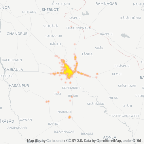
Map of Pin Code 244001 - Moradabad, Uttar Pradesh
Interactive Map
Pin Code 244001 - Moradabad, Uttar Pradesh Population
Years 1975 to 2030
| Data | 1975 | 1990 | 2000 | 2015 | 2020 | 2025* | 2030* |
|---|---|---|---|---|---|---|---|
| Population | 619,859 | 903,039 | 1,095,160 | 1,383,681 | 1,247,812 | 1,265,763 | 1,305,317 |
| Population Density | 3,855.4 / km² | 5,616.7 / km² | 6,811.6 / km² | 8,606.1 / km² | 7,761 / km² | 7,872.7 / km² | 8,118.7 / km² |
Pin Code 244001 - Moradabad, Uttar Pradesh Population change from 2000 to 2020
Increase of 13.9% from year 2000 to 2020
| Location | Change since 1975 | Change since 1990 | Change since 2000 |
|---|---|---|---|
| Pin Code 244001 - Moradabad, Uttar Pradesh | +101.3% | +38.2% | +13.9% |
| Morādābād | +16.9% | +16.3% | +10.5% |
| Uttar Pradesh | +149.2% | +69.8% | +36.7% |
| India | — | — | — |
Pin Code 244001 - Moradabad, Uttar Pradesh Median Age
Median Age: 19.5 years
| Location | Median Age | Median Age (Female) | Median Age (Male) |
|---|---|---|---|
| Pin Code 244001 - Moradabad, Uttar Pradesh | 19.5 yrs | 19.6 yrs | 19.5 yrs |
| Morādābād | 19.5 yrs | 19.6 yrs | 19.5 yrs |
| Uttar Pradesh | 21.3 yrs | 21.7 yrs | 21 yrs |
| India | 24.9 yrs | 25.4 yrs | 24.5 yrs |
Pin Code 244001 Population Density
Population Density: 7,761 / km²
| Location | Population | Area | Density |
|---|---|---|---|
| Pin Code 244001 | 1.2 million | 160.8 km² | 7,761 / km² |
| Moradabad | 739,500 | 35.1 km² | 21,089 / km² |
| Uttar Pradesh | 231.9 million | 240,777.3 km² | 963 / km² |
| India | 1,307 million | 3,083,563.4 km² | 424 / km² |
Pin Code 244001 - Moradabad, Uttar Pradesh Historical and Projected Population
Estimated Population from 100 to 2100
- JRC (European Commission's Joint Research Centre) work on the GHS built-up grid
- CIESIN (Center for International Earth Science Information Network)
- [Link] Klein Goldewijk, K., Beusen, A., Doelman, J., and Stehfest, E.: Anthropogenic land use estimates for the Holocene – HYDE 3.2, Earth Syst. Sci. Data, 9, 927–953, https://doi.org/10.5194/essd-9-927-2017, 2017.
Area Codes
Percentage Area Codes used by businesses in Pin Code 244001 - Moradabad, Uttar Pradesh
Industries
Business Distribution by Industry in Pin Code 244001 - Moradabad, Uttar Pradesh
| Industry Description | Number of Establishments | Average Age of Business |
|---|---|---|
| Clothing stores | 1,370 | — |
| Education | 912 | 30 years |
| Electronics stores | 961 | 18.1 years |
| Hardware store | 1,167 | — |
| Health and medical | 765 | — |
| Pharmacies and drug stores | 1,220 | — |
| Restaurants | 1,000 | — |
| Shopping | 2,138 | 38.9 years |
| Shopping other | 1,916 | — |
| Unreachable | 863 | — |
Human Development Index (HDI)
Statistic composite index of life expectancy, education, and per capita income.
Pin Code 244001 - Moradabad, Uttar Pradesh Gross Domestic Product (GDP)
GDP per capita, PPP (constant 2017 international $)
| Data | 1990 | 1995 | 2000 | 2005 | 2010 | 2015 | 2020 | 2022 |
|---|---|---|---|---|---|---|---|---|
| GDP per capita | $854 | $935 | $1,164 | $1,155 | $1,541 | $2,101 | $2,597 | $2,877 |
| Total GDP | $697.3M | $832.2M | $1.1B | $1.2B | $1.8B | $2.6B | $3.3B | $3.6B |
Pin Code 244001 CO2 Emissions
Carbon Dioxide (CO2) Emissions Per Capita in Tonnes Per Year
| Location | CO2 Emissions | CO2 Emissions Per Capita | CO2 Emissions Intensity |
|---|---|---|---|
| Pin Code 244001 | 1,649,055 tn | 1.32 tn | 10,256.7 tons/km² |
| Moradabad | 1,028,704 tn | 1.39 tn | 29,336 tons/km² |
| Uttar Pradesh | 275,745,856 tn | 1.19 tn | 1,145.2 tons/km² |
| India | 1,928,568,344 tn | 1.48 tn | 625.4 tons/km² |
| 2013 CO2 emissions (tonnes/year) | 1,649,055 tn |
| 2013 CO2 emissions (tonnes/year) per capita | 1.32 tn |
| 2013 CO2 emissions intensity (tonnes/km²/year) | 10,256.7 tons/km² |
Natural Hazards Risk
Relative risk out of 10
| Hazard | Risk Level |
|---|---|
| Drought | High (8) |
| Flood | High (10) |
| Earthquake | Medium (4) |
Recent Nearby Earthquakes
Magnitude 3.0 and greater
| Date▼ | Time↕ | Magnitude↕ | Distance↕ | Depth↕ | Location↕ | Link |
|---|---|---|---|---|---|---|
| 11/7/07 | 8:42 PM | 3.7 | 59.6 km | 10,000 m | Uttaranchal-Uttar Pradesh border region, India | usgs.gov |
| 4/7/04 | 2:02 AM | 4.2 | 34.1 km | 10,000 m | Uttar Pradesh, India | usgs.gov |
| 3/22/99 | 11:29 PM | 3.7 | 16.4 km | 33,000 m | Uttar Pradesh, India | usgs.gov |
| 3/16/99 | 2:27 PM | 4.2 | 63.5 km | 33,000 m | Uttar Pradesh, India | usgs.gov |
| 2/7/98 | 12:45 AM | 3.5 | 74.4 km | 33,000 m | Uttaranchal-Uttar Pradesh border region, India | usgs.gov |
| 10/27/91 | 5:19 AM | 3.9 | 78.2 km | 33,000 m | Uttaranchal, India | usgs.gov |
| 11/5/75 | 4:11 PM | 4.9 | 98.6 km | 33,000 m | Uttaranchal-Uttar Pradesh border region, India | usgs.gov |
| 8/14/66 | 7:15 PM | 5.6 | 35.9 km | 27,000 m | Uttar Pradesh, India | usgs.gov |
Primary City
Moradabad ( pronunciation ) is a city, commissionary, and a municipal corporation in Moradabad district in the Indian state of Uttar Pradesh. It was established in 1625A.D. by Rustam Khan and is named after prince Murad Baksh, the son of the Mughal E..
Moradabad Wikipedia Page
About Our Data
The data on this page is estimated using a number of publicly available tools and resources. It is provided without warranty, and could contain inaccuracies. Use at your own risk.