Pin Code 400053 - Andheri, Maharashtra
| Primary City | Andheri |
| Area of Pin Code 400053 | 8.4 km² |
| Population | 285,007 |
| Male Population | 153,251 (53.8%) |
| Female Population | 131,756 (46.2%) |
| Population change from 1975 to 2015 | +50.5% |
| Population change from 2000 to 2015 | +9.3% |
| Median Age | 28.6 years |
| Male Median Age | 28.4 years |
| Female Median Age | 28.9 years |
| Area Codes | 22 |
| Associated Cities | Mumbai |
| Neighborhoods | Andheri, Andheri West, Jogeshwari West, Lokhandwala Complex, Andheri West, Mhada Colony, Andheri West, Swami Samarth Nagar, Veera Desai Industrial Estate, Andheri West |
| Timezone | India Standard Time |
| Coordinates | 19.143391846927038° / 72.82505096643175° |
| Related Pin Codes | 400041, 400050, 400051, 400052, 400054, 400055, 400056, 400057, 400058, 400059 |
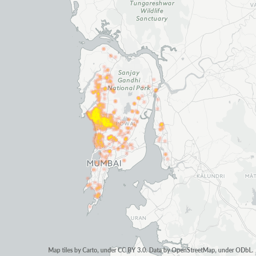
Map of Pin Code 400053 - Andheri, Maharashtra
Interactive Map
Pin Code 400053 - Andheri, Maharashtra Population
Years 1975 to 2020
| Data | 1975 | 1990 | 2000 | 2015 | 2020 |
|---|---|---|---|---|---|
| Population | 189,399 | 234,227 | 260,843 | 285,007 | 298,158 |
| Population Density | 22,498.1 / km² | 27,823 / km² | 30,984.7 / km² | 33,855 / km² | 35,417.2 / km² |
Pin Code 400053 - Andheri, Maharashtra Population change from 2000 to 2015
Increase of 9.3% from year 2000 to 2015
| Location | Change since 1975 | Change since 1990 | Change since 2000 |
|---|---|---|---|
| Pin Code 400053 - Andheri, Maharashtra | +50.5% | +21.7% | +9.3% |
| Maharashtra | +98% | +45.2% | +21.9% |
| India | +111.1% | +50.6% | +24.5% |
Pin Code 400053 - Andheri, Maharashtra Median Age
Median Age: 28.6 years
| Location | Median Age | Median Age (Female) | Median Age (Male) |
|---|---|---|---|
| Pin Code 400053 - Andheri, Maharashtra | 28.6 yrs | 28.9 yrs | 28.4 yrs |
| Maharashtra | 27.2 yrs | 27.8 yrs | 26.6 yrs |
| India | 24.9 yrs | 25.4 yrs | 24.5 yrs |
Pin Code 400053 Population Density
Population Density: 33,855 / km²
| Location | Population | Area | Density |
|---|---|---|---|
| Pin Code 400053 | 285,007 | 8.4 km² | 33,855 / km² |
| Maharashtra | 126.5 million | 307,683.7 km² | 411 / km² |
| India | 1,307 million | 3,083,563.4 km² | 424 / km² |
Pin Code 400053 - Andheri, Maharashtra Historical and Projected Population
Estimated Population from 1780 to 2100
- JRC (European Commission's Joint Research Centre) work on the GHS built-up grid
- CIESIN (Center for International Earth Science Information Network)
- [Link] Klein Goldewijk, K., Beusen, A., Doelman, J., and Stehfest, E.: Anthropogenic land use estimates for the Holocene – HYDE 3.2, Earth Syst. Sci. Data, 9, 927–953, https://doi.org/10.5194/essd-9-927-2017, 2017.
Industries
Business Distribution by Industry in Pin Code 400053 - Andheri, Maharashtra
| Industry Description | Number of Establishments | Average Age of Business |
|---|---|---|
| Advertising and marketing | 392 | 16.6 years |
| Clothing stores | 569 | — |
| Corporate management | 1,696 | 22.2 years |
| Electronics stores | 698 | 28.3 years |
| Film, tv and video production | 876 | 22.2 years |
| Health and medical | 439 | 22.2 years |
| Real estate | 1,126 | 23.8 years |
| Restaurants | 954 | 13.7 years |
| Shopping | 1,298 | 40.4 years |
Business distribution by price for Pin Code 400053 - Andheri, Maharashtra
Human Development Index (HDI)
Statistic composite index of life expectancy, education, and per capita income.
Pin Code 400053 CO2 Emissions
Carbon Dioxide (CO2) Emissions Per Capita in Tonnes Per Year
| Location | CO2 Emissions | CO2 Emissions Per Capita | CO2 Emissions Intensity |
|---|---|---|---|
| Pin Code 400053 | 276,784 tn | 0.97 tn | 32,878.2 tons/km² |
| Maharashtra | 216,189,622 tn | 1.71 tn | 702.6 tons/km² |
| India | 1,928,568,344 tn | 1.48 tn | 625.4 tons/km² |
| 2013 CO2 emissions (tonnes/year) | 276,784 tn |
| 2013 CO2 emissions (tonnes/year) per capita | 0.97 tn |
| 2013 CO2 emissions intensity (tonnes/km²/year) | 32,878.2 tons/km² |
Natural Hazards Risk
Relative risk out of 10
| Hazard | Risk Level |
|---|---|
| Drought | Medium (7) |
| Flood | Medium (4) |
| Earthquake | Low (2) |
Recent Nearby Earthquakes
Magnitude 3.0 and greater
| Date▼ | Time↕ | Magnitude↕ | Distance↕ | Depth↕ | Location↕ | Link |
|---|---|---|---|---|---|---|
| 7/24/19 | 12:33 PM | 4 | 66.7 km | 15,150 m | 42km WSW of Shirgaon, India | usgs.gov |
Primary City
Andheri is a suburb or 'Taluka' of Mumbai, situated in the west of the city on the Salsette Island. Andheri derives its name from a small hill called 'Udayanagari' located close to Mahakali Caves. Like many other localities in Mumbai, the railway lin..
Andheri Wikipedia Page
About Our Data
The data on this page is estimated using a number of publicly available tools and resources. It is provided without warranty, and could contain inaccuracies. Use at your own risk.